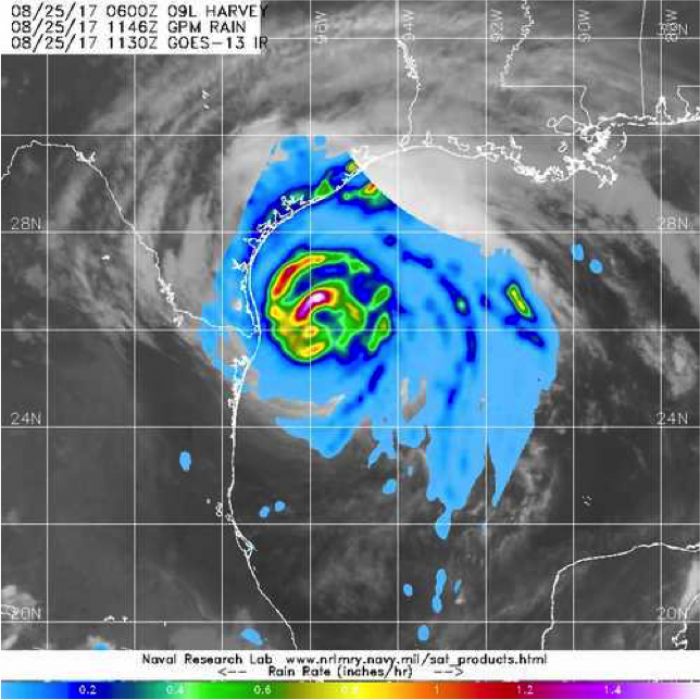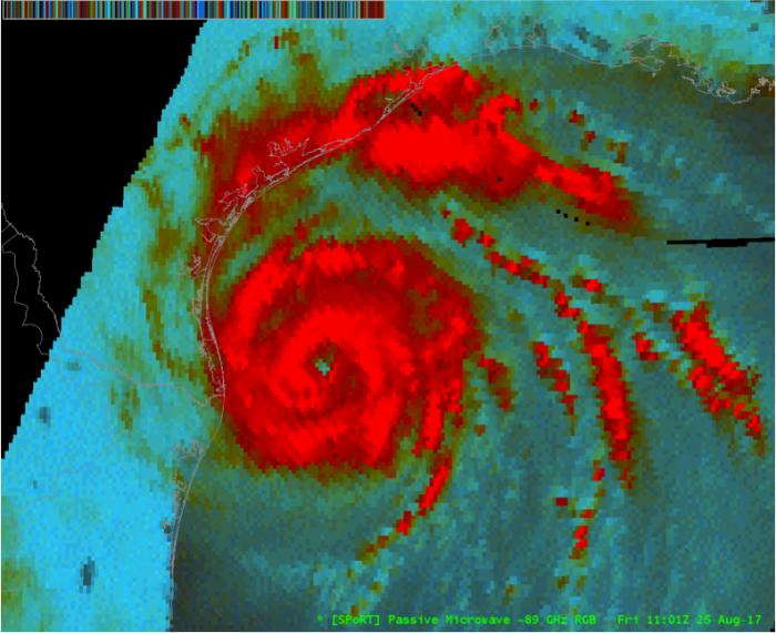
NASA’s Short-term Prediction Research and Transition (SPoRT) Center collaborated with the Naval Research Laboratory to integrate false color composites of passive microwave brightness temperatures that are helpful for identifying the center of circulation of storms like Hurricane Harvey, especially when thick cloud cover may otherwise obscure the center of the circulation. A false color composite is generated using 89 GHz brightness temperatures from the Global Precipitation Measurement (GPM) Microwave Imager (GMI), identifying the strongest thunderstorms associated with Harvey in bright reds, along with the outermost intense rainbands that were striking the coast of Texas on Friday, August 25 (bottom image). The eye of the storm can be seen in the center, along with the counterclockwise circulation of the surrounding rainbands. These images are shared with the National Weather Service and the National Hurricane Center to help integrate the use of unique NASA mission imagery and products within the weather forecasting process.The above image shows rainfall rates for the same overpass at 11:46 UTC which utilizes the GMI and Dual-frequency Precipitation Radar (DPR). These data are routinely used by NRL and other forecast groups to improve tropical cyclone tracking and forecasts.