Published
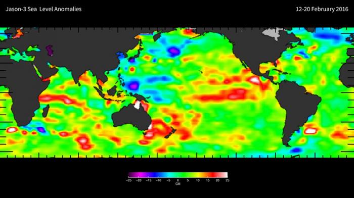
Jason-3 is the fourth mission in U.S.-European series of satellite missions that measure the height of the ocean surface. Launched on January 17, 2016, the mission will extend the time series of ocean surface topography measurements (the hills and valleys of the ocean surface) begun by the TOPEX/Poseidon satellite mission in 1992 and continuing through the Jason-1 (launched in 2001) and the currently operating OSTM/Jason-2 (launched in 2008) missions. These measurements provide scientists with critical information about circulation patterns in the ocean and about both global and regional changes in sea level and the climate implications of a warming world.
Learn more about Jason-3: https://sealevel.jpl.nasa.gov/missions/jason3/


