NASA’s Land, Atmosphere Near real-time Capability for EOS (Earth Observing System) (LANCE) provides data and imagery from Terra, Aqua, Aura, Suomi NPP and GCOM-W1 satellites in less than 3 hours from satellite observation, to meet the needs of the near real-time (NRT) applications community. LANCE leverages existing satellite data processing systems in order to provide data and imagery available from select EOS instruments (currently AIRS, AMSR2, ISS LIS, MISR, MLS, MODIS, MOPITT, OMI, OMPS, and VIIRS). These data meet the timely needs of applications such as numerical weather and climate prediction, forecasting and monitoring natural hazards, agriculture, air quality and disaster relief.
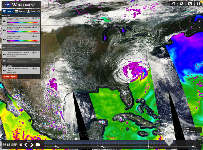
LANCE NRT AMSR2 L2B products include surface precipitation rate, wind speed over ocean, water vapor over ocean and cloud liquid water over ocean. The LANCE AMSR element at the AMSR SIPS generates Level-2B swath and incremental Level-3 daily products from the AMSR2 instrument on JAXA's GCOM-W1 satellite. The AMSR2 instrument was designed to detect water in all its state phases in the environment and monitor the water processes that exert a strong influence on climate and weather. NRT AMSR2 products are generally available 90 minutes after observation. AMSR-2 on JAXA's GCOM-W1 spacecraft, launched May 18, 2012.


