NASA Earth Applied Sciences Disasters Program GIS Lead Jeremy Kirkendall recently returned as a featured guest on the GIS Directions podcast. The podcast, created by Esri Australia, connects geographic information systems (GIS) users to look at new trends in GIS and share geospatial tips and insights. GIS is a standardized data framework that allows for gathering, analyzing and visualizing all types of geographic data.
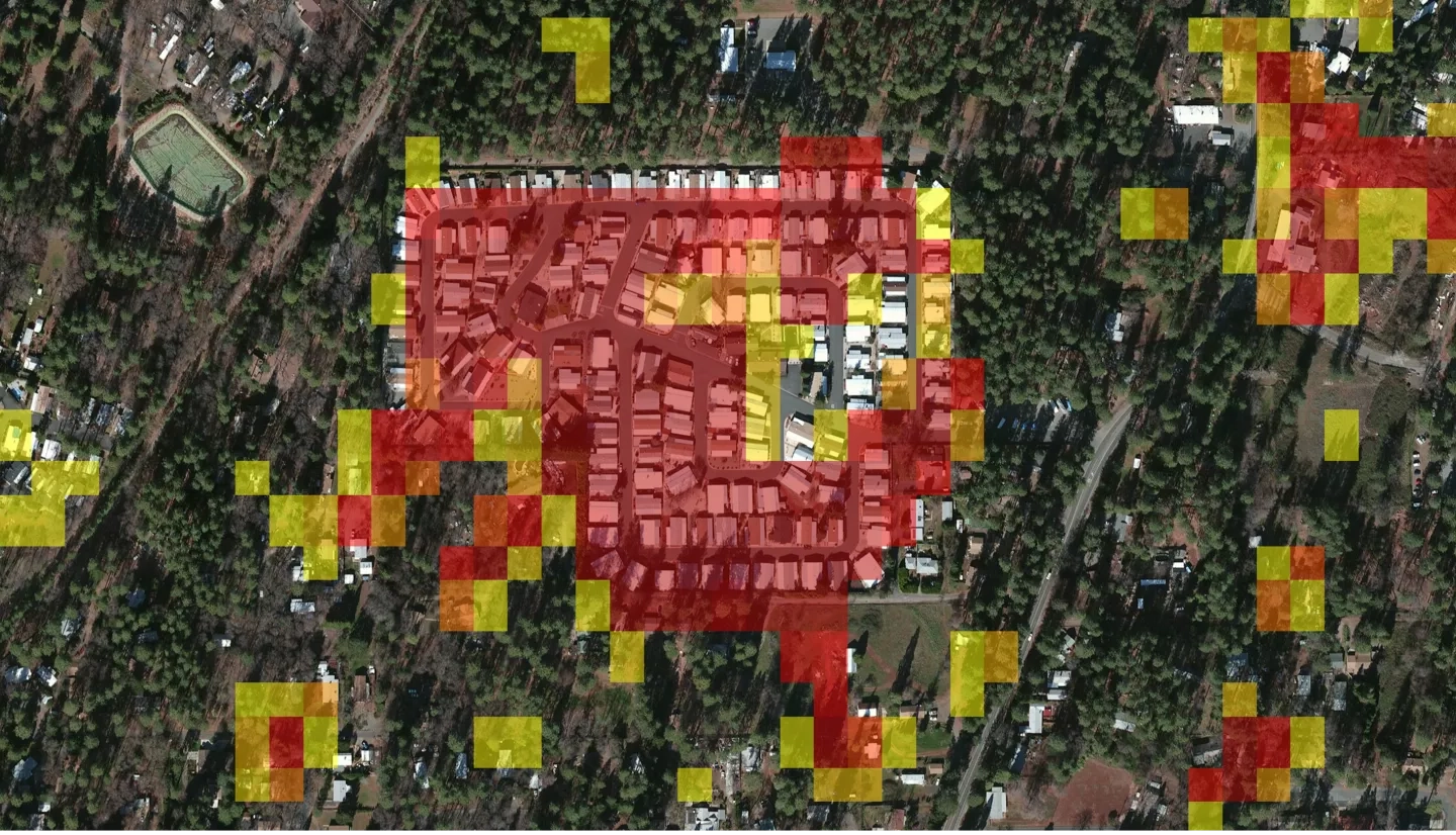
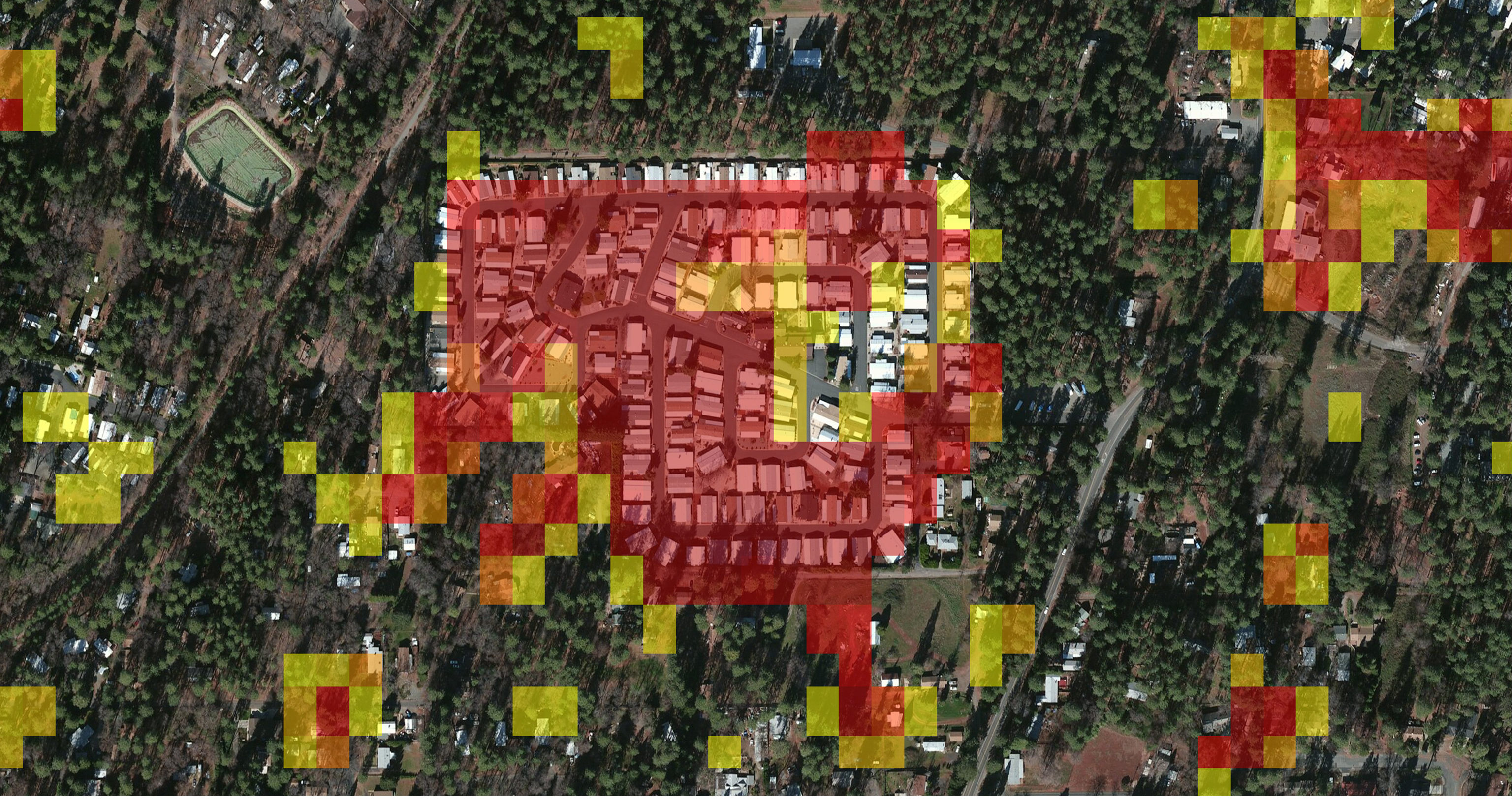
In this episode, “A Crash Course in NASA’s SAR Data,” Kirkendall chats with hosts Wayne Lee-Archer and Rylea McGlusky about Synthetic Aperture Radar (SAR). They examine how SAR data can be used to detect, track and mitigate the impact of natural hazards and potential disasters. Kirkendall shares some unique advantages that SAR technology brings – such as its ability to see through clouds and measure very small vertical changes in surface elevation–and how that makes the technology especially useful for disaster management. The episode includes tips on how to get started with SAR and how users worldwide can access and get free and open SAR data and training via resources from NASA and others.
Kirkendall last appeared on the GIS Directions podcast in December 2020, talking about NASA’s open data and the agency's Disasters Mapping Portal, which hosts disaster-relevant research, data, and satellite imagery from across NASA as well as interactive web applications and story maps. The Disasters program area of NASA's Earth Science Applied Sciences Program has pioneered the use of GIS technology for NASA Earth-observing data, making the data easier to access for local disaster management agencies, and processing, analyzing and visualizing the data to inform risk reduction, resilience and recovery efforts for disasters around the world.


