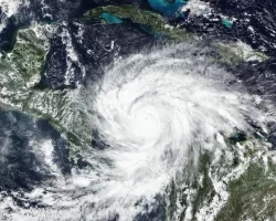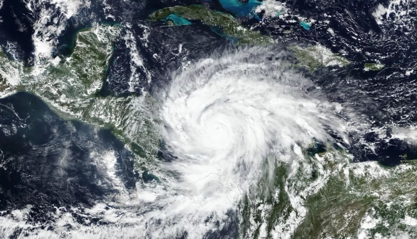
On November 3, 2020, Hurricane Eta made landfall as one of the most powerful hurricanes to hit Central America in years. The category 4 storm destroyed hundreds of homes, killed more than 100 people, and brought torrential rains that triggered large and numerous landslides in Guatemala and Honduras. Less than two weeks later, Hurricane Iota—an even more powerful category 4 storm—nearly retraced Eta’s path.
Within hours of Eta’s landfall and flooding rains, researchers at NASA’s Goddard Space Flight Center worked to predict landslides and map the storm’s aftermath. One team assessed potential landslide hazards using a computer model. Another team analyzed satellite data to map the resulting landslides, some of which were successfully predicted by the model. The NASA Earth Science Disasters program shared the information with national and international emergency response agencies to provide better insight of the hazards to personnel on the ground. The teams are currently running those landslide analyses again for areas hit by Hurricane Iota.
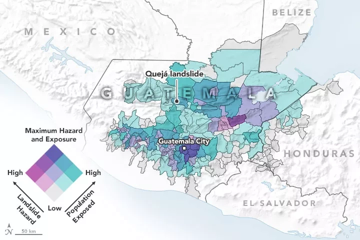
The map above shows the predicted landslide hazard on November 5 for Guatemala, as determined by NASA’s Landslide Hazard Assessment for Situational Awareness (LHASA) model. The researchers overlaid the model with district-level population data so they could better assess the proximity between potential hazards and densely populated communities. Shades of purple represent the hazard associated with landslides, with the darkest shades having the highest risk. Shades of teal depict the size of the population exposed to the risk. Areas where hazard and exposure are both elevated may experience the most severe impacts.
The LHASA model allows researchers to assess landslide hazards within hours of storms. The model incorporates rainfall data from the Global Precipitation Measurement (GPM) mission, which provides precipitation estimates around the world every 30 minutes. The model also integrates information about roadways, the presence or absence of tectonic faults, the types of bedrock, changes in tree cover, and the steepness of slopes. In the wake of Eta, the team also included some new machine learning that placed more weight on conditions that contributed to past landslides in the region, such as recent rainfall and slope changes.
Read the full article on NASA Earth Observatory