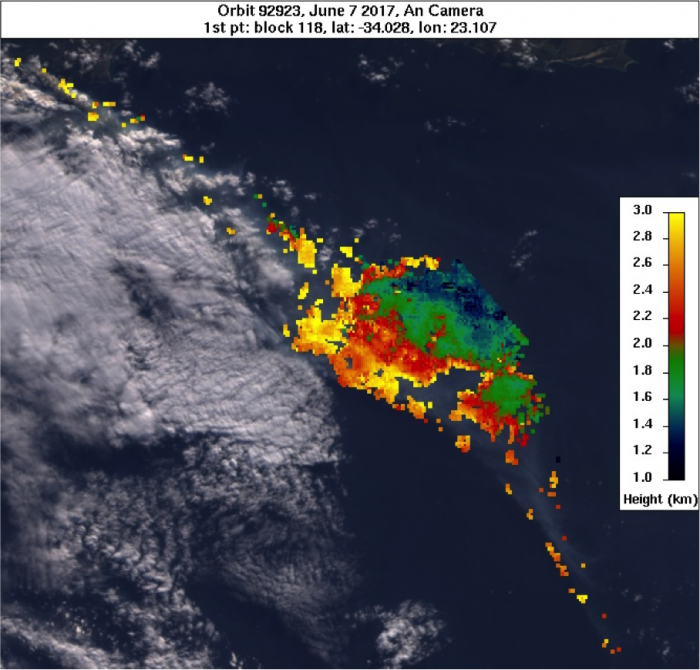
Wildfire outbreaks can generate a significant amount of atmospheric aerosols that can have regional to global impacts on Earth’s energy balance and surface temperature. To determine the influence of wildfires, accurate plume heights are needed, but are difficult to obtain in areas of significant cloud cover. Stereo images from NASA’s Multi-Angle Imaging Spectroradiometer (MISR) make it possible to retrieve plume heights using parallax by constraining the smoke plume layer height. When the retrieval height is significantly below the Lifting Condensation Level (LCL), the effects of cloud contamination are often reduced.
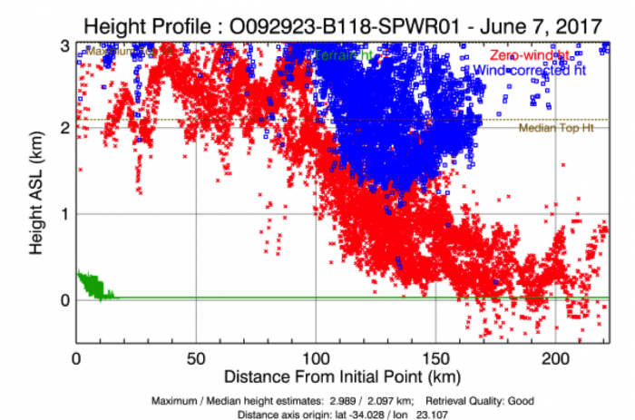
The Knysna Wildfire began the evening of June 6, 2017 and by June 07, consisted of 26 fires. These fires were fanned towards residential areas by strong winds from a cyclone to the west. The towns of Belvidere, Breonton-on-Sea, and Rheenendal were evacuated after news that a family of three passed away in the fire on June 6. The smoke observed by MISR on June 7 was injected at 3+ km. At this height, the aerosols can escape the boundary layer and enter the middle Troposphere, causing enhanced regional cooling and increased long-range aerosol transport.