
Published
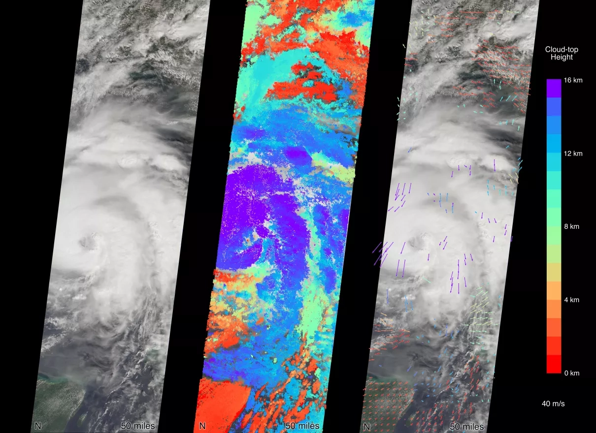
MISR (a NASA instrument that flies aboard the Terra satellite) carries nine cameras fixed at different angles, each of which viewed Michael over the course of approximately seven minutes when it was just off Florida's west coast on Tuesday October 9, 2018. This composite image shows the view from the central, downward-pointing camera (left), the calculated cloud-top heights (middle), and wind velocity vectors (right) superimposed on the image. The length of the arrows is proportional to wind speed and the colors show the altitude of the cloud tops in kilometers. Images from the nine views are used to calculate the height of the cloud tops, and the motion of the clouds between the views provides information on wind speed and direction.
1004


