Published
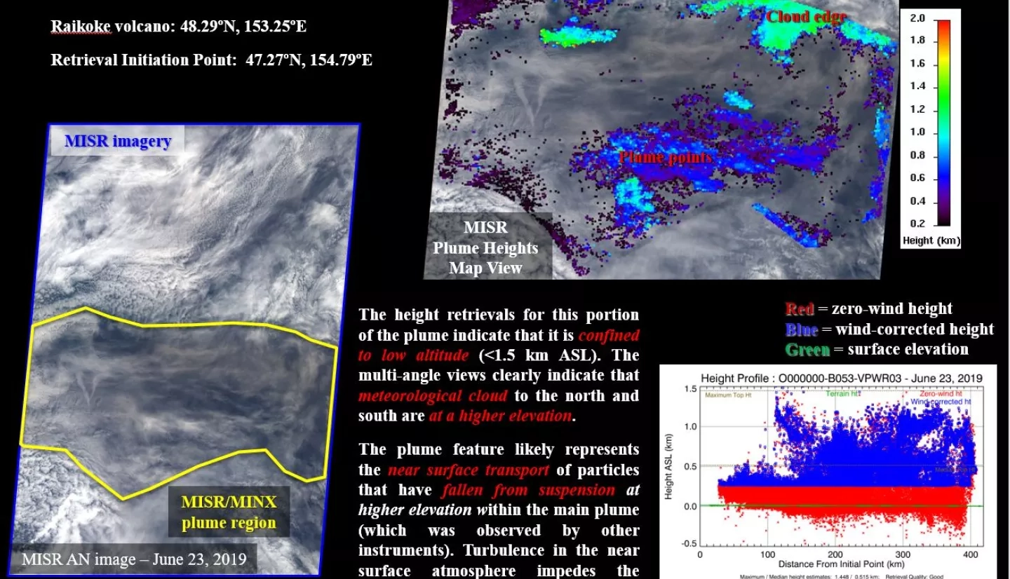
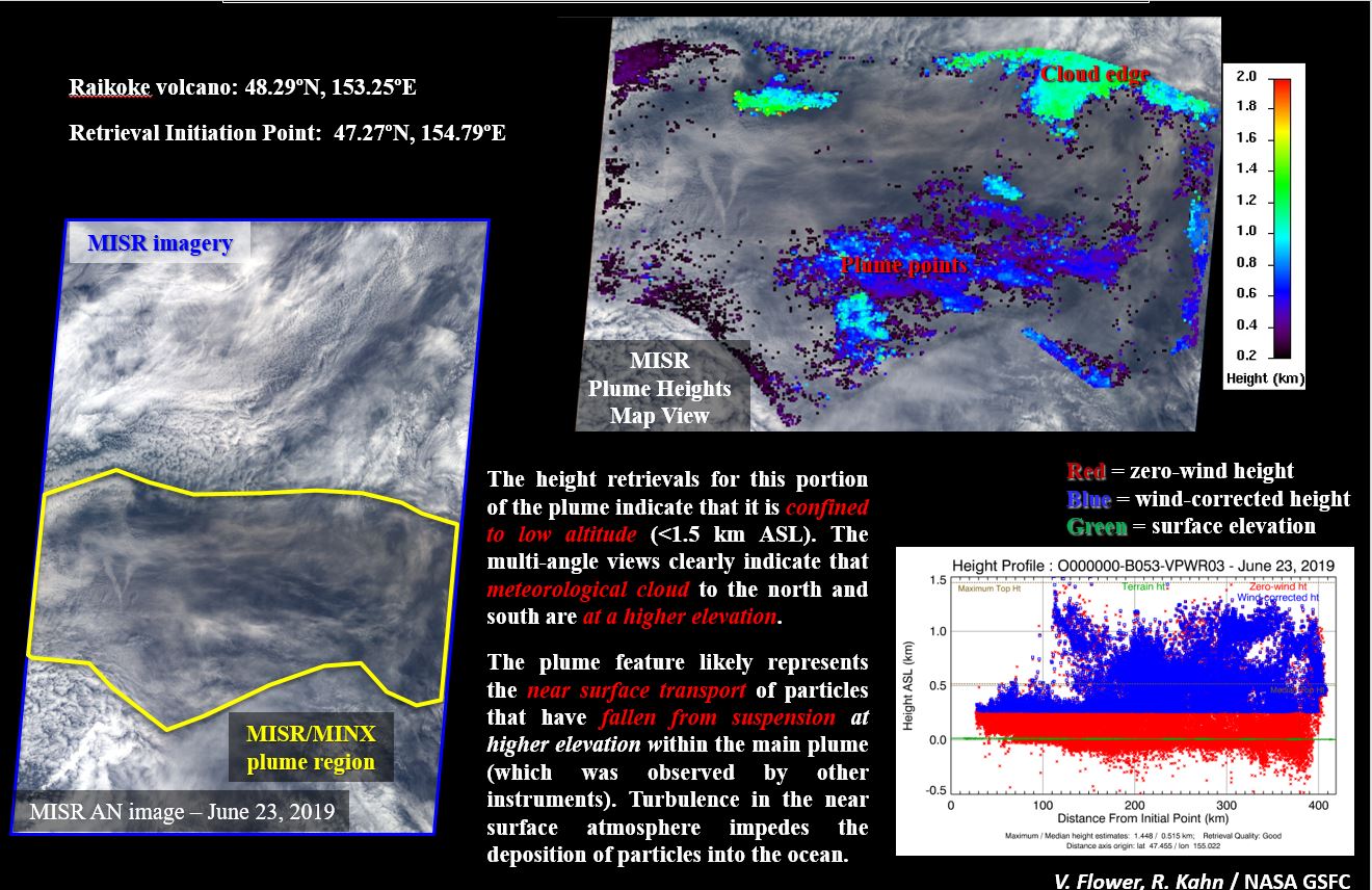
Volcanic eruptions can generate significant amounts of atmospheric aerosols that often have regional to global impacts. To determine the influence of volcanic eruptions, accurate plume heights are needed, but are difficult to obtain due to the hazardous nature of such eruptions. Stereo images from NASA’s Multi-Angle Imaging Spectroradiometer (MISR) make it possible to map plume heights in ongoing eruptions using parallax in the stereo imagery. We can also distinguish eruptive plumes from metrological clouds and remobilized ash with these data.
Download the full set of MISR highlight slides from the Raikoke eruption (.pptx)
1107


