Published
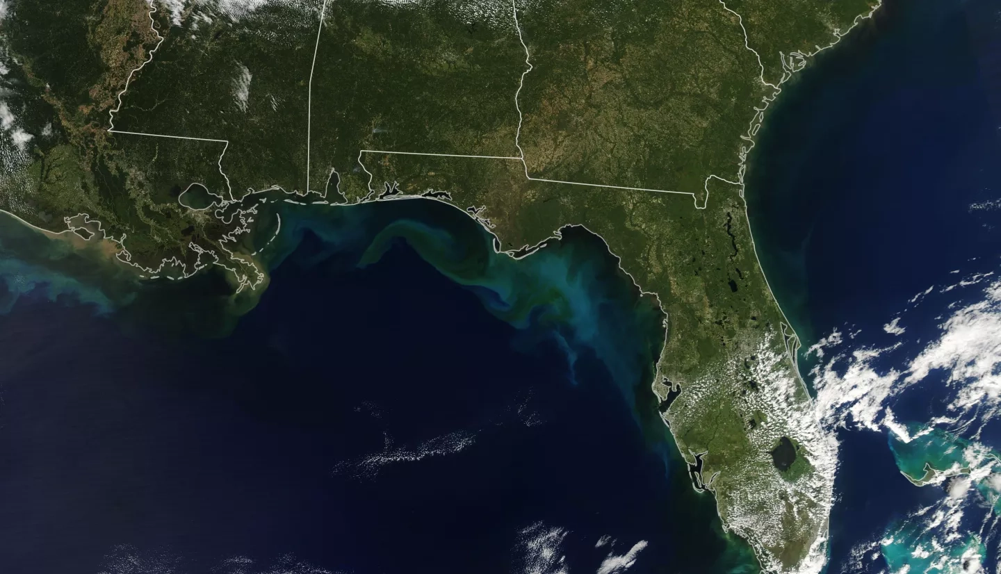
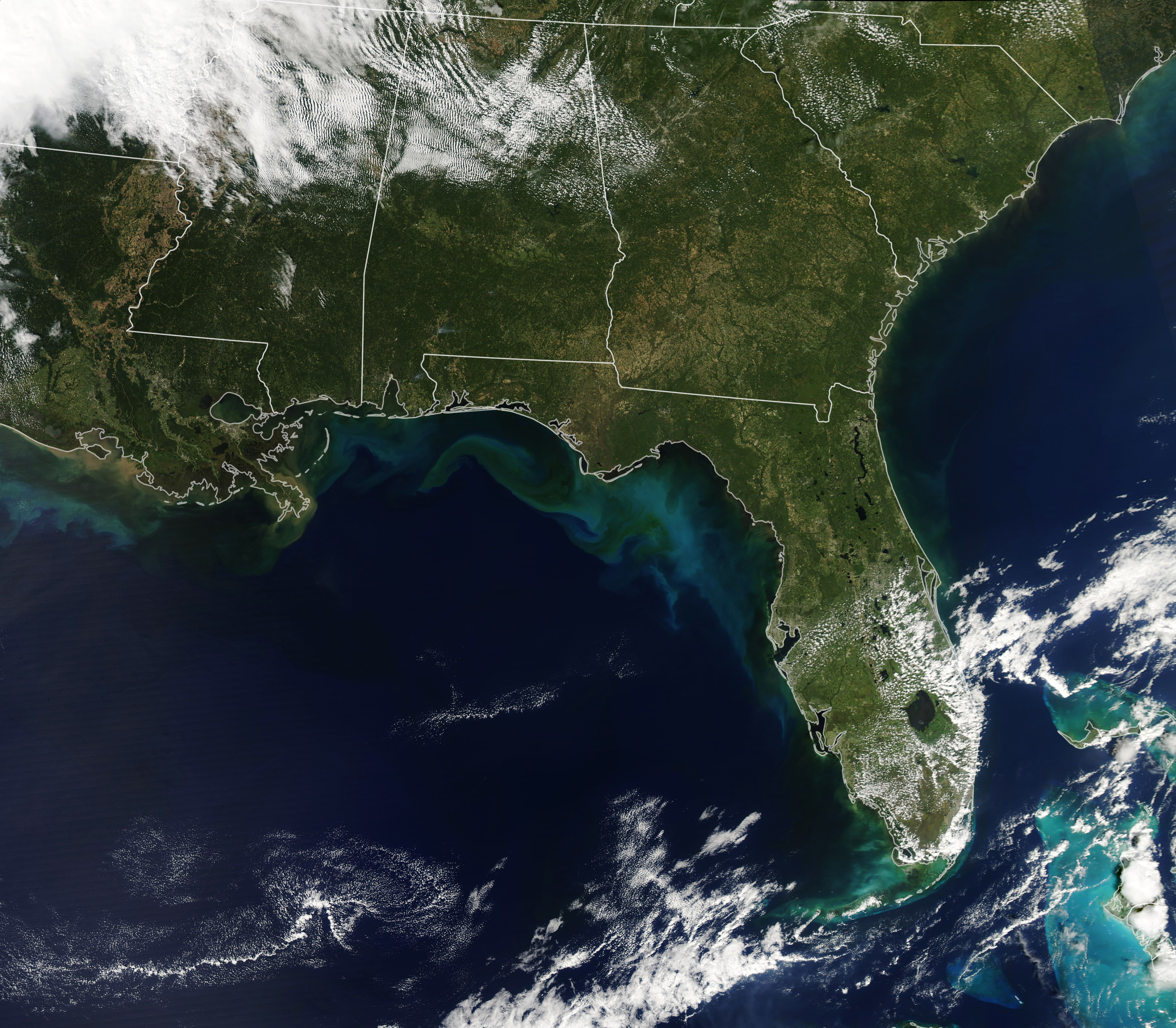
The Moderate Resolution Imaging Spectroradiometer (MODIS) on NASA’s Aqua satellite acquired this natural-color image of seafloor sediment and river outflows (and possibly plankton) discoloring the water along the Gulf Coast of Florida and Alabama. The satellite passed over the area in the early afternoon on October 13, 2018. The sediment and other debris was stirred up by the churning action of wind and waves as Hurricane Michael tore through the area on October 9-10.
1046


