
Published
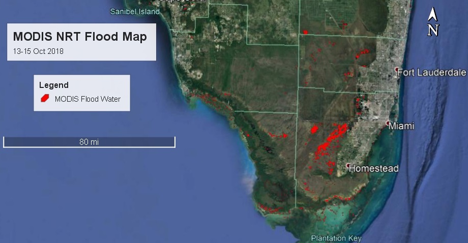
These maps were created from the Moderate Resolution Imaging Spectroradiometer (MODIS) Near Real-Time Global (NRT) Flood Mapping product. The red color on the map represents new flood waters from October 13 -15, 2018 in Florida.
The MODIS Near Real-Time (NRT) Global Flood Mapping Project produces global daily flood water maps at approximately 250 m spatial resolution. NASA Land, Atmosphere Near real-time Capability for EOS (LANCE) provides data to the NRT Global MODIS Flood Mapping initiative. This project was developed in collaboration with Bob Brakenridge at the Dartmouth Flood Observatory (DFO): http://floodobservatory.colorado.edu.
Discover and Access MODIS NRT Global Flood Mapping Data:
https://floodmap.modaps.eosdis.nasa.gov
1037


