The war in Ukraine continues to negatively impact crop commodity prices, trade logistics, and global food supply. NASA Harvest is NASA's global food security and agriculture consortium. It provides transparency on food security impacts of the war using the best-available satellite data and resulting insights on crop conditions, agricultural lands under occupation, and supply chain disruptions.
“The world’s breadbasket is at war,” said Inbal Becker-Reshef, director of NASA Harvest.
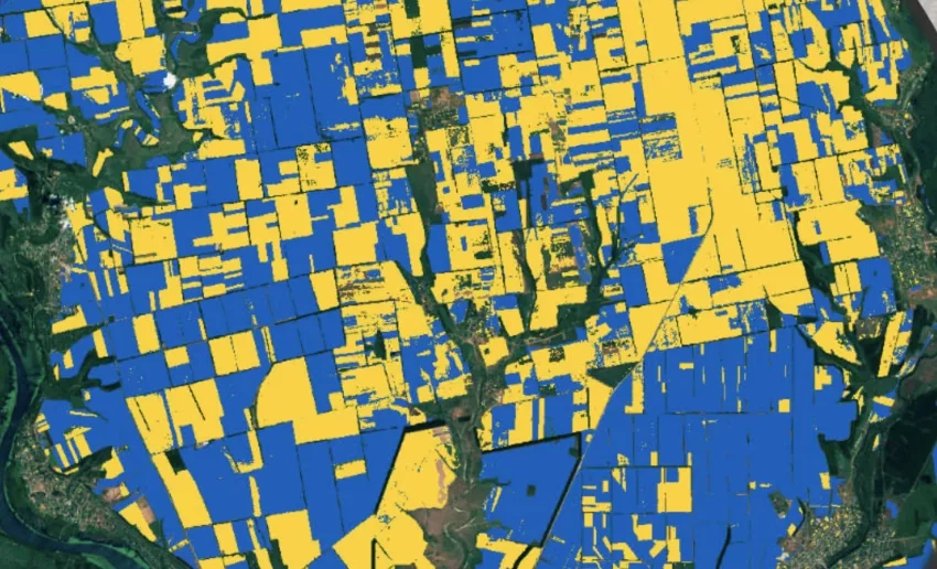
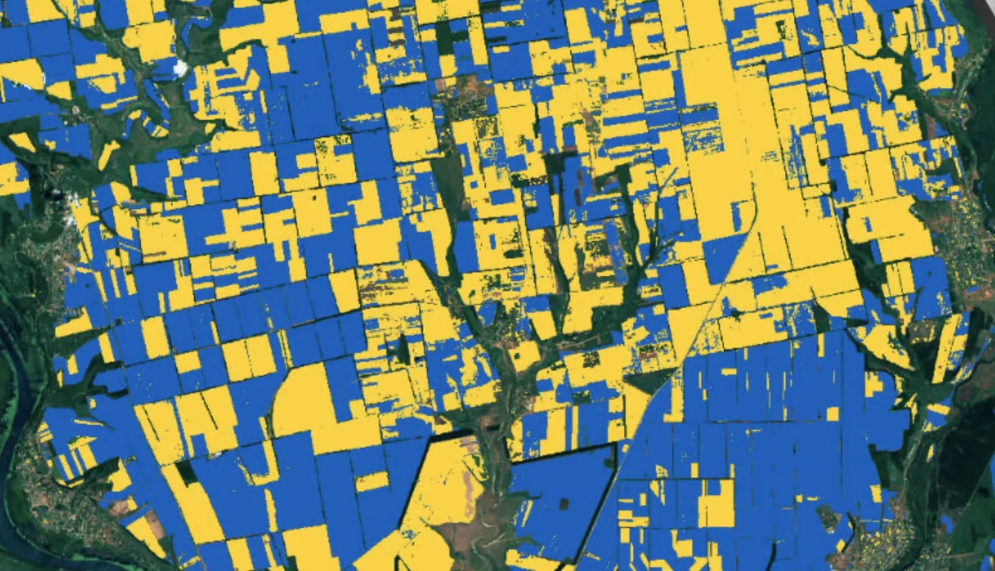
Using a combination of various satellites including from NASA, the European Space Agency (ESA) and Planet and machine learning models, NASA Harvest is developing several products. Those include estimates of planted area of winter and spring crops, tracking crop health (using variables including precipitation, temperature, soil moisture, and the ‘'greenness’ of vegetation, and others), forecasting crop yields, and monitoring harvest progress of wheat.
The team is also reviewing port logistics and trade flows, and food price spikes. These analyses provide critical information to aid in planning for and mitigating impacts of the war on the global food supply.
In collecting and producing this information, NASA Harvest works closely with the Ministry of Agrarian and Food Policy of Ukraine, international groups such as the Group on Earth Observations Global Agricultural Monitoring Initiative (GEOGLAM), the Famine Early Warning Systems Network (FEWS Net), the Institute for the Study of War, the University of Strasbourg in France, the ESA World Cereals project, the Agricultural Market Information System, and the UN Food and Agriculture Organization, and Planet, to name a few.
These types of analyses provide critical information to aid in planning and mitigation efforts from a regional to global scale.
More about NASA Harvest work is available at the Earth Observatory story, Measuring War’s Effect on a Global Breadbasket.