The week of July 13, 2020, NASA’s Earth Applied Sciences Program is participating in the all-virtual Esri User Conference. Esri is the organization responsible for ArcGIS, a software that helps researchers map complex components of Earth’s systems. With learning opportunities like technical workshops and lightning talks, the event will connect NASA scientists to communities of potential users of NASA resources, to highlight how Earth observations and research products can be used to inform efforts to advance and protect human and ecological health.
NASA is a founding member of the U.S. Group on Earth Observations (USGEO), an inter-agency forum established by the U.S. government to support the development of Earth-observing resources.
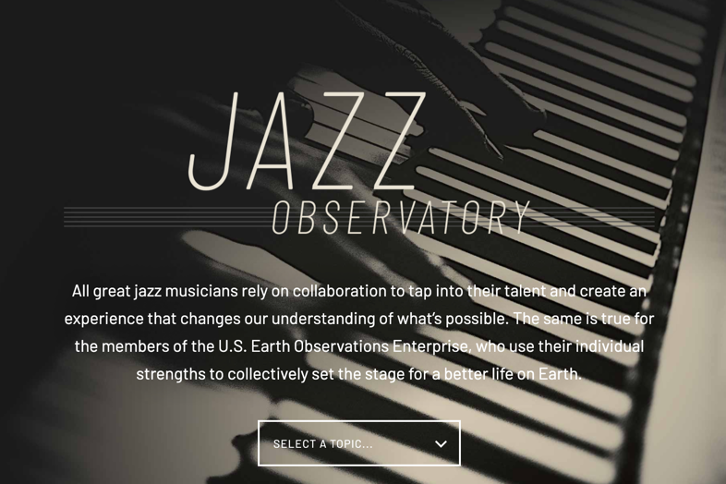
USGEO is hosting a virtual exhibit at the Esri Users Conference titled Jazz Observatory. Jazz Observatory combines music and science to explain how scientists and communities can collaborate to use Earth observations, like those from NASA satellites, for everything from emergency preparedness to ecological conservation. During the virtual conference, USGEO will also brief attendees on the national plan to foster partnerships that support and inform vital decision making across the country, and answer questions from participants on some of the most pressing Earth science issues that scientific collaboration like USGEO can help address.
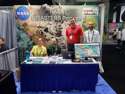
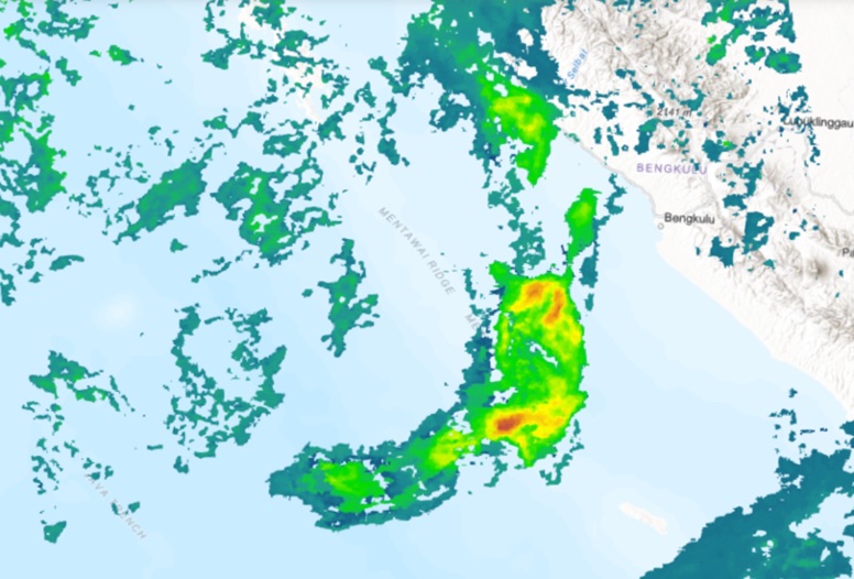
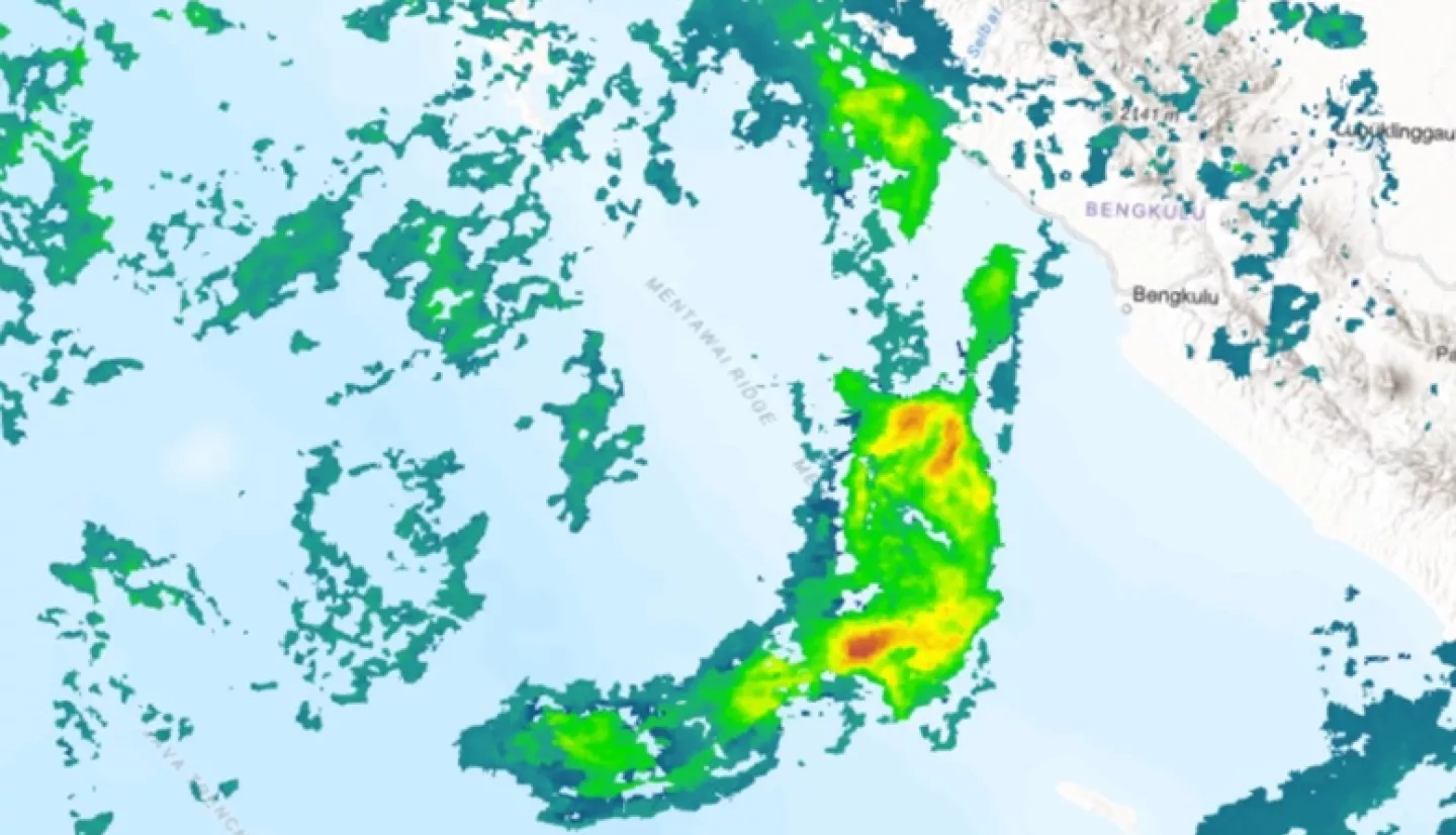
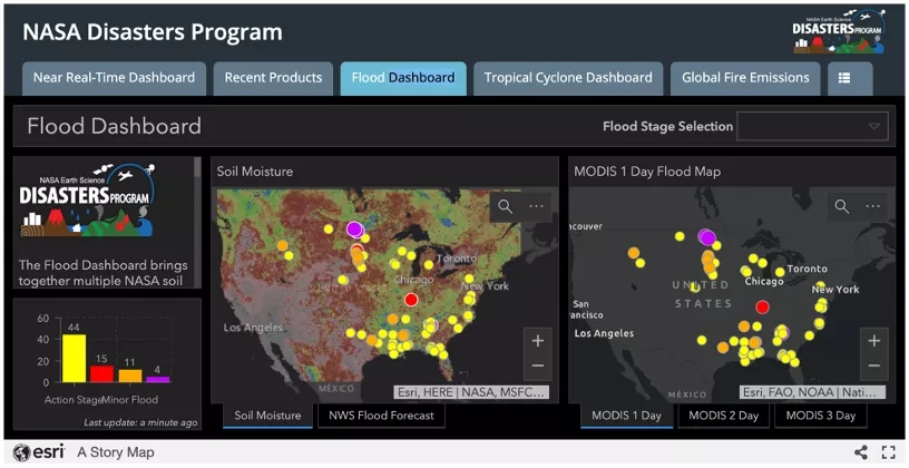
NASA’s Disasters program area is participating with a virtual booth that will highlight the NASA Disasters Mapping Portal, which provides data products, maps and applications to support the preparedness, response, recovery and mitigation of disasters both domestically and around the world. This web interface, designed for emergency response managers and scientists alike, uses Esri’s ArcGIS software to view and analyze the latest satellite data products and disaster response datasets in near real-time. Researchers working with the NASA Disasters program area will be available at the virtual booth throughout the conference to answer questions and discuss topics such as weather forecasting, tracking landslides using citizen science, using synthetic aperture radar (SAR) to improve resilience and response, and more.
A new book produced by Esri, “GIS for Science, Volume 2: Applying Mapping and Spatial Analytics,” will be premiered at the Esri User Conference and made available free to all attendees of the Science Symposium as a digital download. The book includes a chapter entitled “Monitoring Disasters,” written by the NASA Disasters program area Geographic Information System (GIS) team, and provides many real-world examples of how the NASA Disasters Mapping Portal has been used to aid in disaster response and recovery in the past few years. An official print version of the book will be published and released later this year.
While last year’s Disasters booth at the 2019 Esri Users Conference saw 18,000 visitors, this year’s new virtual format is expected to allow up to 60,000 people to better understand NASA’s resources by interacting with the virtual booth.
To learn more about how NASA resources are used in emergency response, visit the NASA Disasters program area website.