Published
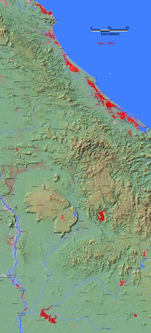
Darthmouth Flood Observatory of University of Colorado estimated maximum flood extent on November 7th, 2017 using NASA MODIS and Copernicus Sentinel 1 satelite data, operated by the European Space Agency (ESA). In the figure, the light gray denotes all previously-mapped flooding, and red is the active flooding. Blue shows the reference water extent.


