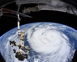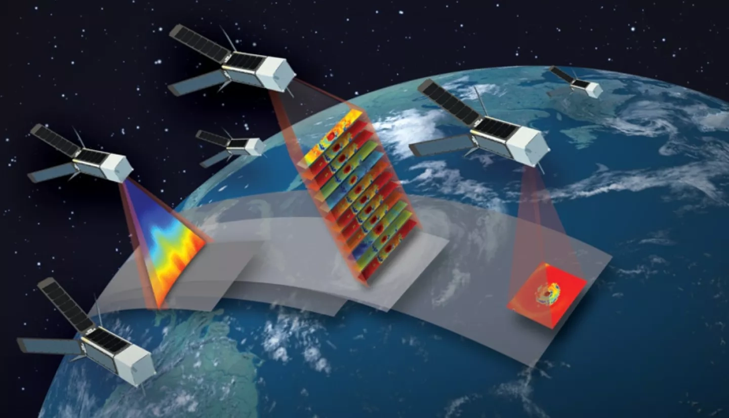
In 2022, NASA will launch a constellation of six small satellites (smallsats) to improve our understanding of tropical cyclones and support NASA’s TROPICS (Time-Resolved Observations of Precipitation structure and storm Intensity with a Constellation of Smallsats) mission. But before then, NASA launched the TROPICS pathfinder, a test satellite that aids the TROPICS mission by enabling full testing of the technology, communication systems, data processing, and data flow to application users in advance of the constellation’s launch next year. After being in orbit for only two months, the satellite captured images of Hurricane Ida just before and after it made landfall in Louisiana.
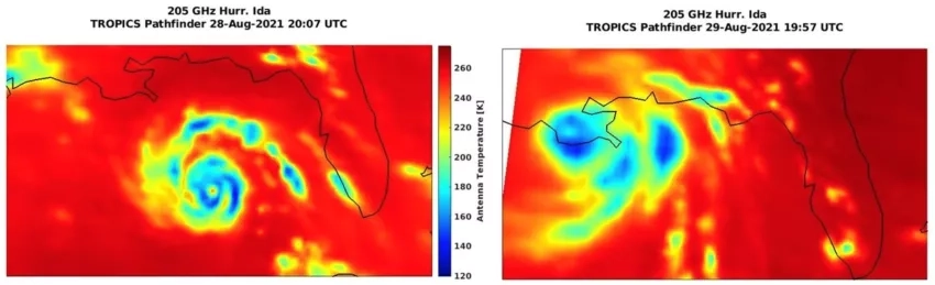
Aboard the TROPICS pathfinder is an instrument called a microwave radiometer, which detects temperature, moisture, and rainfall in the atmosphere. The satellite’s primary mission objective is to relate the structure of the atmospheric characteristics detected by the microwave radiometer to the evolution of tropical cyclone intensity – thus improving the accuracy of storm forecasts. The images of Hurricane Ida, captured at 205 GHz (Gigahertz), provide researchers with a first look into how the completely new 205-Ghz imaging channel works. “It’s really great to see how well the 205-GHz imagery represents Ida’s inner core,” said Patrick Duran, TROPICS Applications Lead at NASA’s Marshall Space Flight Center. “These initial images lend a lot of confidence that the data we receive from the imager will be useful in characterizing a hurricane’s structure.”
One thing that really stands out in the Aug. 28 image is the big band of blues and greens most pronounced to the north and east of the storm, far from its inner core. That is a squall line – a line of thunderstorms – associated with a tropical cyclone’s 24-hour cycle, which can cause severe weather far from the storm’s center. Since TROPICS is a constellation of satellites, it will be able to collect data much more frequently over a given storm, enabling a more in-depth analysis of these squall lines and how they form.
Learn more about NASA’s TROPICS Pathfinder: Small Satellites to Study Big Storms – NASA Prepares for the TROPICS Mission