In 2022 NASA is launching a constellation of six small satellites (smallsats) to improve our understanding of cyclones in the tropics. With a revisit time of 30 to 60 minutes between overpasses, the TROPICS mission will provide frequent observations of tropical storms as they form and strengthen, which will increase our understanding of the physical processes within storms and improve the accuracy of storm forecasts to better protect lives and property. On June 30, 2021, a TROPICS pathfinder satellite launched, which will enable full testing of the technology, communication systems, data processing, and data flow to application users in advance of the constellation’s launch.
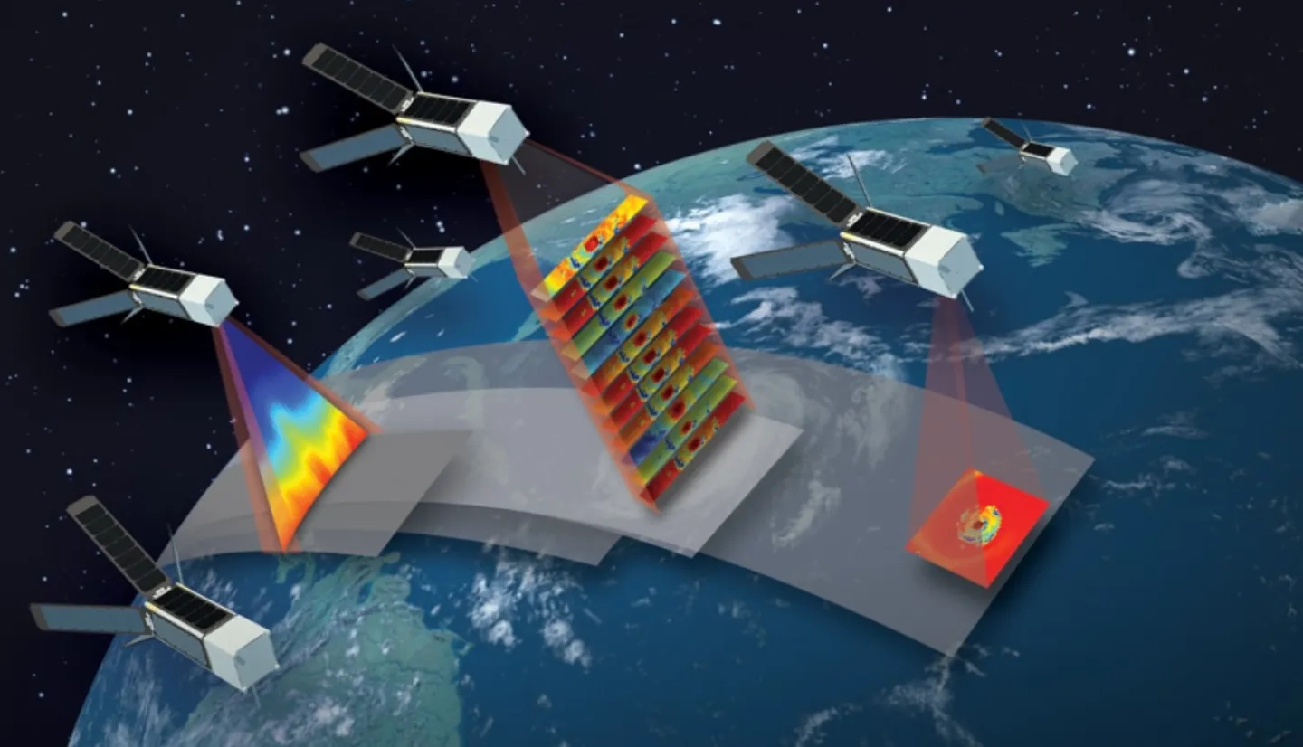
When launched, the TROPICS satellites will work together to provide near-hourly microwave observations of a storm's precipitation, temperature, and humidity. The mission is expected to help scientists understand the factors driving tropical cyclone intensification and to improve forecasting models.
Credits: NASA
The Time-Resolved Observations of Precipitation structure and storm Intensity with a Constellation of Smallsats (TROPICS) mission will measure the temperature, humidity and precipitation of storms in the tropics using passive microwave (PMW) sounder instruments, with spatial resolution comparable to current operational PMW sounders but greatly improved temporal resolution. The satellites for the TROPICS mission were delivered to NASA in 2019 and are currently scheduled to be deployed in a series of three launches between Jan. 8 and July 31, 2022. The NASA-funded mission is led by the MIT Lincoln Laboratory and is a collaboration between NASA, NOAA, and several other University and industry partners.
A New View of Tropical Storms

The primary mission objective of TROPICS is to relate temperature, humidity, and precipitation structure to the evolution of tropical cyclone intensity. Most previous passive microwave instruments have flown aboard satellites in polar or high-inclination orbits, which allows them to cover a larger area of the globe at the cost of taking longer between visits over the same region. For example, the NASA / JAXA Global Precipitation Measurement Mission (GPM) uses an international constellation of satellites in various overlapping orbits. As a result, it has improved the satellite sampling frequency of cyclones compared to past missions. However, each GPM constellation satellite has different hardware and measures at different channel frequencies, necessitating calibration and correction to merge and analyze data from the various sensor types. In contrast, the TROPICS smallsats use identical sensors and provide average revisit times between 30 and 60 minutes, allowing for better measurements of the quickly evolving changes within tropical cyclones over their entire life cycles. In addition to the insights gained by these frequent storm observations, the lessons learned from TROPICS will help develop future missions with applications for monitoring severe weather and aiding response and recovery efforts for disasters such as floods and hurricanes.
Applications Workshop Leads to Pathfinder Launch

To prepare for the TROPICS mission NASA hosted the 2nd TROPICS Applications Workshop in Miami, Florida, on Feb. 19 and 20, 2020. The workshop brought together researchers and potential end-users to discuss the mission’s status and direction and explore potential applications of TROPICS data. Attendees discussed potential techniques and tools for visualizations, mission latency, and the strengths and limitations of using small satellites in applied research and operations.
After the workshop, a full summary report was developed to outline recommendations for the science team and applications community to maximize the societal impact and benefit of the TROPICS mission. The applications community expressed a strong desire for the science team to launch a single TROPICS smallsat early, to verify the satellite performance and allow the teams to integrate these new observations in applied research and applications prior to the launch of the full constellation. The applications community feedback was well aligned with the efforts of the science team, and thus a TROPICS pathfinder mission was scheduled for launch in June 2021, which will allow the teams to prepare algorithms and ground systems and reduce the risk leading into the complete constellation launch. The TROPICS pathfinder mission is part of NASA’s Earth System Science Pathfinder (ESSP) program, which aims to stimulate new scientific understanding of the global Earth system through the development and operation of remote-sensing missions, advance knowledge of Earth as a system to meet environmental change challenges, and improve life on our planet.


