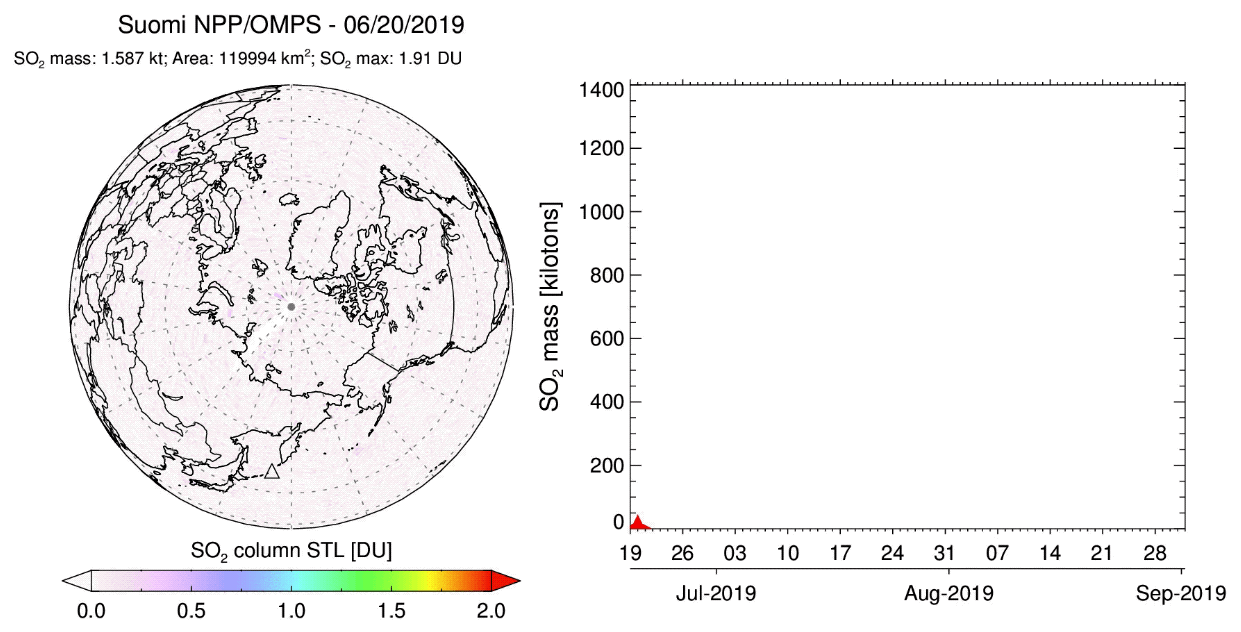
On June 22, 2019, the Raikoke volcano on Kuril Island erupted, spewing large volumes of ash and volcanic gases into the atmosphere. Volcanic ash (VA) and gasses pose a major threat to aviation, while gasses including sulfur dioxide (SO2) also impact climate and stratospheric ozone. Large concentrations of SO2 in the volcanic plumes pose a short-term hazard to aviation by impacting cabin air quality and also have possible long-term effects on aircraft. Traditionally, SO2 serves as a proxy for ash, which is the primary hazard to aircraft engines, frame and avionics.
In response to the eruption, SO2 maps and mass estimates were automatically produced by NASA’s near real-time (NRT) Global Sulfur Dioxide Monitoring system (https://so2.gsfc.nasa.gov), which was developed with funding from the NASA Earth Applied Sciences Disasters Program. The VA and SO2 satellite data products are routinely used by nine international Volcanic Ash Advisory Centers (VAACs) to issue VA advisories and short-term VA forecasts, which help re-route flights to avoid VA affected airspace. NASA has no formal responsibility for issuing aviation warnings, but regularly provides advice and consultation to partners at the USGS Alaska Volcano Observatory who consulted Anchorage-VAAC forecasters.
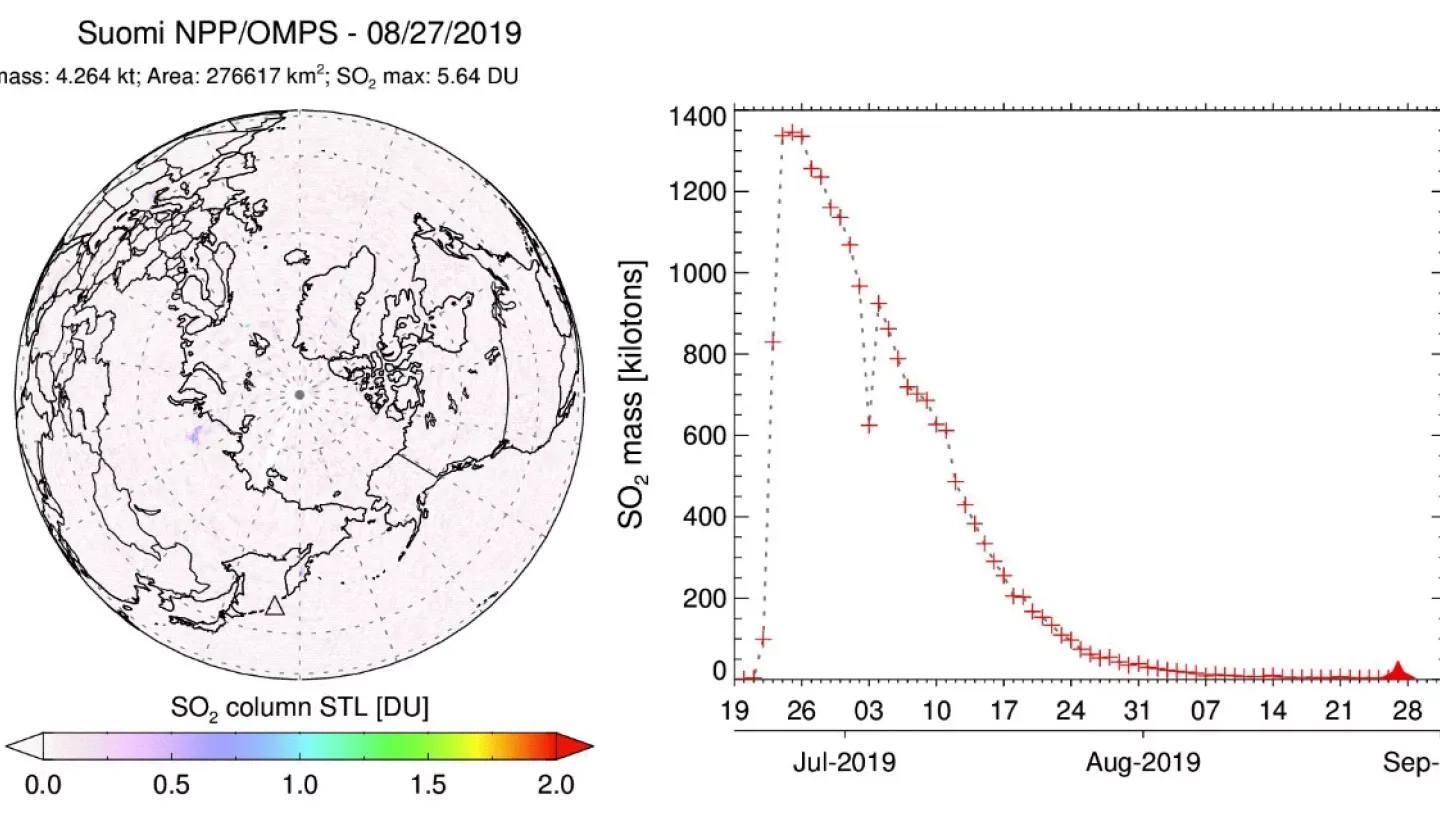
Raikoke was the largest eruption in the past decade in the North Pacific, and produced a widespread and long-lasting volcanic SO2 cloud. As part of post-response scientific analysis, an animation of refined daily SO2 maps was created by Prof. Simon Carn which visualizes the long-term SO2 dispersion from June 20 to August 31, 2019 and quantifies total SO2 mass decay due to chemical oxidation to sulfate aerosols. These relatively rare volcanic eruptions aid scientists in refining the volcanic cloud models used to estimate volcanic effects on climate and atmospheric ozone.
The instrument used to conduct the SO2 measurements was the Ozone Mapping and Profiler Suite (OMPS) Nadir Mapper – an Ultraviolet (UV) spectrometer aboard the NASA-NOAA Suomi National Polar-orbiting Partnership Satellite (Suomi NPP). Suomi NPP functions to observe many aspects of climate change and ozone layer conditions, as well as disasters, air pollution, vegetation, and more. OMPS also includes a Limb Profiler sensor to observe the atmospheric limb, gathering stratospheric ozone and aerosol profiles at high vertical resolution. Suomi NPP passed over the affected region daily to capture the SO2 data) shown in the animation. Accompanying the animation is a chart, which displays an exponential decay trend in the total SO2 mass as it is converted to sulfate aerosol over the course of a few weeks.
The goal of the Disasters Program volcanic research project “Day-Night Monitoring of Volcanic Sulphur Dioxide and Ash for Aviation Avoidance at Northern Polar Latitudes” lead by Nickolay Krotkov is to use the International Planetary Orbiter Processing Package (IPOPP) developed by the NASA Direct Readout Laboratory to expand the OMPS DR (direct readout) UV measurements of volcanic plumes, which are crucial to protecting flights by providing timely warnings and more accurate forecasts. The OMPS SO2 DR data are locally processed at the Geographic Information Network of Alaska (GINA) at the University of Alaska Fairbanks and at the Finnish Meteorological Institute (FMI).


