
To help users navigate NASA air quality data and instruments, NASA is conducting a two-part training series giving an inside look at how NASA measures air pollution from space.
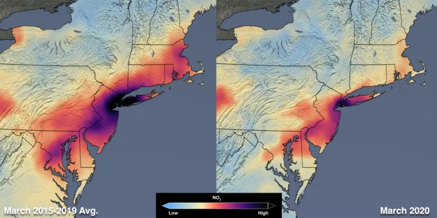
The series is in response to increased attention on Earth observations that are impacted by human behavior, such as air pollution, as the world responds to the COVID-19 pandemic. These changes include a 30 percent drop in air pollution over the northeastern United States as communities have adhered to shelter-in-place orders, with similar figures being reported in other parts of the world.
To support all users of NASA Earth science data, this training will cover which pollutants can be measured from space, how satellites make these measurements, the do’s and don’ts in interpreting satellite data and how to download and create your own visualizations. Both parts will be offered in English and Spanish, and anyone ranging from the general public, journalists, meteorologists and those new to remote sensing can benefit.
If you would like to take part in this two-part series, please register on ARSET’s website, arset.gsfc.nasa.gov. Dates and times are below:
Dates: May 26, 2020 & May 28, 2020.
Times: 10:00 - 11:30 a.m. EDT (English) & 2:00 - 3:30 p.m. EDT (Spanish)


