The recent catastrophic fires in California have yielded scenes of chaos in the region and the NASA Disasters program is working on providing the most recent satellite information that could help people on the ground. Dispersed smoke through the region has serious impacts on air quality and satellite information can bring several perspectives of smoke layers that are released into the atmosphere.
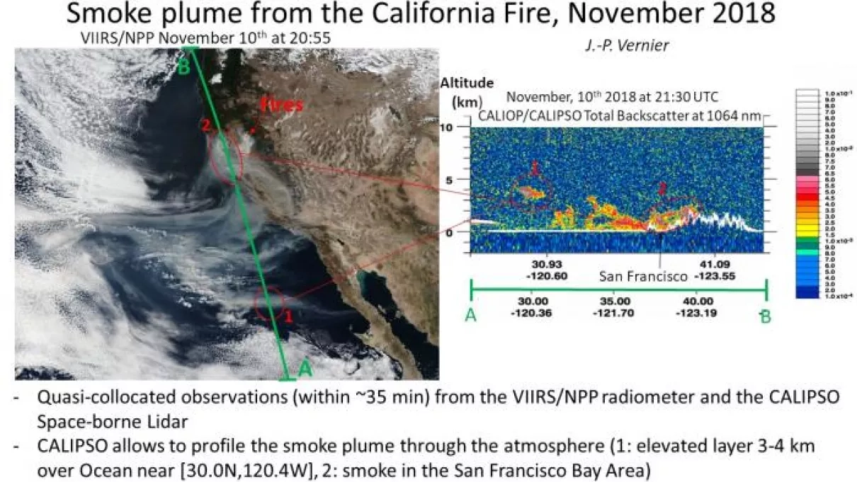
Two satellites, the NASA/NOAA Suomi National Polar-orbiting Partnership, or Suomi NPP and Cloud-Aerosol Lidar and Infrared Pathfinder (CALIPSO), flying within 30 minutes from each other have been used to investigate smoke plumes on November 10, 2018. The Visible Infrared Imaging Radiometer Suite (VIIRS) radiometer on the NPP satellite captured an image of the smoke coming from the Camp Fire in California and spreading across the Pacific Ocean. The CALIPSO space-borne lidar is used to profile the smoke. Elevated smoke layers up to 3-4 km are observed by the CALIPSO lidar across the Pacific Ocean (area 1 on the figure), while smoke near the source region over the San Francisco Bay area seems to remain near the ground between 0-2 km. Smoke caped near the ground worsens air quality and poses serious risk to public health. The NASA Disasters Program is working on providing satellite information to end-users to improve air quality forecasts.


