Near real-time fire emissions products from the Global Fire Emissions Database (GFED) have recently been added to the NASA Disasters Mapping Portal, making it easier to for disaster researchers and responders to track aerosols and changes in greenhouse gases and air quality from fires around the world.
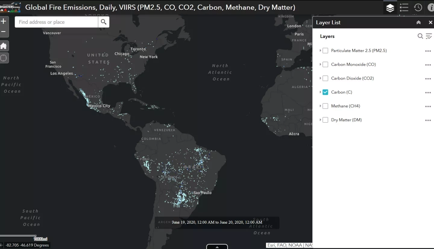
This application from the NASA Disasters Mapping Portal animates the past week of GFED near real-time data. Carbon emissions are shown by default, but you can click the “layers” icon in the upper right to toggle the display of other emissions such as methane, carbon monoxide and carbon dioxide. Credit: NASA
View on the NASA Disasters Mapping Portal
The dataset tracks six different emissions, which are carbon (C), methane (CH4), carbon monoxide (CO), carbon dioxide (CO2), dry matter (DM) and fine particulate matter (PM2.5). Data are presented in gigagrams (Gg) at 0.25° (~28km) resolution. Emissions data are updated daily and are available from January 2019 to present.
Fire emissions estimates from the GFED near real-time product are based on active fire detections from the Visible Infrared Imaging Radiometer Suite (VIIRS) instruments aboard the Suomi-NPP and NOAA-20 satellites. The historical relationship between VIIRS active fire detections and GFED emissions from 2012 – 2016 are used to create a statistical model which can convert active fire detections to biomass burned in near real-time. Long-term GFED emissions estimates are calculated using satellite burned area data and a carbon cycle model that cannot be produced in real-time. However active fire detections, including estimates of fire radiative power, are available within hours of the satellite overpass.
The Global Fire Emissions Database project is funded in part by the NASA Carbon Monitoring System (https://carbon.nasa.gov/), with additional funding from the Gordon and Betty Moore Foundation and the Netherlands Organisation for Scientific Research (NWO). The NASA Earth Applied Sciences Disasters Program Geographic Information System (GIS) team worked closely with the GFED team to get their data integrated into the mapping portal, including help with writing user and GIS friendly metadata, building web applications to demonstrate how to use the data, and sharing it to ArcGIS Online to enhance its discoverability. Making these data available in standard GIS formats makes it easier for disaster responders and researchers around the world to download and ingest the product for their own research and response purposes. These data can be used for situational awareness during active fires, including air quality monitoring and forecasts.


