Share icon
Published
Image of observed flooding areas of Tropical Storm Florence using Landstat 8 and Copernicus.
Credit: USGS, Robert Brakenridge (Dartmouth Flood Observatory at the University of Colorado) and Albert Kettner (Dartmouth Flood Observatory at the University of Colorado).

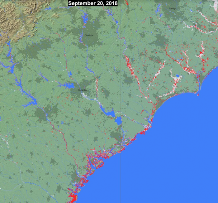
This image shows the maximum observed flooding areas using Landsat 8 and Copernicus / ESA Sentinel SAR data for Tropical Storm Florence. Landsat 8 is jointly managed by NASA and the United States Geological Survey (USGS). Copernicus is supported by the European Commission.

Related Impact

Story
News