Published
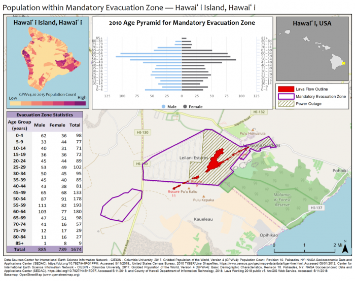
These two map provide some socioeconomic information on age, structure, and economic status of the population affected by the recent Kilauea Volcano eruption.
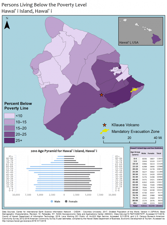
These two map provide some socioeconomic information on age, structure, and economic status of the population affected by the recent Kilauea Volcano eruption.


