Do you know how to protect yourself when an earthquake strikes? Earthquakes are one of the deadliest natural hazards on the planet, claiming thousands of lives and costing billions of dollars in damages every year. The Great ShakeOut event, organized by the U.S. Geological Survey (USGS) and partners, aims to encourage public participation in earthquake preparedness drills to reduce earthquake fatalities. The ShakeOut’s premise is simple – if more people understand how to protect themselves during an earthquake, we can lower the number of lives lost. Every year, International ShakeOut Day is held on the third Thursday of October, placing this year’s event on Oct. 21. Currently, the 2021 International ShakeOut Day has over 23.9 million global participants registered to partake in the event, including workplaces, schools, colleges, government agencies, and more.
Click here to learn more about The Great ShakeOut and how you can prepare for earthquakes.
NASA Supports Earthquake Preparedness
NASA’s Earth Applied Sciences Disasters program area advocates for disaster preparedness as a means of reducing overall disaster impact. When individuals, regions, and governments have a plan in place before disasters strike, they can prevent unnecessary loss in their communities. This year’s International ShakeOut Day is an opportunity for millions of people to learn about earthquake risk and create a plan to protect themselves.
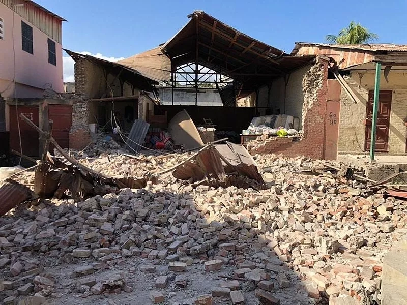
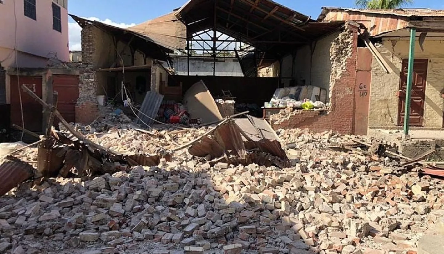
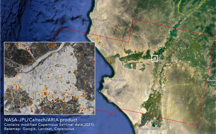
NASA also supports earthquake preparedness, response, and recovery with remote sensing technology. For example, NASA’s Advanced Rapid Imaging and Analysis (ARIA) project, a collaboration between Caltech and NASA’s Jet Propulsion Laboratory (JPL), uses radar and optical remote sensing, Global Positioning System (GPS), and seismic observations to study earthquakes and their impacts. With ARIA, maps of surface deformation caused by earthquakes and the damage they cause to buildings and infrastructure can be made within a day to several days after the event, depending on the availability of post-earthquake radar observations. These images can help disaster responders know which communities require immediate assistance, allowing for a smoother dispersion of life-saving emergency supplies and resources.
Earthquakes that occur near or under the ocean can trigger tsunamis, flooding entire communities and costing billions in infrastructure damage. Since tsunamis occur 15 to 30 minutes after an earthquake, it’s imperative that officials warn communities as quickly as possible. NASA’s research project, “Local Tsunami Early Warning with GNSS (Global Navigation Satellite System) Earthquake Source Products,” led by Diego Melgar, uses an algorithm that delivers real-time estimates of an earthquake’s magnitude, geographic extent, and details of the amount of motion on a fault. Tsunami warning centers can use this information to determine tsunami risk and notify the public in under five minutes. Through the combined use of NASA technology and research, and public education programs like ShakeOut, we can make earthquakes safer for everyone involved.
Read more about NASA’s role in earthquake resilience here: Supporting Earthquake Response and Recovery