Published
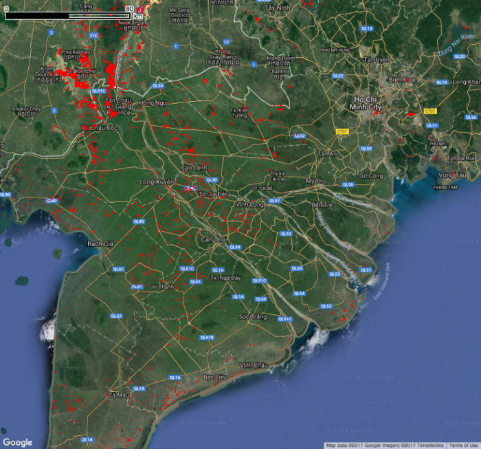
Current inundation layer from the Project Mekong App as of 11/10/2017. Red indicates areas with detected flooding. The application uses LANCE MODIS imagery (collected today, 11/10/2017) and applies a dynamic surface water classifier based on statistical training and thresholding of NDVI values. The method is outlined in more detail in Ahamed and Bolten, 2017 (https://doi.org/10.1016/j.jag.2017.05.006).


