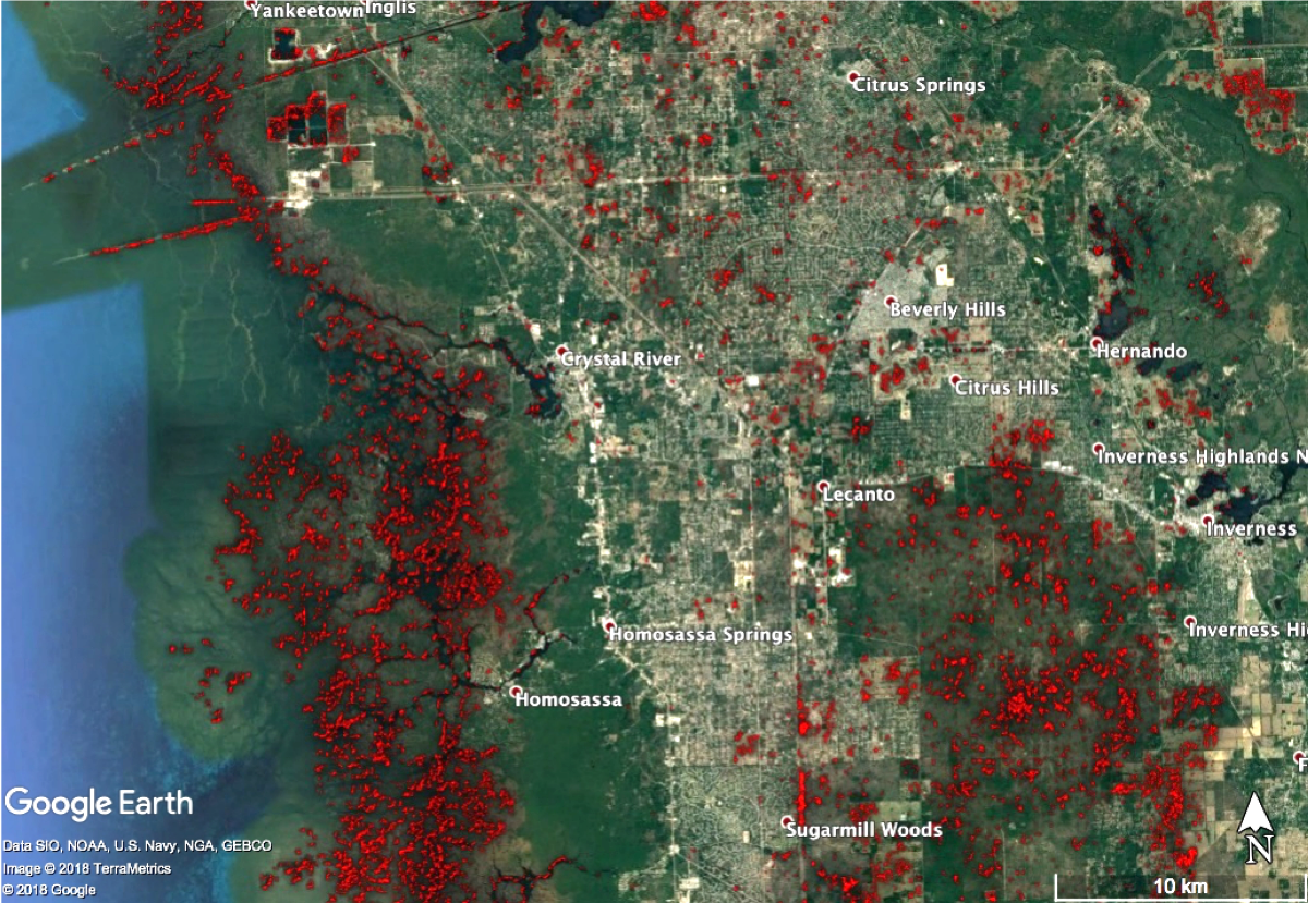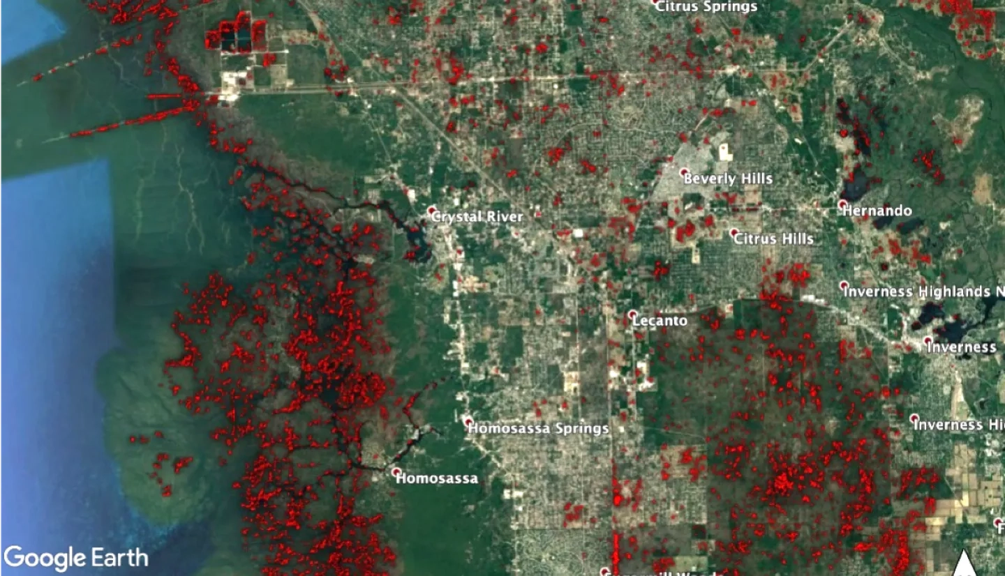
Radarsat-2 imagery was produced using images from October 11-14, 2018 in response to Hurricane Michael.The areas in red show regions with a 50% lower radar backscatter energy after the storm. The reddened areas identify locations where potential damage and/or flooding may have occured as a result of Hurricane Michael .
RADARSAT-2 is Canada's next-generation commercial SAR satellite, the follow-on to RADARSAT-1. The new satellite was launched in December, 2007 on a Soyuz vehicle from Russia's Baikonur Cosmodrome in Kazakhstan.
RADARSAT-2 has been designed with significant and powerful technical advancements which include 3m high-resolution imaging, flexibility in selection of polarization, left and right-looking imaging options, superior data storage and more precise measurements of spacecraft position and attitude. RADARSAT-2 is a unique collaboration between government - the Canadian Space Agency, and industry - MacDonald, Dettwiler and Associates Ltd. (MDA). MDA is responsible for the operations of the satellite and the ground segment. The CSA, who contributed funds for the construction and launch of the satellite, will recover its financial investment in the program through the supply of RADARSAT-2 data to Canadian government agencies during the lifetime of the mission