Published
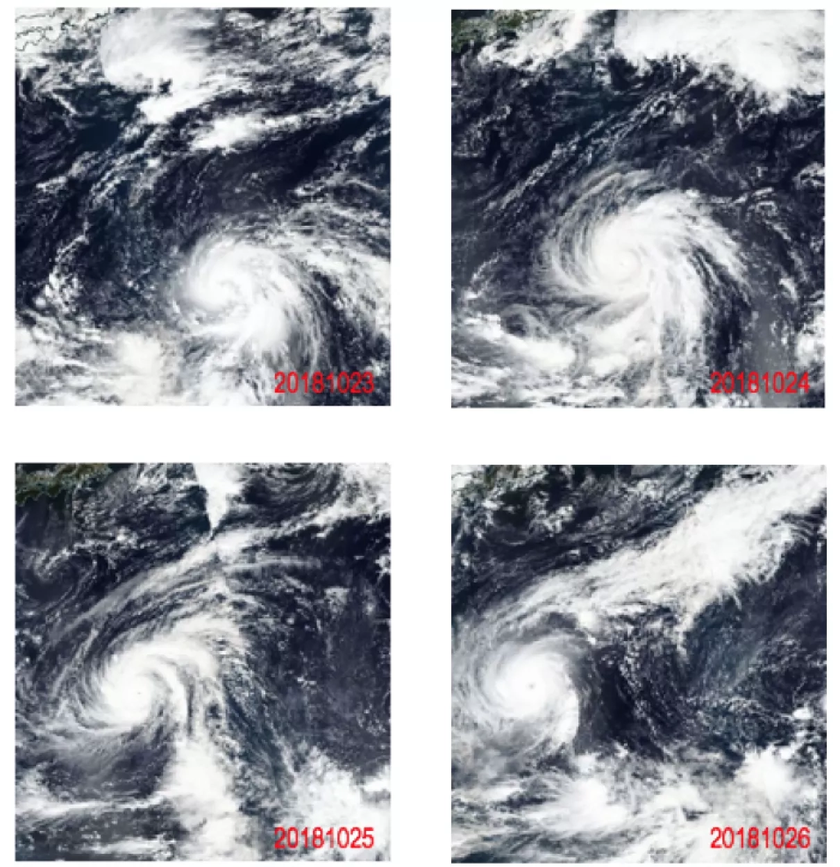
The VIIRS (Visible Infrared Imaging Radiometer Suite) instrument aboard the Suomi National Polar-orbiting Partnership (NPP) observed Typhoon Yutu around 1:30 pm local time from October 23 to 26, 2018. The VIIRS images revealed a cloud-filled eye. The Suomi NPP satellite is part of the Joint Polar Satellite System (JPSS), a joint NOAA/NASA program, created in order to design and launch the next generation of polar orbiting satellites. VIIRS data is used to measure cloud and aerosol properties, ocean color, ocean and land surface temperature, ice movement and temperature, fires, and Earth's albedo. Climatologists also use VIIRS data to improve our understanding of global climate change.


