
Published
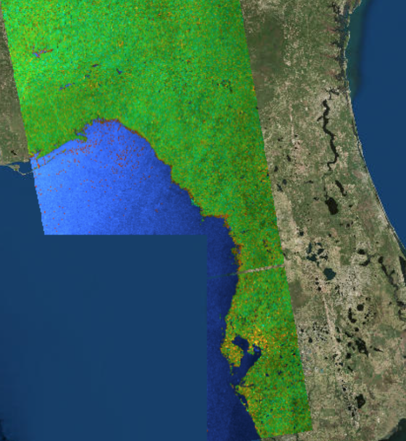
The Alaska Satellite Facility has developed a false color Red, Green, Blue (RGB) composite image of the Sentinel 1A/B Synthetic Aperture Radar (SAR) instrument which assigns the co- and cross-polarization information to a channel in the RGB composite. When used to support a flooding event, areas in blue denotes water present at the time of the satellite overpass prior to the landfall of Hurricane Michael. This product shows three areas: known reference water (blue), anomalous water identified outside the known reference water areas (red), and water detected in known wetlands or barren land (tan). The areas in red would be the likely flood waters due to the effects of Hurricane Michael.
1006


