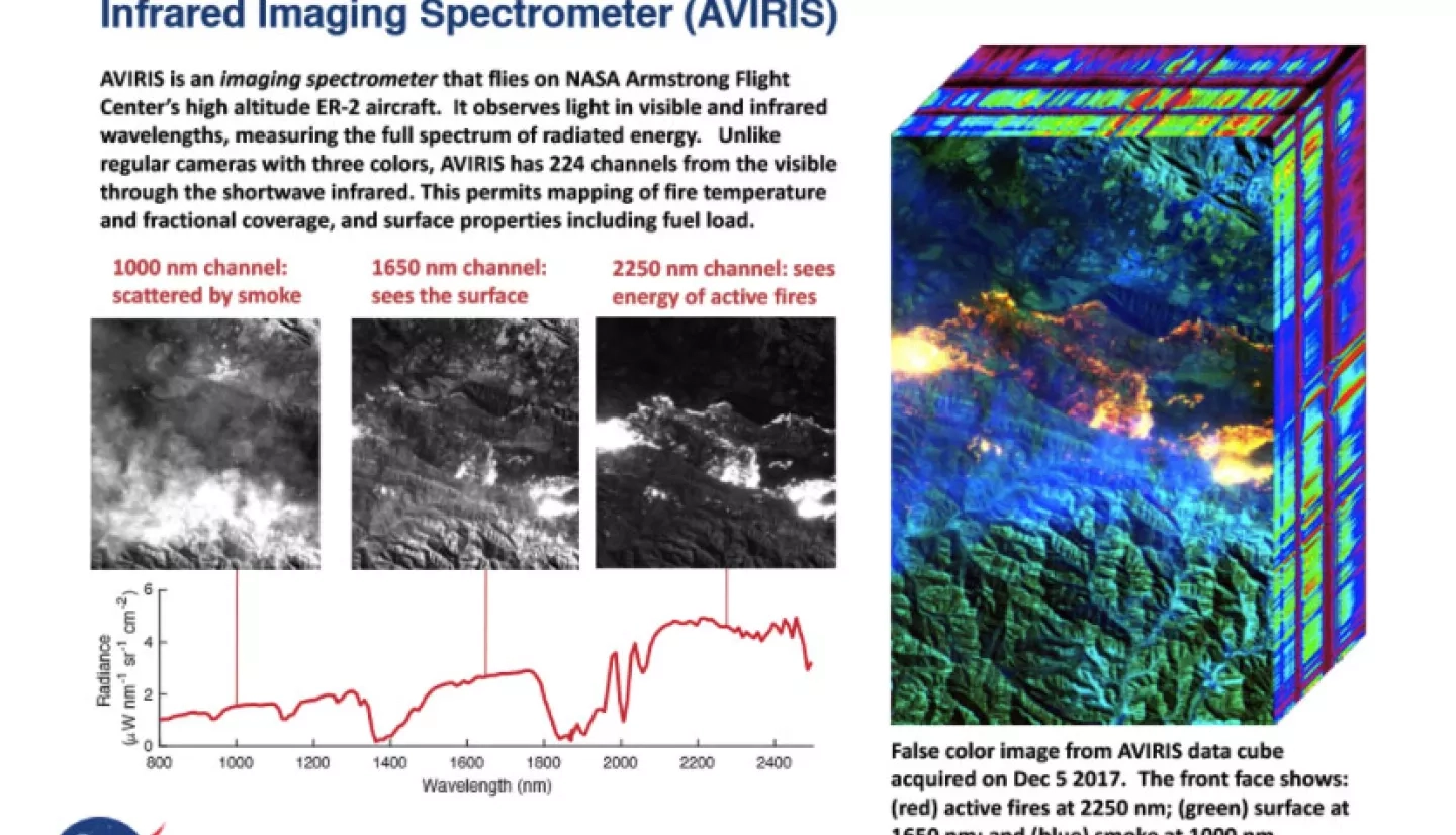
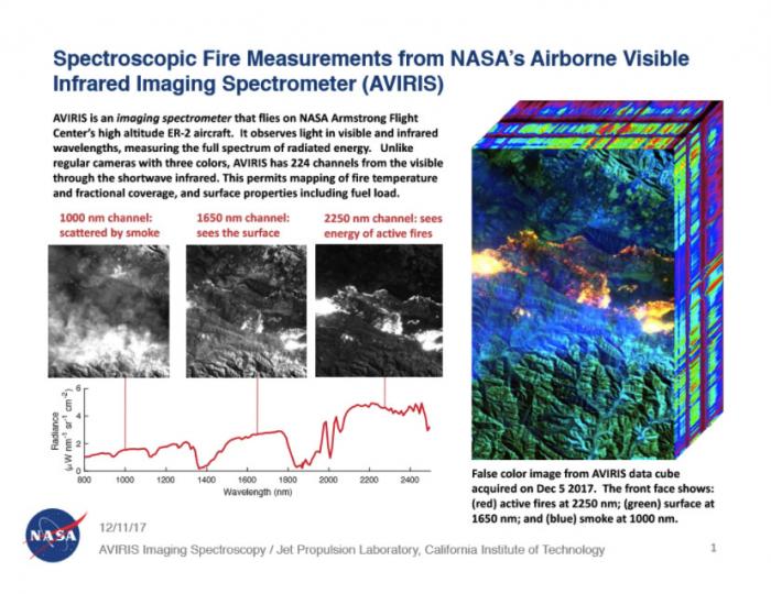
This data was acquired by the ”Classic” Airborne Visible Infrared Imaging Spectrometer (AVIRIS-C) instrument on December 5-7th. This is an instrument that flies on NASA Armstrong Flight Center’s high altitude ER-2 aircraft. It observes light in visible and infrared wavelengths, measuring the full spectrum of radiated energy. Unlike regular cameras with three colors, AVIRIS-C has 224 channels from the visible through the shortwave infrared, which provides a chemical signature or fingerprint.
Applications:
Imaging Spectroscopy data permits mapping of fire temperature and fractional coverage, and surface properties including fuel type and condition (alive vs. dead, moist vs. dry). Spectroscopy is also valuable for characterizing forest drought conditions and health to assess fire risk. AVIRIS-C has been observing fire-prone areas in Southern California over the span of many years, forming a growing time series of before/after imagery. This is helping to improve scientific understanding of fire risk and ecosystem response to the California drought.
Not only can this data be used to improve our scientific understanding of ecosystems, drought and fire, but also it is being used by state and federal land management agencies to inform fuel management and restoration initiatives, which require spatially-explicit information on vegetation species and their condition. Furthermore, the shortwave infrared detection of fire helps map the fire front even under smoke, which would be obscured in regular camera imagery, or at very coarse spatial resolution from some of the satellites that exist in space.


