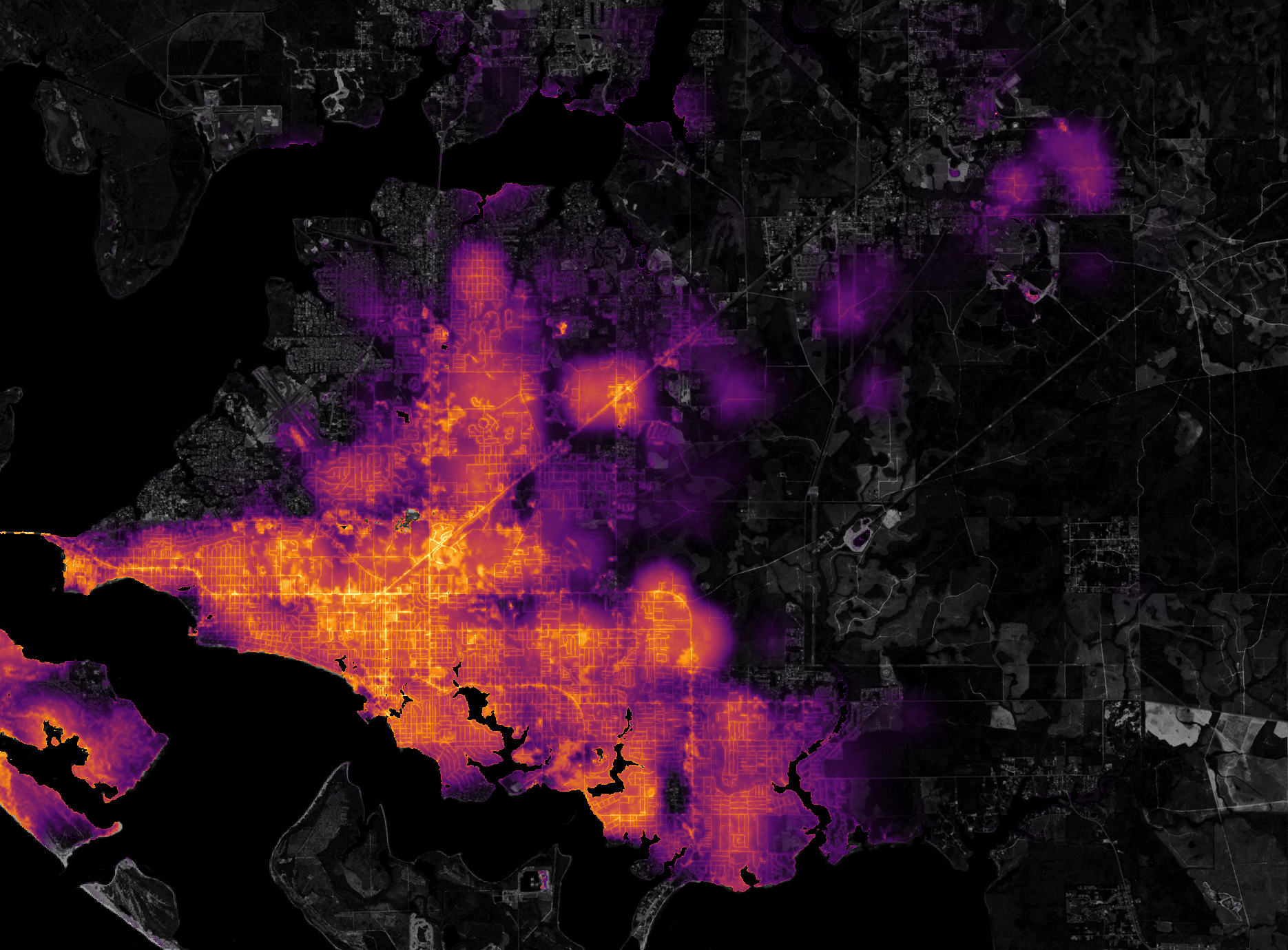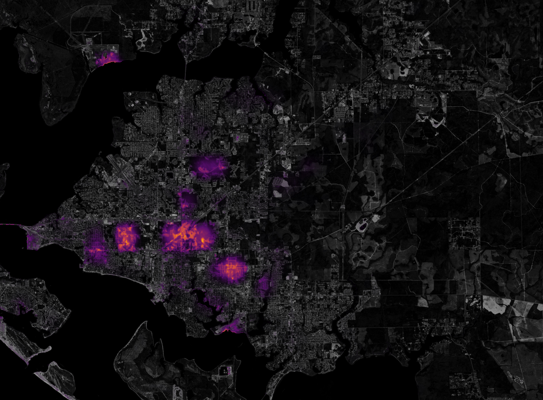
NASA's Earth Observatory featured an article showing night lights before and after Hurricane Michael's destruction.
After making landfall as a category 4 storm on October 10, 2018, Hurricane Michael knocked out power for at least 2.5 million customers in the southeastern United States, according to the Edison Electric Institute. These images of nighttime lights in Florida, Georgia, and Alabama come from the Suomi NPP satellite and were acquired on October 6 and October 12, 2018.
The first set of images (above) shows a natural view of night lights from the “day-night band” (DNB) of the Visible Infrared Imaging Radiometer Suite (VIIRS). The DNB detects light in a range of wavelengths from green to near-infrared, and uses filtering techniques to observe signals such as city lights, auroras, wildfires, and reflected moonlight.
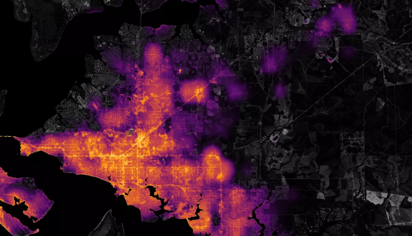
The second pair of images is a data visualization of where lights went out in Panama City, Florida. A team of scientists from NASA’s Goddard Space Flight Center processed and corrected the raw data to filter out stray light from the Moon, fires, airglow, and any other sources that are not electric lights. Their processing techniques also removed other atmospheric interference, such as dust, haze, and thin clouds. The images show conditions on October 6 and October 12, 2018.