Landscape ecologist Naiara Pinto and colleagues at NASA’s Jet Propulsion Laboratory are using synthetic aperture radar (SAR) to take a long view at forest fires in California, trying to decipher where and how well forests and scrublands are recovering in the years after a fire.
SAR instruments allow researchers to observe changes to Earth’s surface over time - such as land deformation after earthquakes, the extent of flooding, or the exposure of denuded or bare ground after large fires. SAR instruments can observe by day or night and can see land through clouds and smoke, so they are helpful for observing fire fronts and burn scars during and shortly after fire ravages a landscape. SAR instruments are carried on the European Space Agency's Sentinel satellites, while NASA currently deploys its Uninhabited Aerial Vehicle Synthetic Aperture Radar (UAVSAR) via research aircraft.
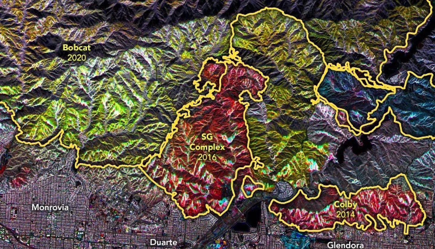
Mounted on the bottom of NASA research planes, UAVSAR has been flown over the same portions of Southern California several times since 2009. Pinto and JPL colleagues Latha Baskaran, Yunling Lou, and David Schimel analyzed that data and developed a mapping technique to show the different stages of removal and regrowth of vegetation (chapparal and forest).
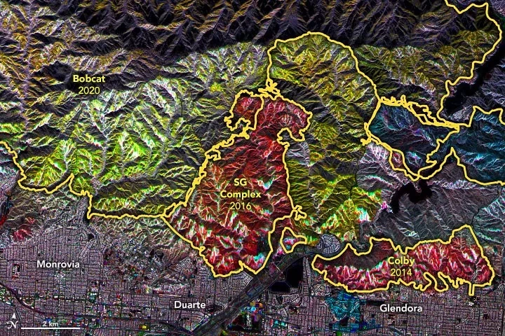
The maps above are essentially mosaics of the observations across a decade. Radar signals bounce off burned, barren terrain differently than they reflect from unburned, brush-covered hillsides or from fresh growth. The colors indicate the relative amount of vegetation observed by different UAVSAR flights at different times. Yellow lines on the maps indicate the extent of several major fires from the past decade: Station, Colby, San Gabriel (SG) Complex, La Tuna, and Bobcat.
“Overall, the colors are telling us that the Angeles National Forest contains a patchwork of plant communities at different stages of regeneration,” said Pinto, who is a science coordinator for UAVSAR. For instance, areas with more red had more vegetation in 2010 than they do now. Areas with more blue and green shading had more vegetation (regrowth) in recent years. Yellow indicates areas burned in 2020 that had a higher volume of vegetation in 2010 and 2017 (red+green) but lower volume in 2020 (blue).
The project has been supported by NASA’s Earth Applied Sciences Disasters program, which generates maps and other data products for institutional partners as they work to mitigate and recover from natural hazards and disasters.
Read the full story at NASA’s Earth Observatory: A Mosaic of Fire Data


