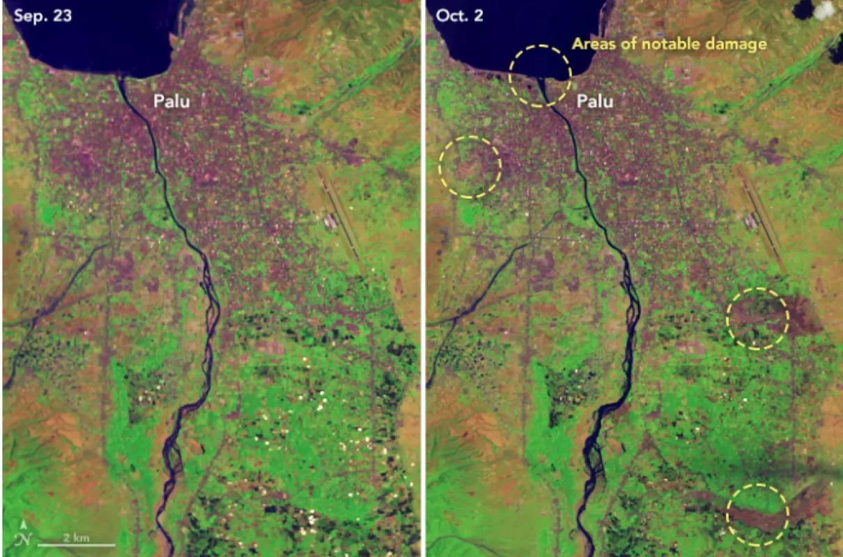
Ball Aerospace & Technologies Corporation Operational Land Imager (OLI) on the United States Geological Survey and NASA’s Landsat 8 satellite captured a natural-color image of Palu, Indonesia on October 2, 2018. The second image shows the same area before the earthquake and tsunami. The false-color (bands 6-5-2) images make it easier to distinguish between urban areas (purple-gray), vegetation (green), and upturned soil (brown and tan).
While coastal areas took heavy damage because of the tsunami, the image also reveals three large inland flows of mud that caused severe damage in densely populated areas. Intense shaking from the earthquake may have triggered liquefaction and lateral spreading, processes in which wet sand and silt takes on the characteristics of a liquid. These processes, which are especially common near streams and on reclaimed land, can produce destructive mudslides even in relatively flat areas.


