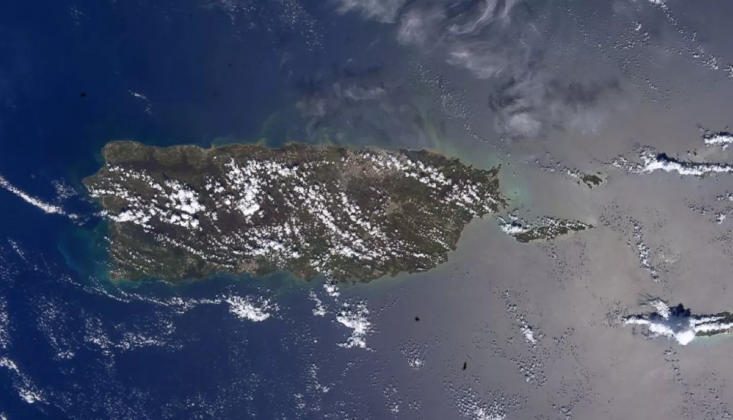
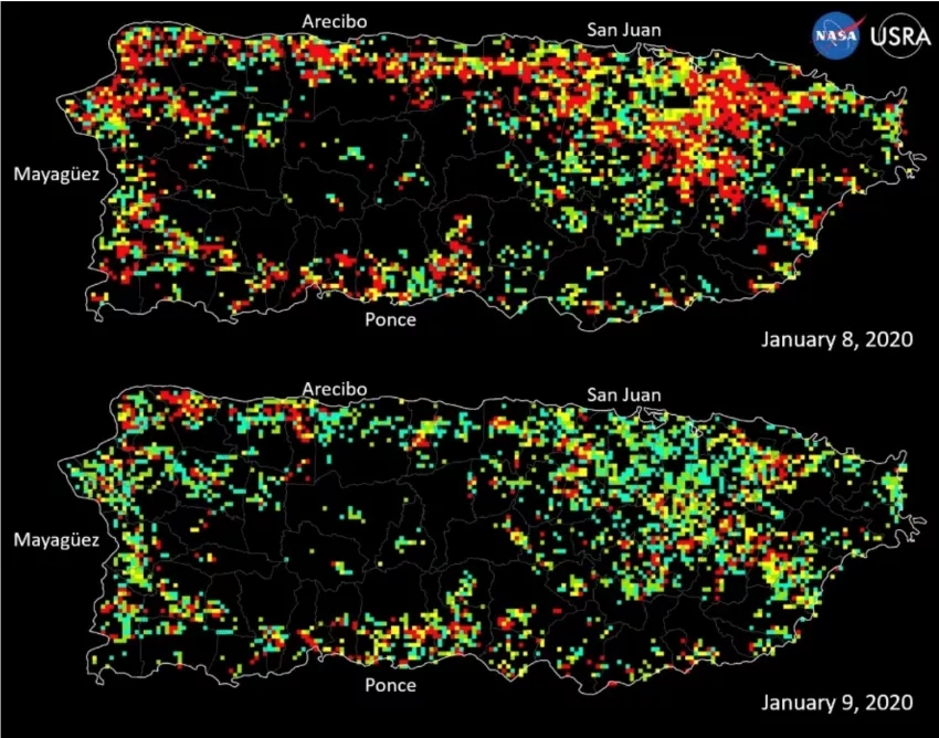
In Dec. 2019, the world anxiously watched as hundreds of earthquakes struck Puerto Rico. The smaller tremors eventually culminated into a powerful 6.4 magnitude earthquake that shook with enough force to leave more than 2,000 Puerto Ricans in shelters, nearly 1 million without power, and hundreds of thousands without water. NASA quickly mobilized to provide Earth-observing satellite data to support response and recovery for the disaster – collecting information and coordinating with stakeholders, university partners, and the federal agencies leading the response effort.
Two years after the event, the affected communities continue to be at high risk for hazards such as landslides, flooding, or tsunamis. To reduce this risk, NASA’s Disasters program sponsored a collaborative investigation on the best practices for risk assessment among vulnerable communities of southwest Puerto Rico. This multi-threat assessment contributes to the Sendai Framework for Disaster Risk Reduction – an international document that articulates principles and targets to reduce global disaster risk and increase resilience. More specifically, this project fulfills the Sendai Framework’s first priority: understanding disaster risk at a systemic level, enabling communities to create solutions for disaster mitigation, adaptation, response and recovery.
NASA scientists are working closely with local and national emergency managers, data product and tool providers, hazard experts, mapping agencies, and conservation planners to ensure community involvement in the project. Among the local collaborators are Dr. Allan Astorga, leader of the SalveTerra methodology – an environmental consulting firm, and Para La Naturaleza – a nonprofit with society at the center of its conservation goals. The investigation aims to compile currently available disaster risk information for the region and combine it with new risk information from NASA’s database and other reliable sources. Then, it will use the aggregated information to create a high-resolution map depicting natural hazards and population risk for 11 municipalities in southwest Puerto Rico.
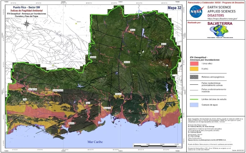
When resources are limited, knowing exactly where to distribute emergency supplies can mean the difference between life and death for disaster-stricken communities. This digital map will help decision-makers determine which populations are at a higher risk for disasters before an event occurs – allowing for a smoother and quicker dispersal of emergency supplies and evacuation plans.
NASA also teamed up with Navteca, a company that is exploring the potential of gaming software to create more immersive visualizations to push the boundaries of technology used for disasters and enhance decision-making. Navteca is creating a 3D version of the Puerto Rican risk assessment map that will allow decision-makers to see the region, complete with bodies of water, terrain, and infrastructure, and add risk data layers as necessary. The goal is to create an immersive map that allows decision-makers to identify high-risk areas quickly and thoroughly in the event of a disaster. Collaborating with like-minded organizations allows NASA to leverage existing resources and relationships to ensure that reliable data is integrated seamlessly into local disaster preparation, response, and recovery plans.


