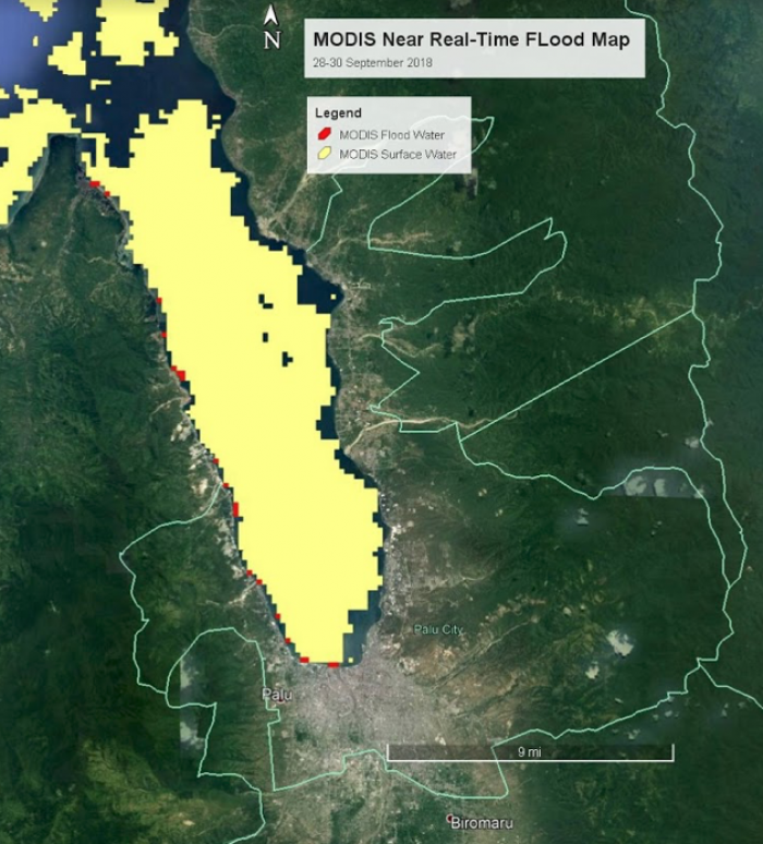
This map was created from the Moderate Resolution Imaging Spectroradiometer (MODIS) Near Real-Time Global (NRT) Flood Mapping product. This image shows the 3-day composite flood (new/anomalous) water in red on top of the surface (known/existing) water in yellow. According to several news media outlets, many coastal buildings and streets were already flooded on September 28, 2018, indicating that an initial wave had already hit the coast in Palu, Indonesia. (Source: The New York Times, https://www.nytimes.com/2018/09/28/world/asia/tsunami-palu-indonesia-ea…). The MODIS Near Real-Time (NRT) Global Flood Mapping Project produces global daily surface and flood water maps at approximately 250 m spatial resolution. NASA Land, Atmosphere Near real-time Capability for EOS (LANCE) provides data to the NRT Global MODIS Flood Mapping initiative. This project was developed in collaboration with Bob Brakenridge at the Dartmouth Flood Observatory (DFO): http://floodobservatory.colorado.edu