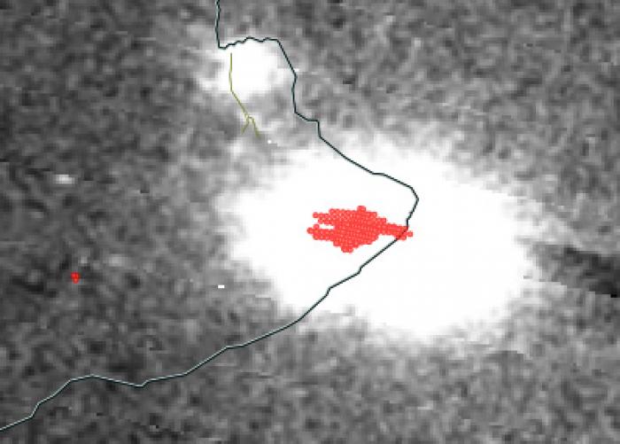
May 22nd, 2018:
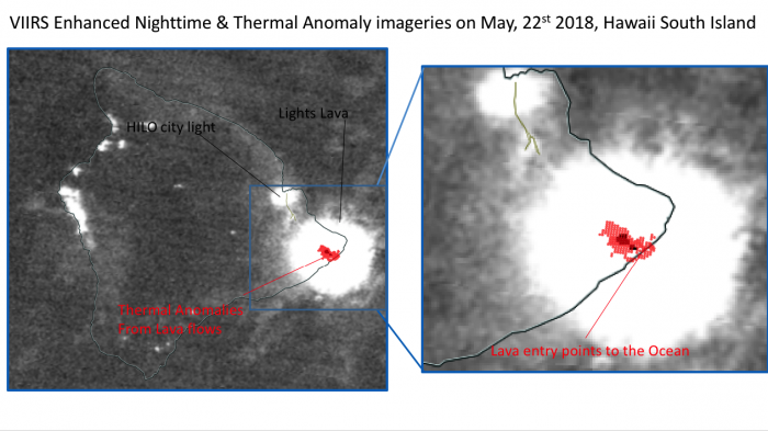
VIIRS thermal anomalies continues to locate lava fountains from fissure 6, 19 and 22 flowing toward the ocean though several channels consistent with thermal maps from the USGS on May, 22nd. VIIRS suggests hot spots along the coast consistent with Lava flow entries warming up the ocean in the proximity of the coast. VIIRS nighttime imagery shows the light coming from the lava and reaching saturation levels.
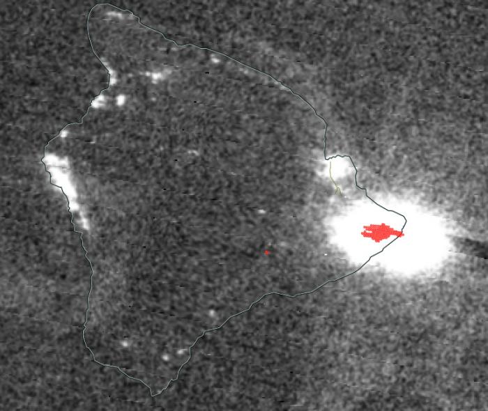
May 21st, 2018:
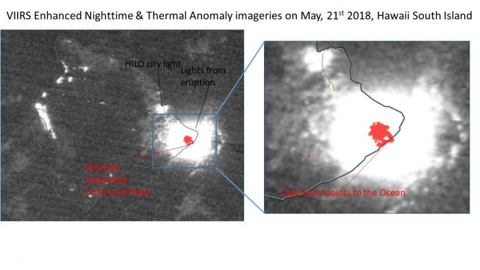
The latest VIIRS day/night band imagery shows thermal anomolies from the lava flows as well as lava entry points to the ocean.
May 20th, 2018:
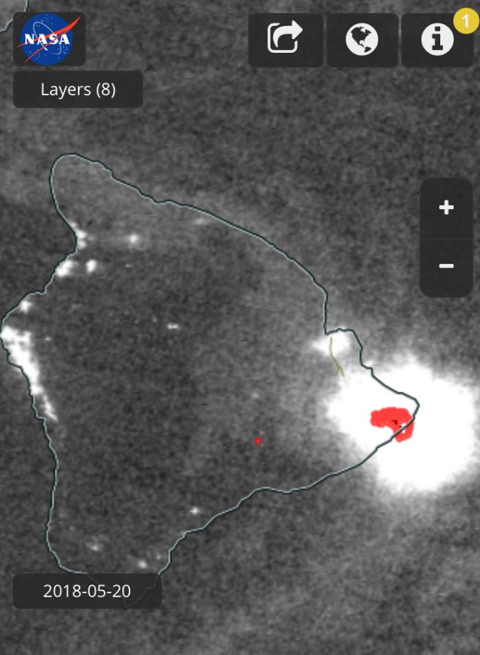
Updated VIIRS Thermal and Optical Imagery for May 20th 2018.. An unusual feature is now visible - thermal anomalies are now observed near and over water. Recent news has confirmed that the lava flows have reached the ocean crossing the 137 road (http://m.hawaiinewsnow.com/hawaiinewsnow/db_330510/contentdetail.htm?co…).
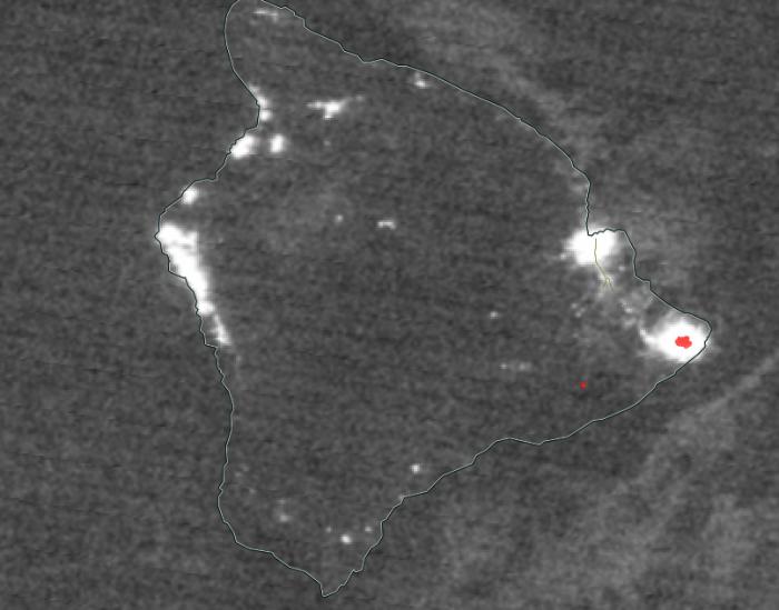
May 19th, 2018:
Thermal anomalies and enhanced night imagery seem to indicate that the Lava flows from fissures (16-17) and maybe more have reached the ocean. One can now see over the south Pohoa region one of the most extensive thermal anomalies since the eruption.
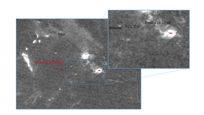
May 16th, 2018:
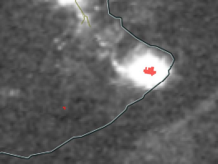
The VIIRS instrument on NASA's Suomi NPP satellite showed this enhanced nighttime image on May 16th, 2018 superimposed with thermal anomalies (red points). Multiple thermal anomalies associated with bright light emissions are observed near the SouthEast tip of Hawaii’s big island (HILO city lights seen further north). A zoom over this area shows that those thermal anomalies are consistent with the opened fissures emitting Lava (fissure 16-17-18) further east from Leilani area. Thermal anomalies are also observed near the Puʻu ʻŌʻō craters but without significant bright spots.
May 15th, 2018:
The VIIRS instrument on NASA's Suomi NPP satellite showed this enhanced nighttime image on May 15th, 2018 superimposed with thermal anomalies (red points). Multiple thermal anomalies associated with bright light emissions are observed near the SouthEast tip of Hawaii’s big island. A zoom over this area shows that those thermal anomalies are consistent with the new observed opening fissures (fissure 16-17-18) further east from Leilani area. Thermal anomalies are also observed near the Kilauea and Puʻu ʻŌʻō craters but without significant bright spots.
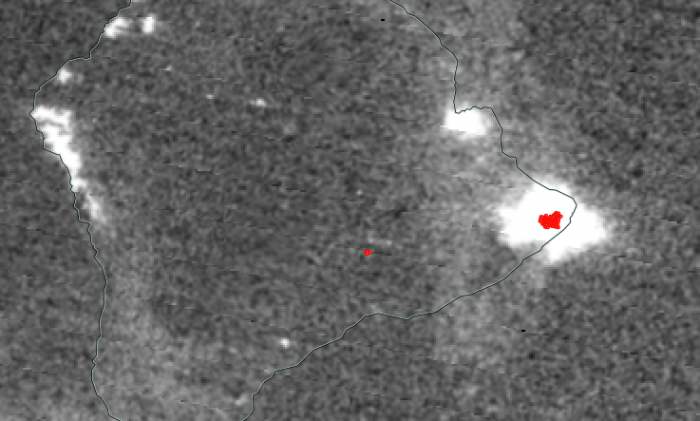
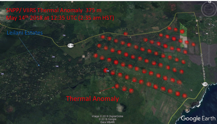
May 14th, 2018:
The VIIRS instrument on NASA's Suomi NPP satellite captured this enhanced nighttime image (top) on May 14th, 2018 superimposed with thermal anomalies (red points). Multiple thermal anomalies associated with bright light emissions are observed on this satellite overpass near the South East tip of Hawaii’s big island. A zoom over this area (bottom) shows that those thermal anomalies are located further east from Leilani area, and are consistent with the new opening fissures observed on the ground (fissure 17th and 18th). The extension of the thermal anomalies toward the ocean also seems to be consistent with lava flow moving toward the water.