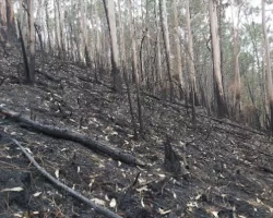
The Washburn Wildfire burned through the Eastern Sierras in California, including Yosemite National Park, from July 7th to 30th and burned over 4,800 acres. The fire caused road closures around and inside the park and, notably, the closure of the Mariposa Grove of Giant Sequoias for multiple weeks.
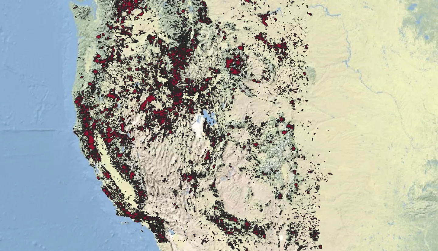
The Washburn Fire fits into a larger pattern of wildfires in the western United States whereby wildland fires are occurring more frequently, and over a longer time period each year – extending the fire season. Funded scientists from NASA's Earth Science Data Systems program, known as NASA EarthData, have been spatializing wildfires, or placing documented wildland fires into easy-to-use mapping software, of all sizes throughout the western United States since 1950. Since the 1980s and 1990s, Earth observation satellites have improved our ability to map fires. Before open-source satellite data was available, scientists assembled similar information from multiple other sources – including ground reports and federal and state reporting.
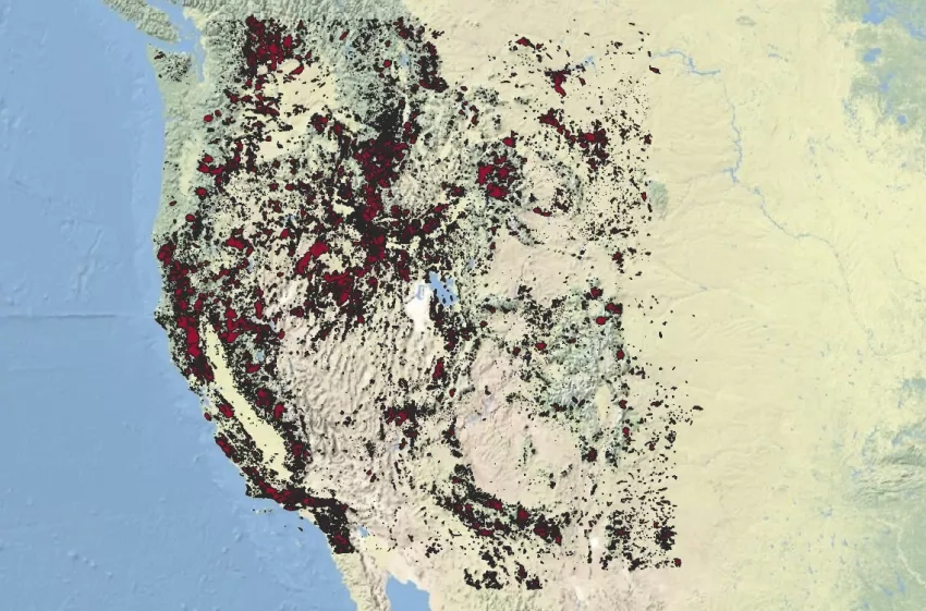
Many land managers and scientists use NASA satellite data and products to under historical fire patterns and changes, including the readily available images from the Landsat missions and the Advanced Very High Resolution Radiometer (AVHRR) instruments aboard many National Oceanographic and Atmospheric Administration (NOAA) satellites. AVHRR measures land and sea surface temperature, cloud cover, snow and ice cover, soil moisture, and vegetation indices. The data from Landsat and AVHRR instruments is open source and free and open to the public. Having the data easily accessible allows many various researchers to identify and track patterns of western wildfires. One NASA-funded study found near exponential growth in fire frequency and size from 1950 to 2019. Wildland fires, like the Washburn Fire, have become much more standard and common in the last few decades. NASA EarthData has shown that mean fire size per decade is increasing, such that the average wildland fires in the 1950s were 1,200 acres (485 hectares), but by the 2010s the average had doubled to over 3,400 acres (1376 hectares). The Washburn Fire not only surpassed the average fire size for the 2010s but was also much larger than historic fires for the same geographic area.
The National Park Service has been recording and mapping fires in Yosemite National Park for the past five decades. The fires that have taken place in the Park Service’s most recent mapped period (2010-2018) have been much larger than in previous decades, resulting in more extensive fires than in previous decades. The Park Service’s data finds that not only are wildland fires in the western U.S. much larger than years previously, first within the Yosemite National Park are also much larger. The National Park Service also noted that between 2015 and 2021, over 85% of the acreage of all giant sequoia groves across the Sierra Nevada burned in wildfires. In the previous century, only 25% of the acreage burned.
Moving forward, there is a need for a collaborative and analytic space for members of the wildfire community to share resources, analyze data (like NASA EarthData), and discuss solutions. The Actionable Fire Science Information Hub, (AFSI), developed by NASA Applied Sciences, is a pilot concept that seeks to satisfy these needs in the pre-fire, active fire, and post-fire communities. For more information can be found at the AFSI Hub website.