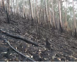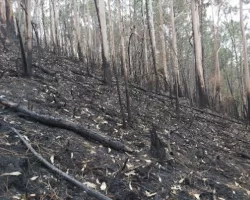
On July 22, 2016, the Soberanes fire began in Monterey County, California. It eventually consumed more than 130,000 acres of forest. The disaster had a major impact beyond destroyed property and smoky air – the soil lost the protective cover holding it in place. This made the ground more vulnerable to flooding and erosion.
Researchers from NASA’s Earth Applied Sciences Program worked with the U.S. Forest Service and Michigan Technological University to create a tool that helps responders navigate this post-fire hazard.
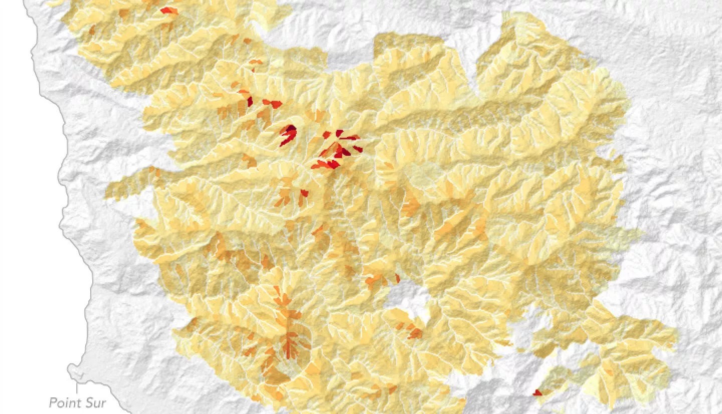
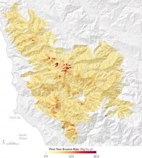
The Rapid Response Erosion Database (RRED) allows users to start by simply uploading an image of a burned area. These images are usually acquired by the Landsat 8 satellite. RRED then assembles vegetation, soil, and elevation data for that area. Emergency response teams can use the results to predict runoff and erosion.
As was the case with the Soberanes fire, areas with steeper terrain are often linked to higher erosion rates. These maps inform fire recovery decisions like where to apply mulch treatments to increase stability.
Storm water runoff also has the potential to overwhelm storm drains along roads. Runoff maps help responders determine whether drainage systems can handle peak water flows.
More information available at the NASA Earth Observatory story Erosion After the Fire.