A Photo Tour with Scientist Ginger Allington
What does a cashmere sweater have to do with the Mongolia Plateau rangeland? Ginger Allington can connect the dots.
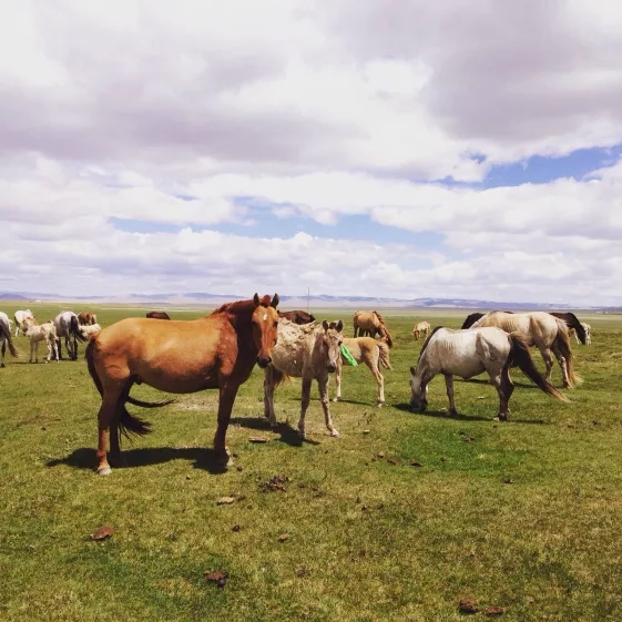
Allington travels to Mongolia to study the plateau’s rangeland— a vast grassland that feeds grazing animals like goats and sheep — and the many factors that shape it. The international demand for cashmere has increased the number of grazing cashmere goats in the Mongolian Plateau and incentivized local herders. These goats eat plants all the way down to the ground, destroying plant communities and causing erosion. Allington studies trends like these to better understand changing rangeland conditions and help local decision makers identify potential steps for recovery.
With travel restrictions due to the COVID-19 pandemic putting her research trips on hold, she’s using photos to take us into the (virtual) field to see how she uses NASA satellite data — with a few fun detours on the way.
Next stop: Mongolia. Buckle up!
The Welcome
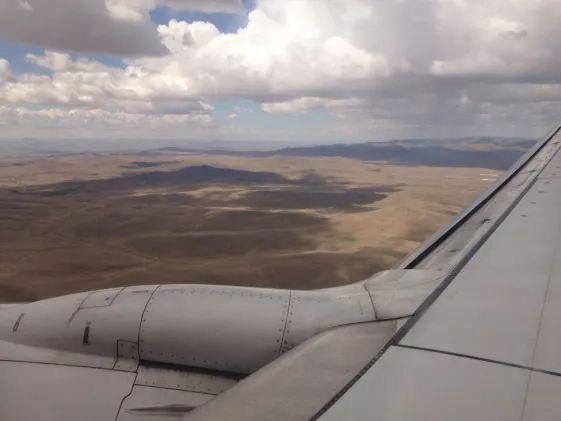
It often takes Allington, an assistant professor of Geography at George Washington University in Washington DC, 18 hours to fly from the United States to Mongolia. Her trip usually includes a 13-hour flight to Beijing and an overnight layover — and that just gets her into the Buyant-Ukhaa International Airport in Ulaanbaatar, Mongolia.
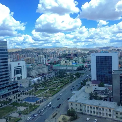
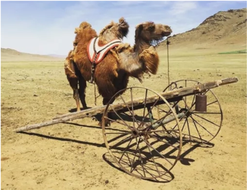
Once visitors arrive, it’s easy to rent a car or hire a driver to get around. Allington says that the country is receptive to travelers, and locals are often welcoming and hospitable. A truly unique Ulaanbaatar experience awaits visitors at the Narantuul Market, a covered market with stalls selling traditional Mongolian lifestyle goods like winter boots and all the parts needed to build your own ger (a portable, round tent). Allington usually stays in camping tents as they’re faster to set up and take down for researchers on the move, but she has plenty of chances to admire the gers in action.
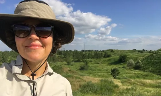
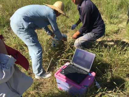
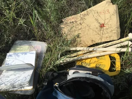
To get information on the plant communities she studies, Allington plans her fieldwork in the summertime during the growing season. Given the remote locations of her fieldwork, Allington camps in the rangeland. While she’s in the field, Allington studies perennial grasses, which maintain their root system from year to year and can help build soil health, and annual grasses, herbs and shrubs, which seed every year and have an easier time taking root where perennial plants have been degraded. By comparing the differences in the composition of plant communities and soils, Allington can better understand the status of the rangeland’s health.
Allington combines the data she collects on the ground with data from NASA satellites to make estimates over broader areas of land. Her work was previously funded by NASA from 2014-2016, and has collaborated with the Applied Sciences Program Ecological Forecasting program area.
The Food
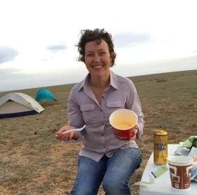
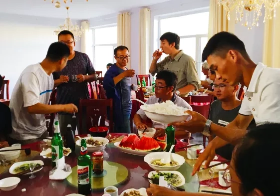
For Allington, one of the most exciting parts of traveling is trying local delicacies. Traditional Mongolian meals are meat and dairy-based; visitors can enjoy staples like khuushuur (fried mutton pancakes), aaruul (dried milk curds) and buuz (Tibetan-style dumplings).
Whether she’s meeting with stakeholders in the city or hunkering down for the night out in the field, Allington enjoys local eats like homemade noodles with beef and fried dumplings. Saikhan khool loorai — bon appétit in Mongolian!
The Language
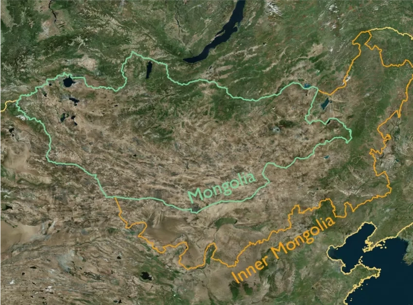
Mongolian is the official language of Mongolia and is spoken in the autonomous regions of Inner Mongolia. Allington’s work takes her across the Mongolian Plateau. While NASA does not fund field work in China, Allington’s research looks at the differences across this border and uses the same data to explore the area. She’s been working in northern China on and off since 2009, and has ongoing, long-term relationships at several research stations.
When she’s in the field, Allington relies on her first language, English, but is trying to build up her Mandarin language skills. Her Mongolian, on the other hand?
“My Mongolian is terrible,” she said. “But part of what I can give back is an opportunity for grad and post doc students to speak English. They put a real priority on that for young researchers.”
The Land
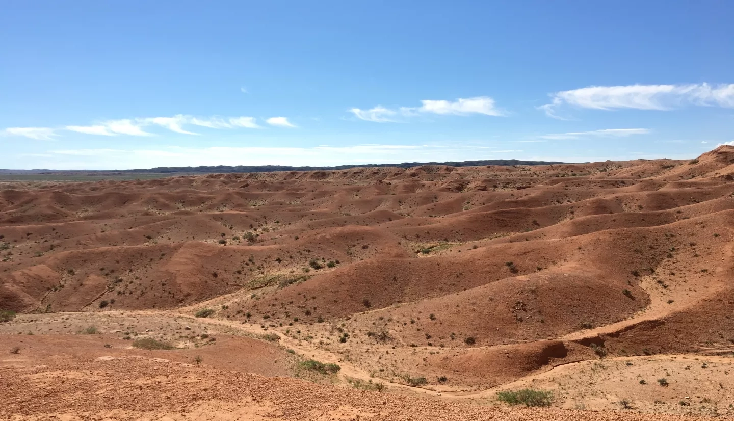
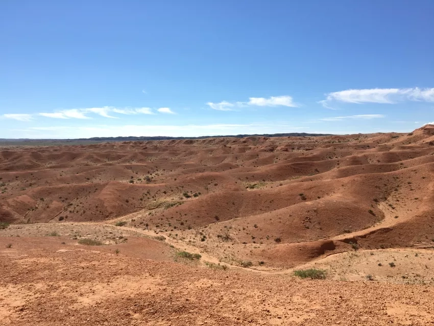
Mongolia has stunning landscapes and diverse terrains. Allington’s work focuses specifically on arid rangeland areas, but the towering buttress-like structures of Tsagaan Suvarga (White Stupa), Khüiten Peak in Bayan-Ulgii Province and the famous fossil bed site in Bayanzag (The Flaming Cliffs) all make Mongolia an exciting travel destination.
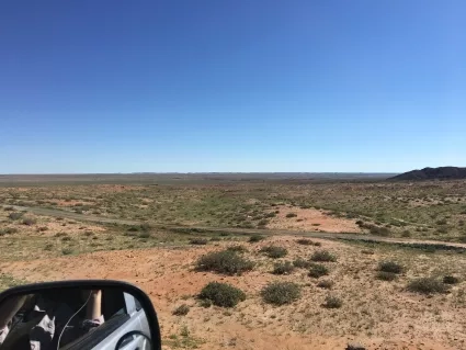
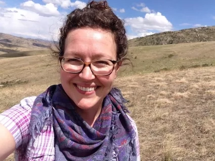
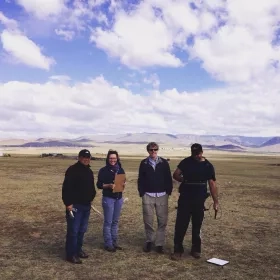
When Allington is in Mongolia, she can usually be found in the field collecting data to better understand the health of the rangeland. She works closely with regional stakeholders to learn about the socio-economic issues tied to the land, as well as researchers on the ground who provide invaluable feedback based on their extensive time in the field. Climate, wildlife, cultural practices, market forces and broad scale policies are all factors that affect the health of the Mongolian Plateau rangeland ecosystem.
“To understand the drivers of degradation and how the landscapes are responding, you have to know what’s happening with the people living there,” Allington said. “And you have to try to understand things at larger spatial scales.”
Allington works primarily with data from the joint NASA-U.S. Geological Survey Landsat series of satellites. The data set includes 35 years of normalized difference vegetation index (NDVI). NDVI essentially measures the ‘greenness’ of plants from space and provides a measure of plant health based on how the plant reflects light at certain frequencies. This measurement helps Allington determine the density of green on a patch of land and better understand how these arid rangeland areas change over time.
“Satellite data is so useful in a place like the Mongolian Plateau because it’s huge,” Allington said. “We’re collecting data on ground level with tape measures – we can’t do that over all of Mongolia. But what we can do is collect data from representative sites and try to link that to observations from satellites so that we can make estimates over broader areas. The really great thing about the Landsat mission is that we have data over space combined a great archive of data over time. So we can look for signals of big shifts by looking at the trajectory, the trends of an area.”
Because her work studying the land is tied closely to the socioeconomics of the area, Allington collaborates closely with regional stakeholders and policymakers from the onset of her work to ensure the system she designs aligns with their needs and learn from their firsthand experience with the region. She also works with non-governmental organizations to help develop sustainable protocols for herd management and rangeland practices that influence herder decision making and benefit herders, wildlife and the rangeland itself.
And while she’s focused on arid rangelands, she envisions opportunities to apply her research to other complex landscapes.
While Allington didn’t make the trip to Mongolia in 2020, she’s looking forward to continuing her work in the coming years once it’s safe to travel again. For now, though, she’s happy to revisit through pictures — and use them to share what it’s like to be a scientist in the field.
More about NASA’s Ecological Forecasting projects can found at its page on the Applied Sciences website.