Editor’s note: This article is part of a series of profiles presented from the perspective of NASA interns and grad students. The intent is to provide opportunities to discover and understand the unique value of NASA’s diverse workforce through new lenses. For this story, NASA Applied Sciences Disasters Program Science Writer Intern and Business Administration student, Brittney Mamon connected with Karen An, a grad student in the postdoctoral research program at NASA’s Jet Propulsion Laboratory.
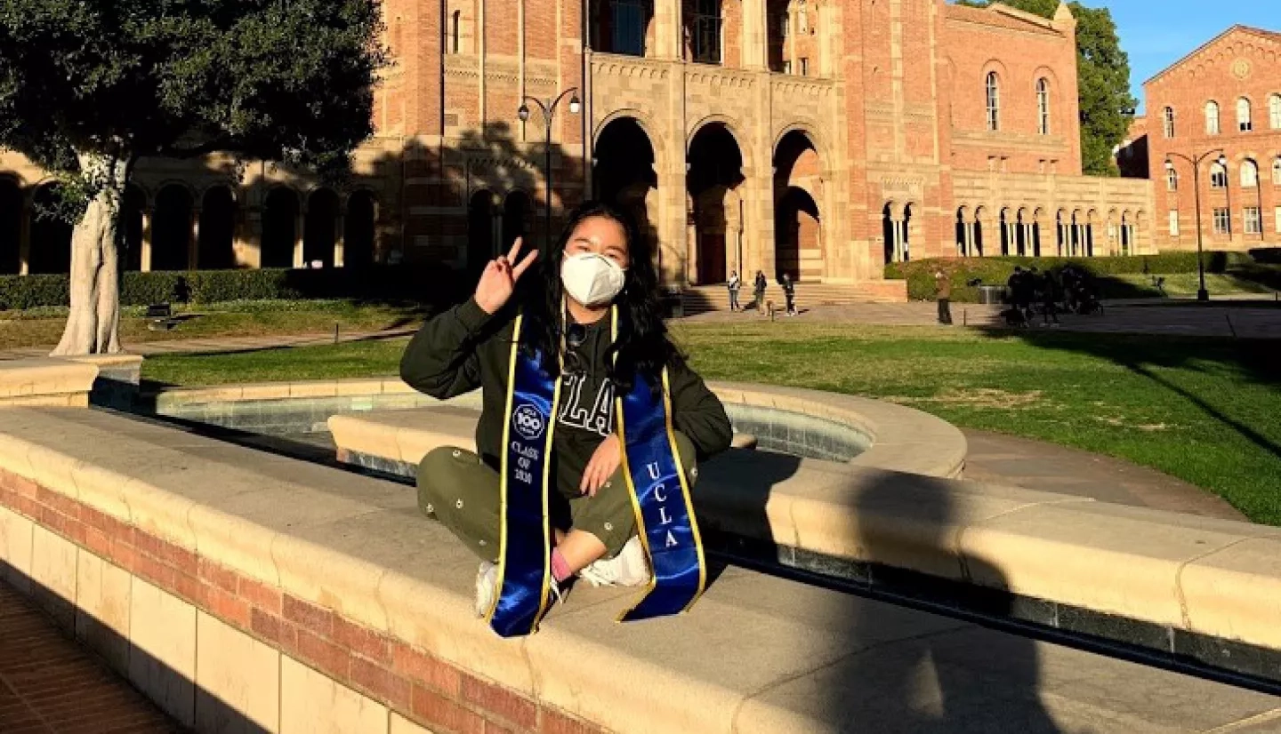
“How can I make a difference?” Karen An wonders. From the moment my conversation starts with An, a postdoctoral scholar at NASA’s Jet Propulsion Laboratory, I know she has an infectious spirit with a positive attitude. Her energy lights up the room as she thinks back on her undergraduate and graduate studies. Karen has earned her Bachelor of Science degree in Environmental Science from the University of California at Irvine (UC Irvine) and earned her Master’s degree and Ph.D. in Geography from the University of California – Los Angeles (UCLA). Her desire to make an impact through her research motivated Karen to work with NASA and pursue postdoctoral research in disaster science.
DISCERNING HER SCIENTIFIC PASSION
I find Karen’s process of finding her purpose nothing short of inspiring. Her down-to-earth nature is clear as she opens up about how she initially chose Biology because many of her peers chose that route. Fortunately, she found her passion early in her collegiate career after being involved in Environmental Science clubs at UC Irvine. Karen remembers that she “was watching documentaries on climate change, which is how she got started in that field.” She impressively chose not just to accept the problem of climate change and its effects. Instead, she decided to be part of the solution.
As she transitioned into her graduate studies, Karen’s grasp of Geography led to her continued research in that field. She particularly enjoyed researching global groundwater depletion and water scarcity tools at UC Irvine. There, she taught herself how to use Geographic Information Systems tools and eventually moved from UC Irvine’s campus to UCLA. As Karen reflects, time proved that “Geography turned out to be a great fit!” given that she earned both a master’s degree and Ph.D. in that field.
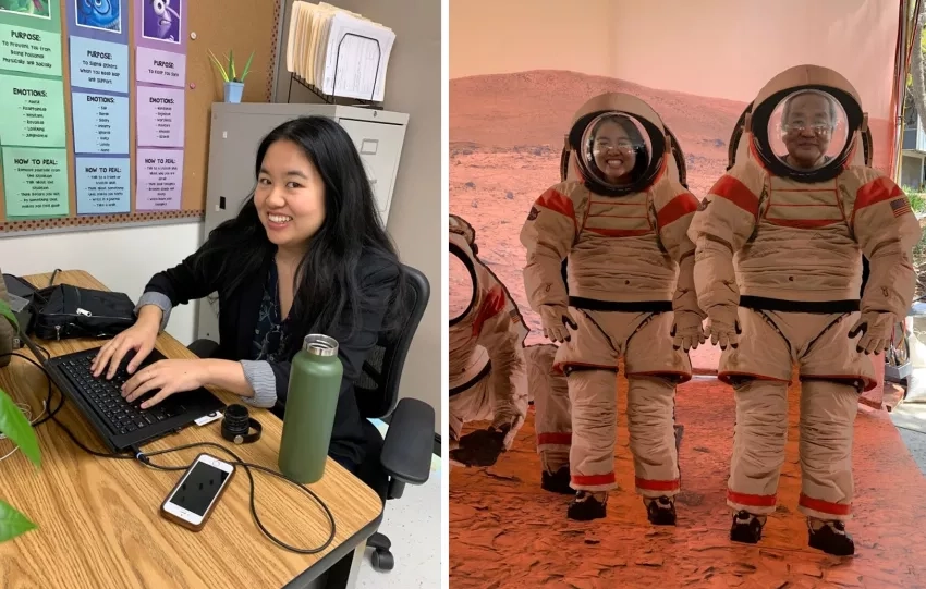
Karen’s experiences at NASA also sustain her passion for science. Karen relays how she felt her research had purpose within the NASA Earth Science Applied Sciences Disasters program area. Having that “feeling like I could do something with my research that made an impact piqued my interest.” Karen shares that the opportunity to work with NASA was beyond what she had ever imagined. Working for a global giant in the science field such as NASA was not on her radar. That’s why, in her early years, she instead saw herself as a teacher. Nevertheless, when Karen saw an opportunity to intern at the Jet Propulsion Laboratory, she went for it. She’s now been at NASA for eight years and hopes to continue that inspiring journey at NASA after her postdoctoral research.
KAREN AN’S RESEARCH
Speaking of radar, one of the most compelling topics that continue to motivate Karen is radar – a type of active sensor technology. Karen’s primary work during her Ph.D. dealt with levee subsidence and seepage, and different types of synthetic aperture radar (SAR) technology. Her research project is titled “Improving Understanding and Monitoring of Levee Seepage and Subsidence Using PolSAR and InSAR for Disaster Risk Management in the Sacramento San Joaquin Delta.” Karen notes that advanced radar technologies are known for being particularly complex to understand. That makes her more motivated to want to master it. She hopes her increased knowledge will become a resource to help others understand them as well.
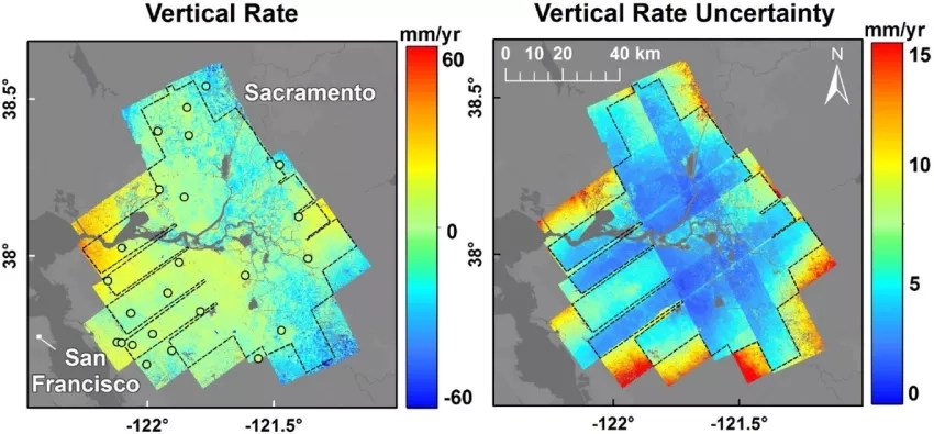
An highlights the difference between active and passive sensors: “When you look at Google Earth and the images that you see there, those are all mostly optical remote sensing … [such as] LandSats which are passive.” Karen explains that active sensors are sending out electromagnetic energy and measuring the response. For instance, after an earthquake, radar can see how much an area has shifted by measuring the difference in phase shift. Similarly, after a flood, one can see with radar how wet a land surface is by observing the types of polarizations reflected in different areas. Given that An’s research deals heavily with floods and land, she uses radar technology often within the NASA Earth Science Applied Sciences program. To that point, although the archetypal cause of land subsidence tends to be groundwater pumping, the most usual cause of such subsidence in the Sacramento Delta – the geographical area of her research – is actually soil oxidation. Understanding these differences is essential. It is also one reason she finds the interferometric SAR (InSAR) technology so useful.

As Karen reflects on her research journey, she remembers a challenge that she is most proud of overcoming: contributing to the modern map of subsidence for the Sacramento Delta with her NASA colleagues. Karen shares that the InSAR subsidence map product took time to develop, because it needed manual inspections of the data. Despite the tedious monotony, Karen proudly exclaims, “Finishing that and generating that map was something that we overcame!” Knowing the map will be a valuable resource to someone someday keeps her motivated through challenging times.
THE VALUE OF MENTORSHIP: AS AN INTERN AND A STUDENT
From An’s NASA and collegiate experiences, what resonates with her the most is the value of mentorship. Karen stresses that a student interested in research should “make sure that the advisor you want to work with really aligns with you, not only with their research interests but also their mentorship style!” An’s biggest takeaway from her internship at the NASA Jet Propulsion Laboratory was the importance of mentorship. She recalls how her mentor, Cathleen Jones, encouraged her while helping her develop her technical acumen. Karen loves working with Jones because she is not only a “radar technology expert” but also “is the one who has been so encouraging since day one ... even as an intern, she treats you like a colleague.” As a result, if Karen mentors interns, she plans to instill the same principles. Karen is already starting her mentorship journey by attending Career Fair days at local middle schools.
HOW KAREN AN’S WORK IMPACTS YOU
“I want whatever I am working on to be helpful,” Karen shares. Ultimately, Karen loves that her research has a purpose and will impact people and the planet. Karen tells me that although one may presume that the goal of a scientist is “having hundreds of publications,” but “if the only other people reading your work are experts in your field … what impact is your work having?” Karen notes, “radar is notoriously difficult to understand, so I am trying to make these products more interpretable for response agencies.” She continues, “After a big flood or a wildfire, radar can see the deformation that has occurred. If I can generate some products that would help these responders, that would be my main goal!” Staying motivated during challenging times is relatively easy for her because “with this work, it really is about the potential impact it can have.”
An continues to discuss how her work can impact everyone – including you – because her work positively assists response agencies. She is currently focusing on wildfires and floods as part of her research. She explains that her team aims “to set up tutorials or a framework for when those events happen,” and the tutorials would explain how to utilize radar technology.
An sums up her journey with a prime moment that shows how her work helps students and aspiring researchers. She’d completed a paper on New Orleans subsidence, and her team was contacted by an organization afterward. The organization wanted to convert her paper into a student-friendly version for high schoolers. Karen thought “that was really cool - translating the paper into something that was easier to understand and showing that modern technology was really inspiring.” Since radar remote sensing is not typically accessible to students due to its complexity, the organization’s request affirms An’s effort to help others understand radar technology. Karen beams with gratitude: “Being able to present these kinds of data sets in a more intuitive manner can go a long way!”


