Shayna Skolnik, Navteca CEO and NASA Collaborator
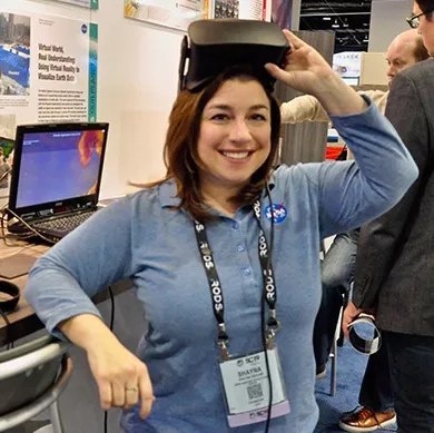
Shayna Skolnik is the founder and CEO of Navteca, a woman and minority-owned technology company that focuses on emerging technologies and IT innovations through artificial intelligence, cloud solutions and advanced data visualization. Through Navteca, Shayna collaborates with NASA to demonstrate and investigate the potential of virtual reality (VR) and augmented reality (AR) to improve data accessibility and visualization for Earth science research and disaster response efforts. VR immerses the user’s entire field of view with computer-generated graphics, while AR projects integrate computer graphics into the user’s environment via a headset, high-tech glasses or mobile device. Skolnik’s role in working with NASA is to examine how NASA’s Earth science research and applications can take advantage of VR and AR. The possibilities of VR and AR have already proven to be extensive, and display increasing promise through Skolnik’s collaboration with the NASA Earth Applied Sciences Disasters Program.
Virtual Reality for Earth Science and Disasters Applications
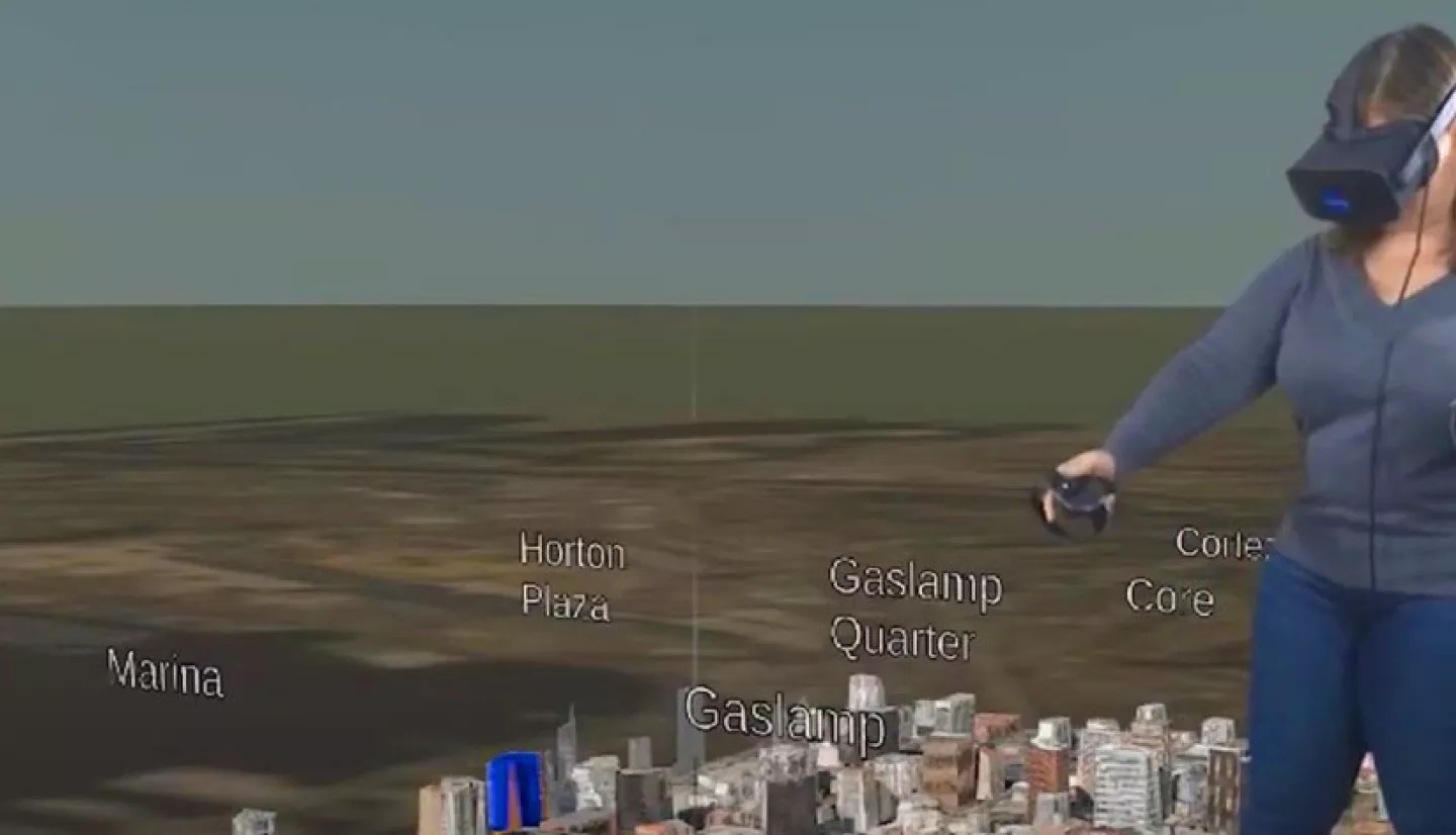
Skolnik explains that the concept behind the current research and development is that “VR provides a common platform for different stakeholders to look at datasets and make sense of them and hopefully inform decision making.” Responding to disasters involves working with federal, state and local authorities such as mayors and city councils—people with many different backgrounds. Therefore, incorporating data in a visual way can help people better understand and collaborate when responding to a disaster event. The difference between hearing or reading numerical data versus seeing it depicted visually in a relatable and accessible way is immense. Skolnik gives an example of this: “If we talk about a 20-foot storm surge for a hurricane or varying levels of sea level rise, what does that even mean? Even the people who work with the data couldn’t really tell you. Does that mean that the downtown buildings in a particular city will be flooded, and which ones? Which streets will be usable? Are evacuation routes affected? Those are the types of things important for disaster planning, response and building long-term resilience.” With VR, Skolnik and her team can take numerical data and visualize it in a way that anyone can understand.
VR is especially helpful in visualizing volumetric data sets such as those that measure precipitation, flooding, volcanic plumes, and air quality. Additionally, VR allows users to visualize data gathered from places that would typically be difficult for the user to imagine, such as beneath the ground. VR can also be used to study how different systems relate to each other. One example of this is the visualization of various factors contributing to coastal flooding, such as storm surges, sea level rise, and sinking or settling ground (a process known as land subsidence). VR could enable users to look at these factors simultaneously to gain a more comprehensive view of coastal impacts. The three-dimensional environment of VR also enables data sets to better connect to each other, resulting in a holistic and dynamic perspective. Time adds a fourth dimension, allowing users to adjust the timescale and view a region in the past and present as well as modeling what it might look like in the future.
Applications and Technical Achievement
With so many dimensions and options in VR and AR, it is clear that users of this technology can gain a better sense of size and scale when it comes to disasters and hazards. For example, VR can provide a more intuitive understanding of what a projected amount of sea level rise actually looks like in a specific city. Handheld controllers can change parameters of the data to provide an intuitive level of interaction that further sets VR apart from other forms of visualization. Skolnik says that the potential of VR is almost limitless because there are so many types of data that can be visualized. VR allows for a multidisciplinary approach, allowing users to view not just Earth science data but also public health data, or information about the infrastructure of a region, in order to better examine the relationship between all contributing factors and impacts from a disaster preparedness perspective.
During a disaster, timely production of data products is crucial, and VR data products do not necessarily take any longer to create than typical data visualization products. Skolnik clarifies that “the timing is more driven by the data side of things and how quickly the data is collected, processed, and distributed.” Automatic ingestion of data into VR would be key toward a VR tool becoming part of an operational process for disasters. This is something that Navteca has achieved: ingesting data by connecting, via an application programming interface (API), to the NASA Disasters Mapping Portal, a geographic information system (GIS) website that is hosted by the National Center for Climate Simulation (NCCS) at NASA Goddard Space Flight Center. This allows new data that enters the portal to be fed into VR without any additional coding—"a big achievement in terms of showing what is possible in terms of speeding up the time to visualize new data,” says Skolnik.
The Future of Virtual Reality
Skolnik shares that VR is “still in its infancy, in terms of how we use it and how ubiquitous it will become.” She compares the emerging technology to cell phones, which began as chunky and seemingly inconvenient products that weren’t widely accepted at first: “There was a significant amount of pushback and people who wondered why they would want to carry it around,” says Skolnik. However, once the first iPhone was released, cellphones became much more than simple devices to make calls. They shrunk in size and increased in capability, with mobile apps replacing many other devices. Skolnik expects VR to take a similar route. VR hasn’t yet reached the status of a ubiquitous device that almost everyone uses, but she believes that we’ll “get to a point where the headsets will be sleeker and much more wearable. You’ll be able to essentially go back and forth between VR and AR.” Technologies will likely converge to make this possible, incorporating artificial intelligence, machine learning and natural language processing to change the way we interface with computers, and thus increasing the usability of VR and AR products.
Skolnik describes a possible scenario she envisions in disaster response efforts: projecting info onto vehicles’ windshields when sending responding teams into the field after a disaster. She details the many elements that could be utilized, such as visualizing the wire frame of a building that has collapsed, or seeing the projected population of that building and its possible hazards, such as noxious gases. One could also incorporate air temperature data, wind speed, and more. All of that projected onto the responding units’ windshields would give responders up-to-date information at a glance. Skolnik notes that “these are all baby steps laying the groundwork for getting to that point.”
Moving forward in VR research and development for disaster applications, Skolnik hopes for continued collaboration and growth to test VR in an operational capacity. Making Earth observing data more discoverable and widely used remains a priority for Navteca, echoing the goals of the Disasters program. This motivation was built upon by Skolnik’s “profound interest in seeing how this technology that’s primarily developed for use in entertainment and gaming can be used to have a beneficial impact in society… For disaster applications in particular, this technology could help people to understand risks better and be better prepared. If it saves lives, that would be an amazing outcome to the work we’re doing.”


