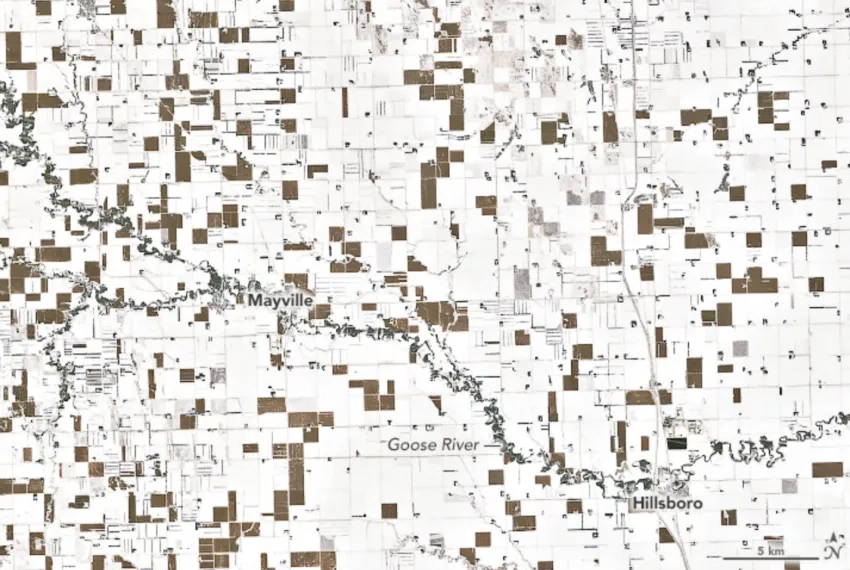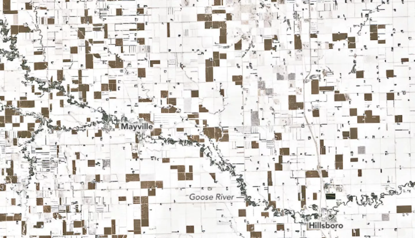
A powerful winter storm in late November is not unusual for eastern North Dakota but a pattern of snow-white and dark brown squares captured of the state’s landscape by satellite imagery is.
While examining images observed on the Enhanced Thematic Mapper Plus (ETM+) on the Landsat 7 satellite, Daryl Ritchison, director of the North Dakota Agricultural Weather Network, spotted a surprising, checkered pattern in December 2019 and posted an image on Twitter. “I’m 100 percent sure it is all corn,” Ritchison said about the brown squares that appeared starkly against the white snow. His belief is based on estimates of unharvested harvested corn from the U.S. Department of Agriculture, and farmers comments plus local knowledge of where corn is planted.
The patches of brown don’t mean a lack of snow; about 6-10 inches of snow is hidden from view. “The corn is planted at what is referenced as ‘row closure,’” Ritchison said. “Corn is touching corn, so the snow on the ground wouldn’t be visible from the air or satellite.”
While North Dakota is used to seeing snow fall in November, farmers typically harvest all their corn by this time of the year. This wasn’t the case in 2019. According to news reports, late November 2019 had the largest amount of unharvested corn since 2009.
Because of the wet fall and corn plants containing too much moisture, farmers had to leave their corn in the field until February or early March. Economic and environmental concerns over moisture content and snow on corn stocks that may clog harvesting equipment impact farmers’ decision on when to harvest.
Read more at the Earth Observatory article, Patchwork of Corn in the Snow.
This story is also part of our Space for U.S. collection.