Space-based data are aiding Great Lakes communities as they combat an invader
Located on the southern shore of Georgian Bay in Ontario, the idyllic Great Lakes town of Collingwood has been battling a growing problem—an invasive wetland reed called Phragmites australis. And the town is not alone in its fight.

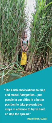
“Phragmites are a very serious problem in the Great Lakes Basin,” said David Ullrich, Executive Director of the Great Lakes and St. Lawrence Cities Initiative (GLSLCI). Phragmites, a nonnative subspecies of a natural Great Lakes reed, can quickly take over a location, crowding out native plants and animals with dense stands of stalks that grow more than 5 meters tall.
“They turn wetlands into monocultures that are much less attractive to fish and wildlife,” Ullrich added. “They also reduce the natural value of wetlands to cleanse water and help reduce flooding.” Using NASA’s eyes in the sky, a DEVELOP project helped guide Collingwood’s battle from above.
Tracking a Tenacious Threat
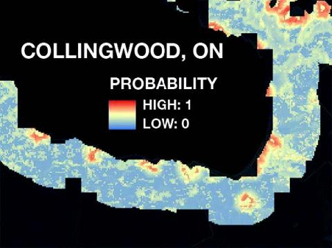
 In partnership with the Michigan Tech Research Institute (MTRI) and GLSLCI, a DEVELOP team led a project that built on earlier MTRI research on Phragmites in the region. The goal of this project was two-fold. The first was to create a current risk map based on habitat suitability for Phragmites throughout the basin.
“We focused our study within 10 kilometers of the U.S. and Canadian coastline, based on in situ data previously collected and the number of communities impacted by Phragmites,” said team member Sean McCartney.
The second goal was to create a future risk map for the entire basin through the year 2020. “Forecasting results help local governments enact policies to plan for and mitigate the spread of Phragmites,” McCartney added.
To do this, the project tapped into precipitation data from NASA’s TRMM and GPM satellites, used Earth observations from the Shuttle Radar Topography Mission, and modeled variables such as soil drainage and topography. The current and predicted Phragmites risk maps gave guidance to the project partners’ on-going monitoring and mitigation efforts.
And, at GLSLCI’s 2016 annual meeting in Niagara Falls, New York, the DEVELOP team shared its findings. Here, Great Lakes mayors and local officials from the U.S. and Canada were able to see the threat they faced from this noxious nuisance.
Armed With Information
For Collingwood, which is in the second year of its “Fight the Phrag!” program, the data is now helping inform officials where to focus both control and eradication efforts around its marshes and shorelines.
“The Earth observations to map and model Phragmites makes it easier because in one image, a person can see the scope of the problem,” Ullrich explained. “If all of this information had to be gathered from groundlevel observations, it would take much longer, be much more labor intensive, and be much more costly.”
And that means Collingwood’s Phrag fighters can save their time and resources for combat.
Mike Ruiz (Michael.L.Ruiz@nasa.gov) leads our DEVELOP program.


