Florida’s famous year-round warmth helps make the state an ecological paradise for thousands of species of flora and fauna – and an annual destination for more than a million human “snowbirds.” NASA satellite data are helping county officials make development plans that protect the area’s valuable natural resources.
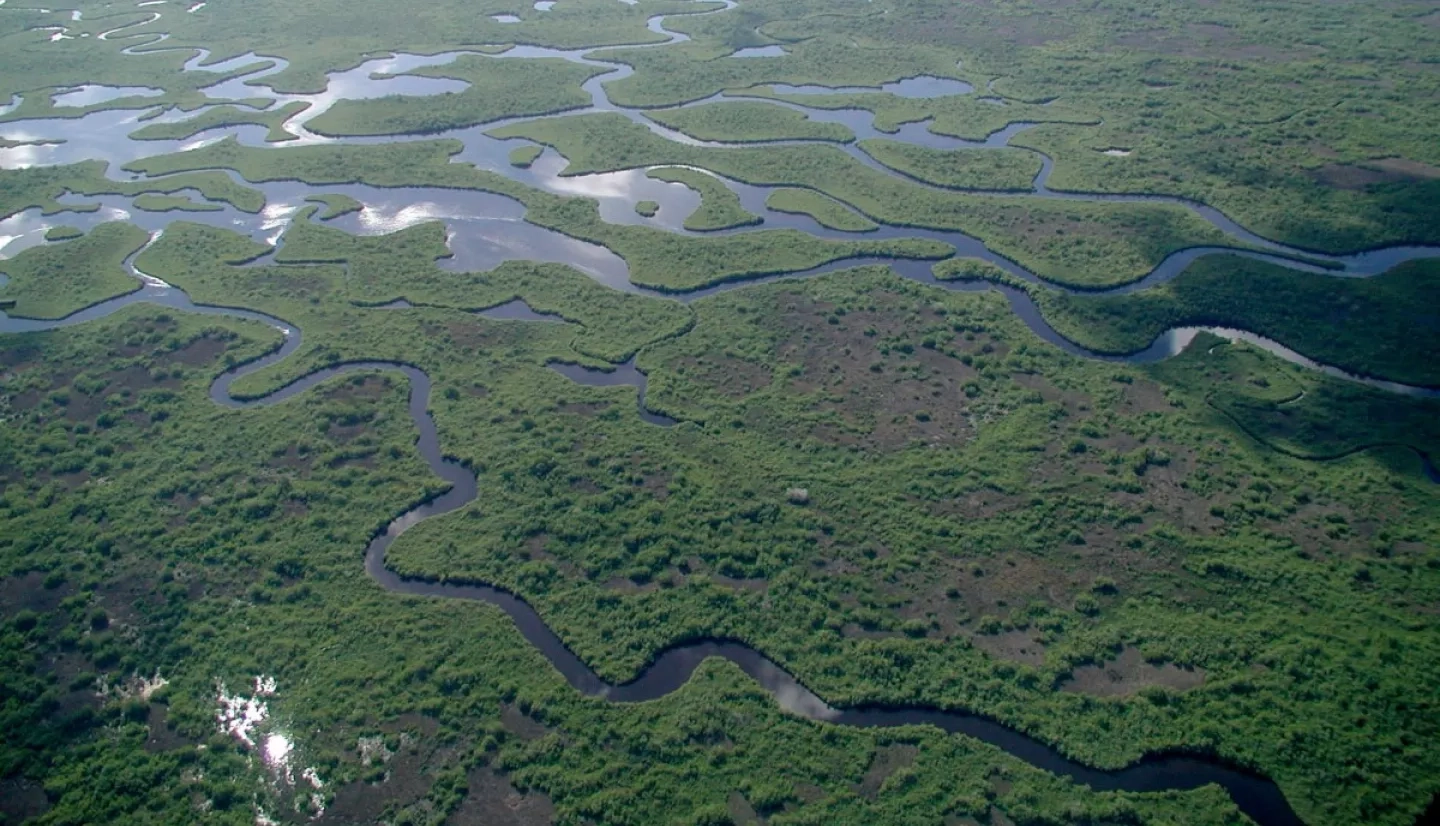
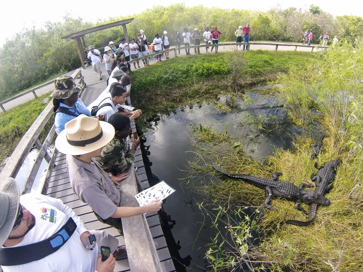
The Everglades lie across 2 million acres (8,094 square kilometers) of central and southern Florida, creating the largest subtropical wetland in the United States. But as vast as this ecosystem is now, it’s about half the size it was 100 years ago. The reason, in large part, is due to South Florida’s swelling population, which is increasingly encroaching on the Everglades.
In the state’s most populous county, planners in Miami-Dade County’s Parks, Recreation, and Open Spaces Department (MDC-PROS), with support from the nonprofit The Trust for Public Land, embarked on a novel effort to combine public use with conservation of the Everglades.
County planners designed a system of eco-friendly trails and recreational destinations along the county’s western edge, connecting the Everglades to Miami-Dade’s more developed areas. When complete, the Miami-Dade Western Greenway will be a natural gateway to public lands, while supporting both Everglades conservation and Miami’s water management.
Alissa Turtletaub, Western Greenway project manager, said the plan calls for development of “a seamless system of greenway trails, which a resident or visitor to Miami-Dade could travel all or portions of … to experience natural areas, public lands, ecotourism, agri-tourism, local businesses, and national parks. Each region of the Western Greenway – north, central, and south – has distinct resources and character.”
In 2014, MDC-PROS partnered with a NASA DEVELOP team from the University of Georgia to incorporate space-based observations into the Greenway planning. NASA Earth Applied Sciences’ DEVELOP program spearheads strategic partnerships seeking solutions to environmental and other Earth science issues.
The project team integrated NASA satellite data about land cover, vegetation and tree cover parameters into the Land-Use Conflict Identification Strategy (LUCIS) model, which is run by software that helps determine a landscape’s suitability and identifies future land-use alternatives. The team used LUCIS to pinpoint the best locations in the Greenway for recreation, conservation and ecotourism. In turn, this helped guide more specific design elements of the Greenway project, including trail alignment.
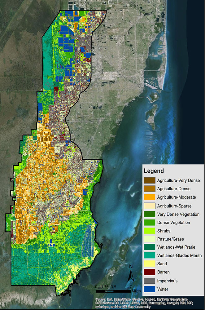
The DEVELOP team also determined that the majority of the agricultural and rural land was located in the Greenway project’s southern region. This area includes the 55,000-acre (223 square kilometers) South Dade Wetlands, a vital habitat for reptiles, mammals, migratory and wading birds, and other animals.
“The NASA DEVELOP team … provided valuable analysis, data, mapping and field work to the Miami-Dade Western Greenway planning project,” Turtletaub remarked. “Their contributions assisted the decision-making process and were used to inform the Greenway routing.”
The satellite data are providing guidance to officials for maintaining the delicate balance between the booming region’s water resources and the Everglades’ ecology. Rosanna Rivero, a member of the technical advisory team from the University of Georgia who reviewed the implementation strategies for the Western Greenway, noted, “The proposed Greenway is located in an important transition zone between Miami and the Everglades, including areas of high ecological value, especially in providing water recharge services for the city itself.
“Using NASA imagery [is] going to bring a new perspective on the land uses and the land cover of the area.”
– Rosanna Rivero, University of Georgia
“Using the NASA imagery [is] going to bring a new perspective on the land uses and the land cover of the area,” she added.
The partnership between an academic institution, a county office and a nonprofit organization has made a huge conceptual project like the Western Greenway, stretching from North Miami to the northern Keys, a reality that will positively affect both the people and the ecology around Florida’s busiest region.
“The Western Greenway project is large in scope, and its implementation will establish a legacy for use by generations to come,” Turtletaub said.
This story is part of our Space for U.S. collection. To learn how NASA data are being used in your state, please visit nasa.gov/spaceforus.