Observations of a NASA Wildland Fire Management intern on her experience with the Windigo Fire Command Post in August 2022
Jenessa Stemke is a NASA FireSense intern with a background in wildfire spatial analysis and post-fire landscape management. She observed decision-making in action at a fire command post and spoke to an emergency response team on an active fire. Here is Stemke’s first-hand account.
I first learned about fire science as an outdoor guide for UC Riverside Outdoor Excursions, where I took groups throughout fire country to destinations such as Yosemite, Mexico, and Utah. In this role, my focus on wildfire was wilderness group evacuation and facilitating discussions on fire ecology.
This summer, I got a first-hand look at fire response as part of a disaster risk reduction course, which included a 4-day field trip. The class focused on discussing challenges and solutions in wildfire. It was led by Dr. Laura Peters of Oregon State University and Jim Whittington, a retired Bureau of Land Management employee and a long-time member of a Type 1 incident management team.
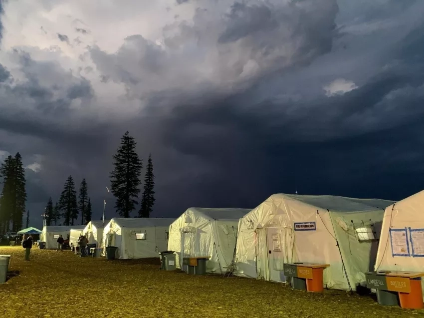
We first visited the Northwest Coordination Center, which facilitates Pacific Northwest interagency coordination for fire preparedness and response. The next day, we visited the Redmond Smokejumper base, which houses air resources for fire response. On Days 3-4, we shadowed the Windigo Fire Incident Management Team (IMT) near Crater Lake National Park, Oregon.
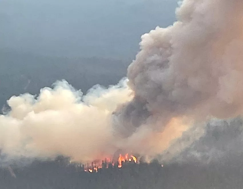
The trip was scheduled assuming that early August would have a sizable fire in driving distance of Corvallis. However, Spring in Oregon was unseasonably cool, and heavy June rainfall delayed the fire season. I frequented two wildfire-tracking websites, Inciweb and NASA FIRMS, wondering if we’d get to visit a fire. The day before our trip, we secured permission to observe the rapidly growing wind-driven McKinney Fire, which started on July 29. Plans changed when lightning ignited 30-40 fires in the East Cascades. These were closer than the McKinney Fire and since we had pre-approval to visit any fire in Oregon, we visited the Windigo Fire, which was assigned a management team.
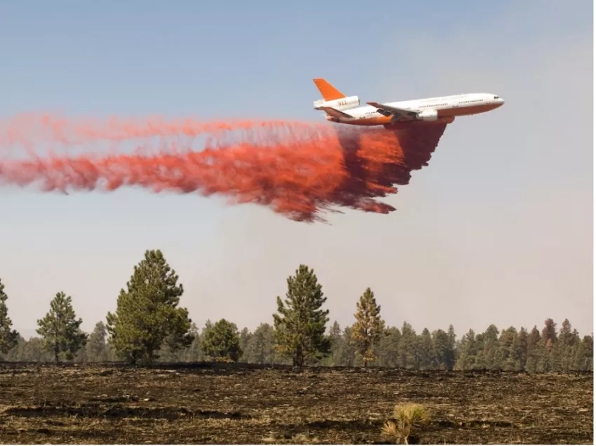
Fire management focuses on protecting valuable resources, including lives, buildings, water sources, and cultural heritage sites. Tactics include: fuel reduction through physical removal, controlled burning, or applying fire retardant. Not all strategies work everywhere; airtanker fire retardant is only effective on ridgetops or open fields; in forests or fires moving upslope, fire can easily pass fire retardant. Fire managers face more fires, rapid-growing fires, longer fire seasons, dwindling personnel, and limited resources. For decades, the U.S. fire response was to quickly extinguish all fires. Fire exclusion resulted in vegetation overgrowth; so we now experience dangerous fire activity. Proactive landscape management (through fuels reduction) is becoming increasingly attractive.
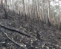
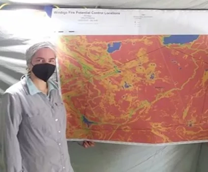
The Windigo Fire Incident Management Team also managed nearby Potter and Big Swamp Fires. These fires collectively burned 1,749 acres (Windigo: 1,007; Potter: 632; Big Swamp: 110). The fires already reached their maximum acreage when we arrived, so we observed the planning process for containing potential further growth. I feel fortunate that we observed the Windigo Fire, as we were able to experience these initial stages. Staff also had time to answer questions; McKinney fire staff would likely have been too busy managing evacuations from a 60,000-acre fire. I even assisted with map production since the full GIS team had not yet arrived.
Fire responders use data from satellites or aircraft, including Landsat (satellite mission that provides global landcover), LANDFIRE (fire-relevant vegetation datasets), and Lidar (pulsed laser mounted on satellites or aircraft that maps surfaces, such as buildings and treetops). In the context of fires, the first two assist in predicting fire behavior; all are used to map dead trees likely to fall. The incident management team’s wish list includes streamlined data access and faster turnaround for LANDFIRE updates.
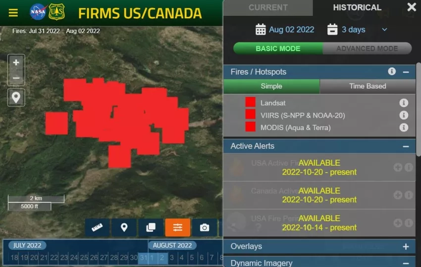
While meeting with the fire-mapping team, I learned that satellite spatial resolution is a source of confusion between the public and fire responders. Spatial resolution represents the distance on the ground represented by a pixel from satellite data. Thermal anomalies (hotspots) detected by VIIRS (375m resolution) and MODIS (1km resolution) are squares on NASA’s fire-detection map. This doesn’t necessarily mean the entire square is on fire; rather, at least a portion of that square is measured as abnormally hot and warrants ground-truthing. While it may be obvious to people familiar with fire data, members of the public are not as familiar with data limitations. Therefore, NASA is actively working to communicate the use-cases, caveats, and limitations of this data more clearly (e.g. NASA FIRMS FAQs).
During my visit to the Windigo Fire, I learned that reducing fire risk includes proactive landscape management-appropriate policy (including prescribed burns and fire-resilient structural improvements), smart intervention, collaboration, and compassion. Fire management and affected communities benefit from adaptive thinking to overcome evolving challenges. It was inspirational to see this approach in action on the Windigo Fire. I have renewed hope that we can live with fire without living in fear. It’s no easy road forward, but my experience has motivated me to participate further in developing solutions that can help restore landscape health.