
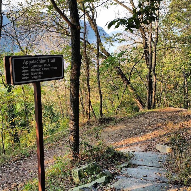
From the Big Sandy River to the Blue Ridge Mountains, the Appalachians define the landscape of West Virginia. Running southwest to northeast through the Appalachian Mountain chain, the 2,175 mile (3,500 kilometer) Appalachian Trail spans 14 states, from northern Georgia to central Maine. Though just a small part of the Appalachian Trail passes through West Virginia, the state is often considered its spiritual heart – due in no small part to the Appalachian Trail Conservancy, which is headquartered in Harpers Ferry.
While the Appalachian Trail’s recreational value is a major draw, it’s also a vital ecosystem in the eastern United States. NASA, the Appalachian Trail Conservancy, and other agencies helped develop a monitoring tool to track large-scale changes to the region's natural resources along the trail.
The trail’s “gradients in elevation, latitude, and moisture sustain a rich biological assemblage of temperate-zone forest species,” said Y.Q. Wang, a professor of Natural Resources Science at the University of Rhode Island. Despite teaching in one of the few eastern states that the Appalachian Trail does not touch, Wang finds his passion and work fully entrenched in this long corridor of land. “The Appalachian Trail may be one of the more biologically diverse units of the National Park System,” Wang remarked.
A NASA Earth Applied Sciences project led by Wang partnered with the Appalachian Trail Conservancy, the National Park Service, U.S. Geological Survey, and U.S. Forest Service to integrate satellite-based Earth-observation data and modeling capabilities into the development of an Appalachian Trail Decision Support System (DSS).
The project team created the DSS by integrating satellite data with NASA landscape models to target environmental vital signs such as biological data, climate, forest health, and landscape changes. With this information, users can monitor large-scale changes along the trail, and detect early, undesirable changes to the region's natural resources, such as invasive species. “The invasion of ecosystems by non-native species is recognized by many as a major driver of biodiversity loss worldwide,” said Wang.
“To protect native biodiversity, informed land management is the key … The open-source data access is critically important and essential for this Appalachian Trail DSS.”
–Y.Q. Wang, University of Rhode Island
West Virginia’s Appalachian trail has seen an invasion from a threat called the tree-of-heaven. Despite its name, the tree is rather devilish – suppressing the growth of native species by releasing vast quantities of airborne seeds that colonize gaps in forest canopies. The West Virginia Department of Natural Resources places the tree-of-heaven on its ”Dirty Dozen” list of exotic or invasive species, and its website ranks the tree “as one of the most significant threats to timberland in the state.”
During this project, the DSS established a monitoring framework focusing on the current status and predicted expansion of the tree-of-heaven. Using NASA Earth-observation data and climate models, the DSS predicted a 48% increase in suitable habitat for the tree-of-heaven over the Appalachian Trail lands under the climate change scenarios through the end of the 21st century.
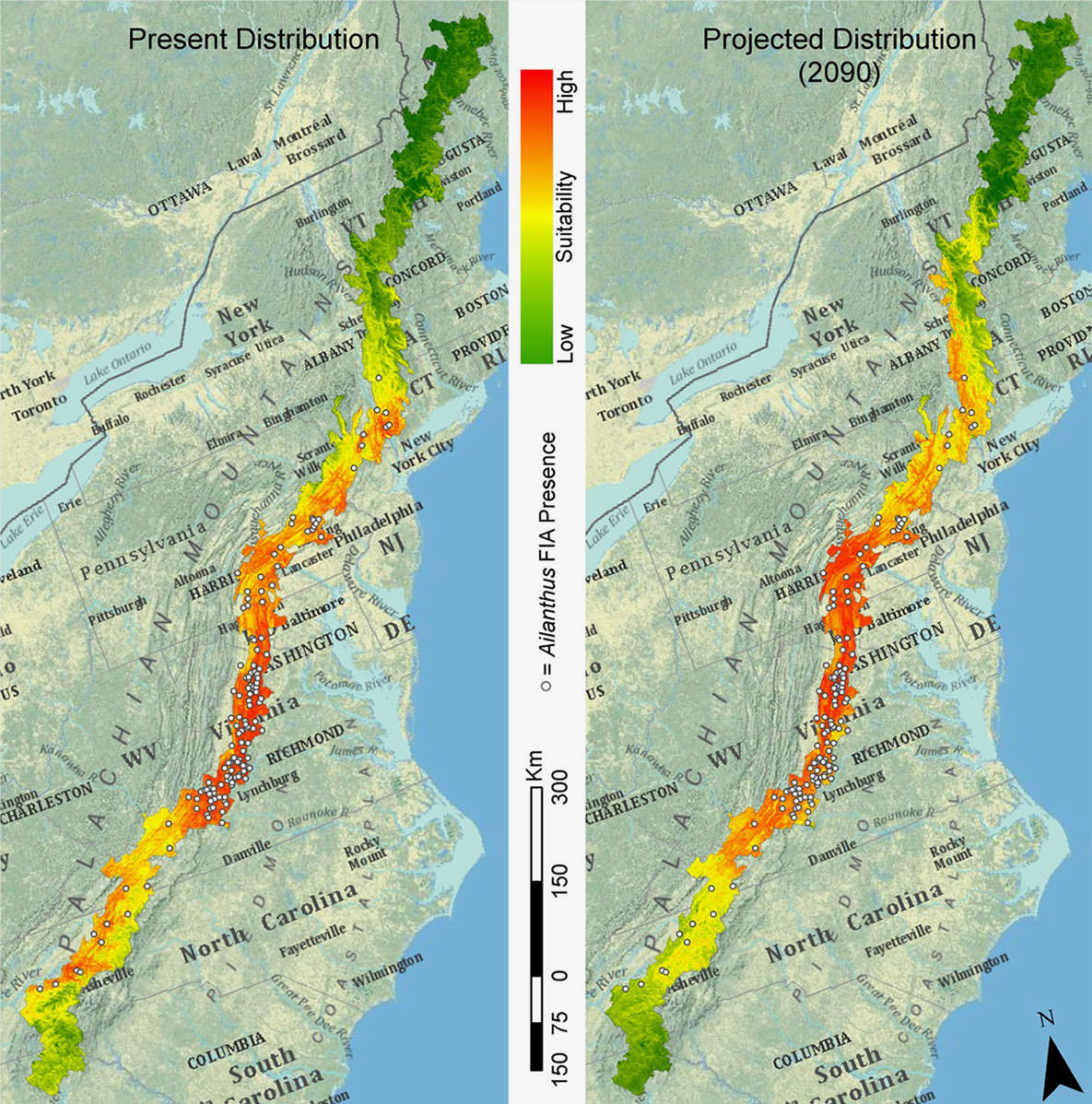
In particular, it showed a significant expansion along the northern extremes of the Appalachian Trail. Although the tree is currently distributed mostly in lowland areas, it could end up in higher elevations to the south of its current range. Highlighting this as an example, Wang noted, “To protect native biodiversity, informed land-management is the key.”
In a recent advancement, the DSS is now accessible via an Appalachian Trail mobile app. The app helps support foresters in the field and promotes awareness of trail monitoring by engaging professionals and citizen scientists to contribute their input.
Wang emphasized, “The open source data access is critically important and essential for this Appalachian Trail DSS. The Appalachian Mountains are fascinating in their natural history and cultural heritage … and information is essential for decision making.”
This story is part of our Space for U.S. collection. To learn how NASA data are being used in your state, please visit nasa.gov/spaceforus.