When the Deepwater Horizon drilling rig exploded in April 2010, oil leaked into the Gulf of Mexico from ruptured pipes deep on the seafloor. NASA satellites kicked into gear to reveal the scope of the disaster. They also tracked the growth of the spill as it spread towards the northern Gulf Coast.
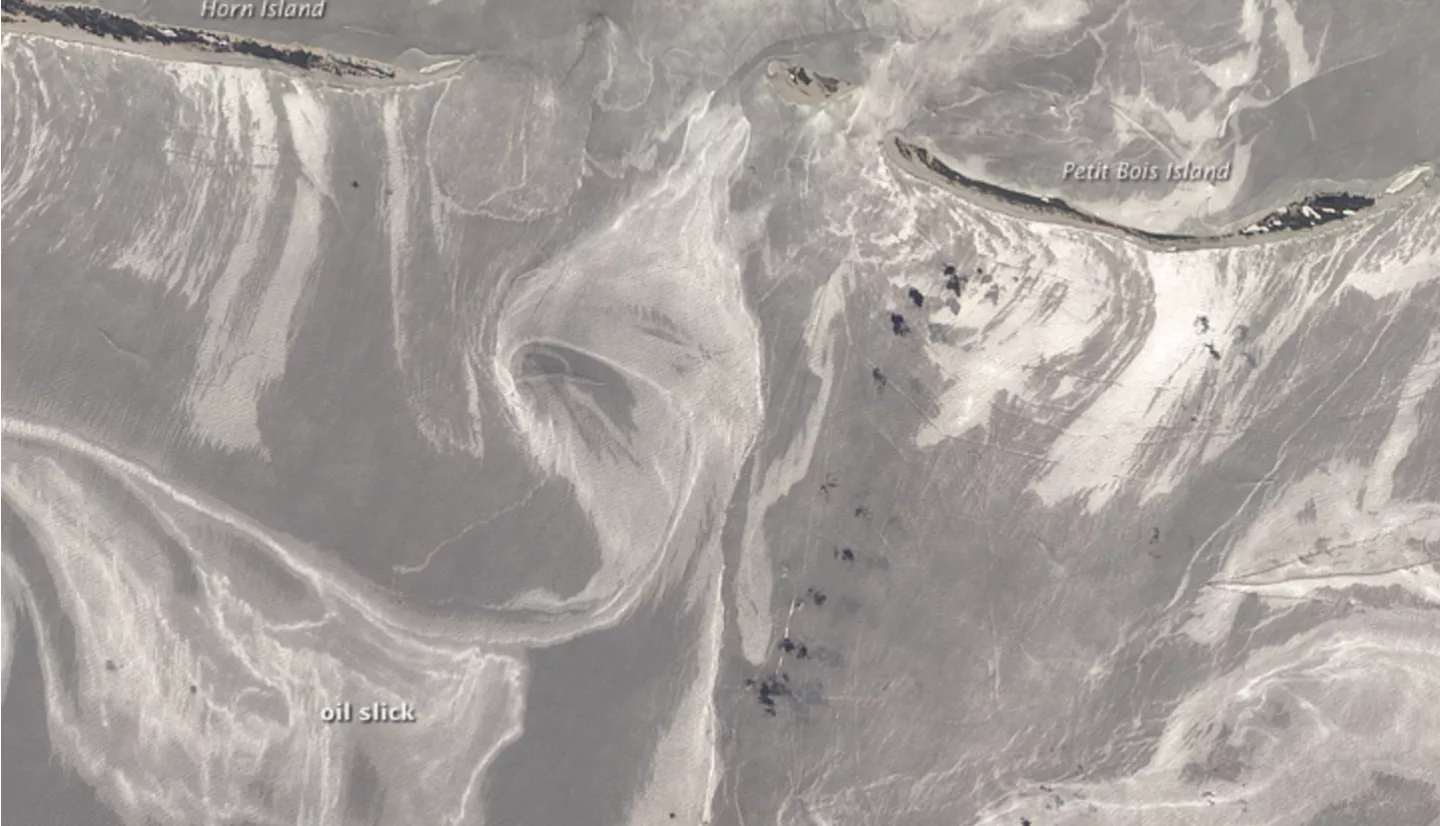
One NASA resource used was the Advanced Land Imager on NASA’s Earth Observing-1 (EO-1) satellite. For as long as two months after the explosion, it captured images of swirling ribbons of oil. These oil ribbons stretched toward Florida and Mississippi’s Gulf Islands National Seashore.
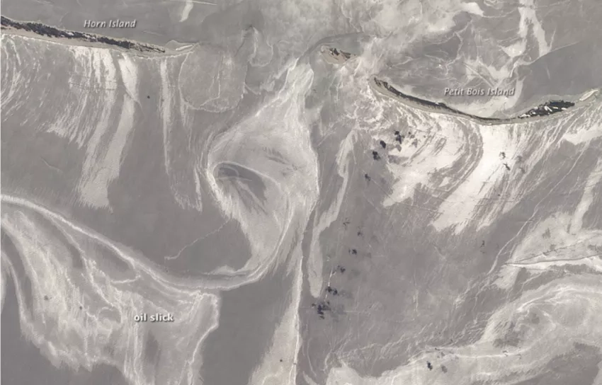
On June 27, 2010, the team labeled as "lightly oiled" the entire gulf-facing beachfront of several barrier islands in eastern Mississippi (offshore of Pascagoula). The team responding to the disaster in the Gulf of Mexico is the Shoreline Cleanup Assessment Team.
EO-1’s high-resolution images showed the size and location of the oil slicks approaching Petit Bois Island and the eastern end of Horn Island. EO-1 launched in 2000. It helped to test new technology for the next generation of Earth-observing Landsat satellites.
More available at the NASA Earth Observatory story: Oil Slick Around Mississippi Barrier Islands


