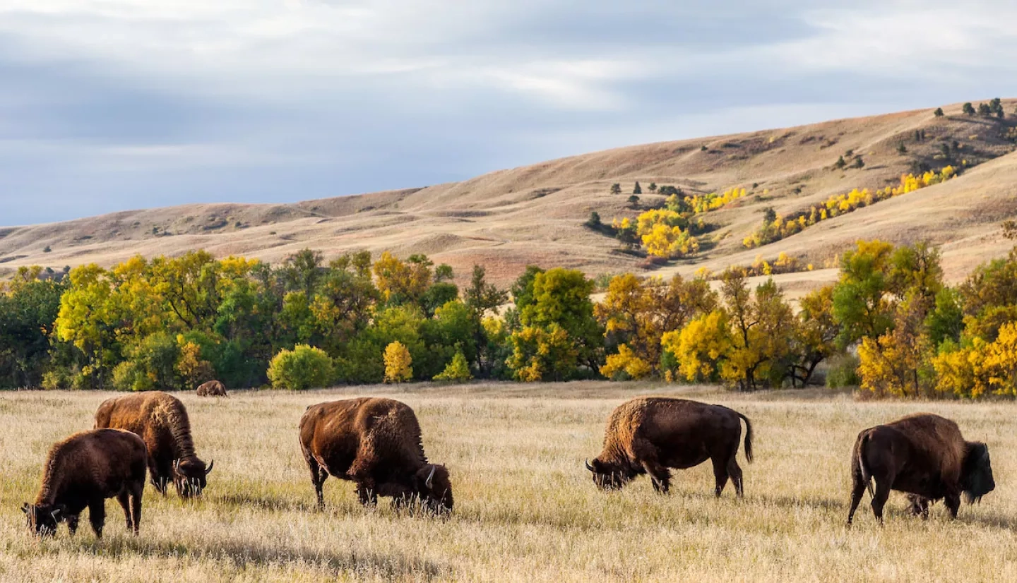
America’s Great Plains are the lifeblood of North Dakota. Valued at $11 billion a year, agriculture is the state’s number-one industry – which makes weather a critical factor in North Dakota’s economy. In response to North Dakota’s ongoing drought in 2017, NASA partnered with universities and federal agencies to develop an agriculture tool using Earth-observing data that provided an early warning system for crop damage.
In northwestern North Dakota, Ryan Ellis owns 4,000 acres of crops and 400 head of cattle outside of Williston. A second-generation farmer, Ellis has felt the effects of drought on his family’s livelihood time and again.
“Drought for us is common,” he said. “We try to grow crops such as lentils, flax, and chickpeas, which tend to be more drought tolerant.” Despite this, his farm remains at the mercy of Mother Nature’s whims. “The saying is that we are always two weeks away from a drought around here.”
Long-term droughts can be devastating for the agricultural community, but quick-onset droughts – also known as “flash droughts” – can be just as damaging. Unlike typical droughts that can take months or years to develop, flash droughts occur much more suddenly and can damage crops in a matter of weeks. Taxed by the stress of too little moisture and high temperatures, the plants suffer well before the stress causes visible signs of damage.
“Agricultural stress occurs when crops do not have adequate soil water during their growth cycle,” explained Christopher Hain, an agricultural scientist at NASA Marshall Space Flight Center. “Even if the stress doesn’t lead to failure of the crop, it can have significant impacts on end-of-season yield.”
In light of this, a NASA project team led by Hain – and composed of scientists from the National Oceanic and Atmospheric Administration (NOAA), and the U.S. Department of Agriculture (USDA), and several universities – recently developed an early-warning system for an impending drought in the contiguous United States. This system, called the Evaporative Stress Index (ESI), uses Earth observations of land temperature, vegetation and landcover data to detect plant stress before it takes a toll on crops.
The integration of Earth-observing information allows the ESI to assess the moisture condition of crop soil. Considering factors other than precipitation – such as irrigation – allows for a more accurate indication of how crops are faring. It also makes the ESI helpful for predicting flash droughts. In many cases, ESI can indicate the signs of a flash drought two to four weeks before its onset.
Along with a network of farmers, agriculture extension agents, and National Weather Service meteorologists, the ESI provides another source of information to the authors of the weekly U.S. Drought Monitor (USDM). The ESI also forms the basis of another NASA-supported agricultural tool called the Quick Drought Response Index, or QuickDRI, which serves as an additional "alarm" for rapidly emerging droughts.
The co-founder of the USDM, Mark Svoboda, emphasized, “New tools and products like the ESI will help our nation’s drought early-warning capacity, which can then help communities detect flash droughts as they come on quickly.”
“New tools and products like the ESI will help our nation’s drought early-warning capacity, which can then help communities detect flash droughts as they come on quickly.”
–Mark Svoboda, U.S. Drought Monitor co-founder
As North Dakota withered under a historic flash drought in 2017, the ESI and QuickDRI were critical pieces of information for USDM. “Even though the dryness started in March, the impact did not show until May,” said Adnan Akyüz, North Dakota’s state climatologist. “Crops were showing the stress signs – which usually takes months – in a matter of weeks.”
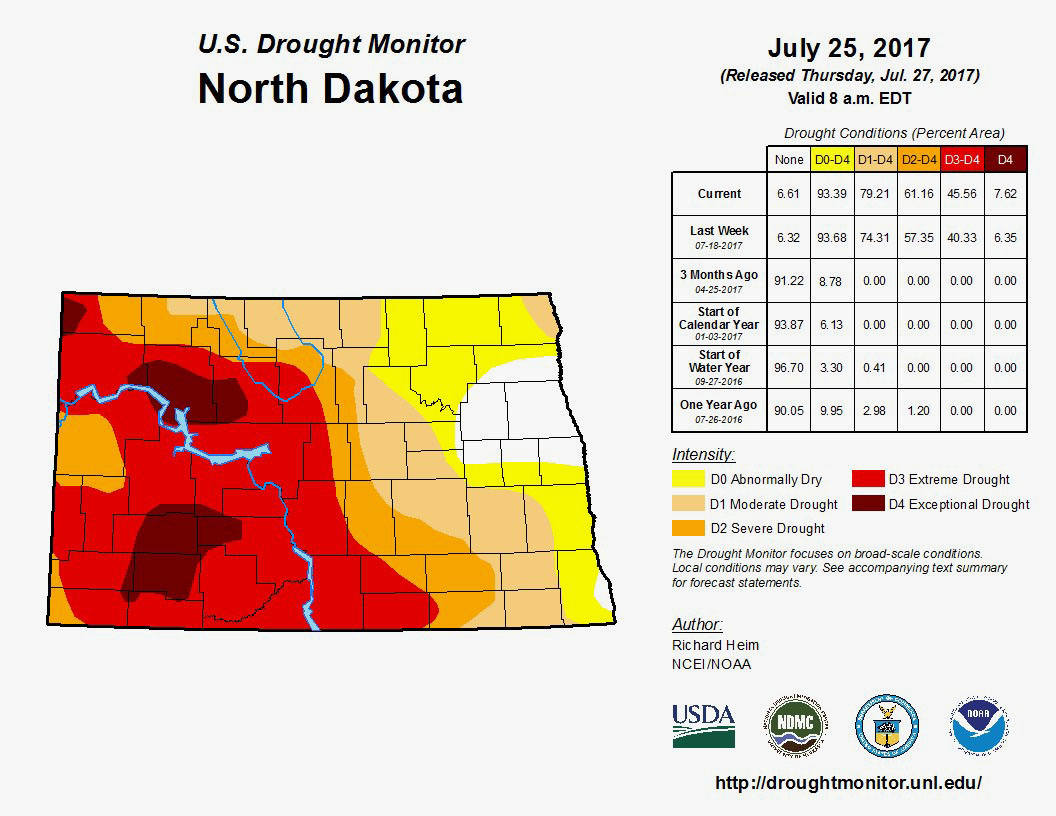
Akyüz occasionally serves on a drought task force that briefs state officials during times of severe dryness. During the summer of 2017, this task force regularly updated Governor Doug Burgum on the severity of the drought. By July, nearly 46% of North Dakota was rated as in an extreme or exceptional drought by the USDM.
In response, Burgum declared a drought disaster for nearly all of North Dakota, paving the way for additional response and assistance from state and federal agencies. “These extreme drought conditions represent a serious economic hardship for our farmers, ranchers and the entire state, while also putting firefighters under considerable stress,” Burgum said. “This disaster declaration is another step toward providing relief where it’s most needed.”
This story is part of our Space for U.S. collection. To learn how NASA data are being used in your state, please visit nasa.gov/spaceforus.


