This article was originally published on the RFF website and appeared in print in the Spring 2023 issue of Resources magazine.
A collaboration between Resources for the Future and NASA is winding down after six years of productive work to quantify the benefits of satellite information when the information is used to make decisions. This unique collaboration, called the VALUABLES Consortium, supported three major projects by interdisciplinary teams of Earth scientists and social scientists as part of its broader portfolio of research and community and capacity-building initiatives. The results from these teams in the Brazilian Amazon, California recreation areas, and rural communities in Bangladesh demonstrate that satellite data can go a long way toward benefiting people and the planet.
Windows on the World: The Value of Satellite Information for Decisionmaking
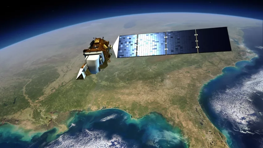
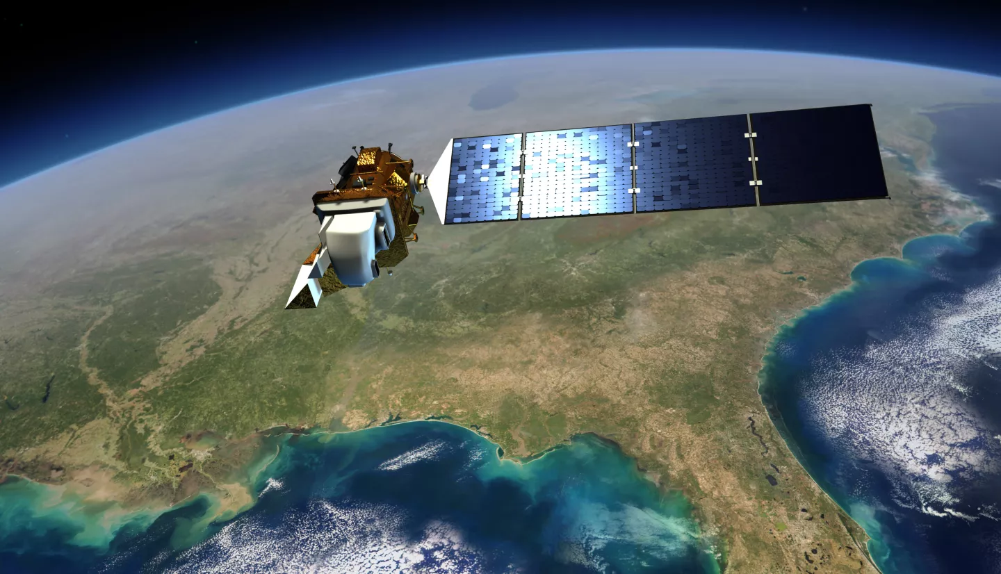
Decision makers on three different continents, facing three disparate problems – deforestation in the Brazilian Amazon, harmful algal blooms in California lakes, and cholera in Bangladesh –can all look to the same place for help: the sky. Information from Earth-observing satellites can help us understand air and water quality, land use, ecosystem functioning, and many other processes on Earth, and this improved understanding can help governments, businesses, and individuals make better decisions.
For example, in Brazil, the satellite-based Real-Time System for Detection of Deforestation (DETER) enables forest managers to enforce laws that protect against illegal forest clearing. And in California and Bangladesh, early-warning systems based on remote-sensing data can help people avoid exposure to harmful algal blooms and cholera.
For the past few years, three interdisciplinary research teams at 14 different institutions have been working with the decision makers in these locations to investigate whether potentially costly investments in remote-sensing technology pay off – by quantifying the societal benefits of using data from satellites. Each team received a $100,000 Grant for Assessing the Benefits of Satellites (GABS) to conduct this research, awarded by the Consortium for the Valuation of Applications Benefits Linked with Earth Science (VALUABLES). VALUABLES is a partnership between Resources for the Future (RFF) and NASA that brings together Earth scientists and social scientists to measure and communicate how satellite information benefits people and the environment when it’s used to make decisions. As the six-year initiative winds down (see Box 1), the GABS teams exemplify the community that VALUABLES has built, which continues to grow and innovate methods for quantifying the benefits of satellite data.
The teams have been among the first to put into action the VALUABLES impact assessment framework, a rigorous tool to investigate how new data influence decisions and quantify how these decisions improve societal outcomes; for example, in terms of lives or dollars saved. The results are a powerful expression of the value of a critical resource: scientific information.
Eyes in the Sky
Space agencies began launching satellites to monitor environmental conditions in the 1960s, with explosive growth beginning in the 1990s. Today, satellites continue to be launched every year, and new applications are being developed nearly daily. When VALUABLES began in 2016, “We had a lot of anecdotes on how these data were being used, but the next step for the consortium and the broader community was quantifying the value of the data in the decision making process,” says Yusuke Kuwayama, director of the VALUABLES Consortium and an RFF fellow. “RFF has historically played an important role in establishing an economics literature that helps policymakers understand the value of nonmarket resources, like clean water and air. And now, a few decades later, RFF has worked with NASA on an initiative to value information, which is a resource in and of itself.”
The GABS teams have provided important case studies across different applications and different types of decisions to demonstrate the value of Earth observations from satellites. VALUABLES supported these projects as part of the consortium’s work to foster an interdisciplinary community of practice in which researchers are empowered to undertake these important evaluations.
The Value of Information to Reduce Deforestation in the Amazon
One group of GABS awardees includes natural scientists and social scientists who have been collaborating on work in the Brazilian Amazon for much of the past two decades. Team leader Jill Caviglia-Harris of Salisbury University explains, “As an environmental economist, I need the work of Earth scientists to do the work I do. You can think of it along a disciplinary-specific path: Earth scientists identify a problem, social scientists design policy interventions, and then policymakers act. But an interdisciplinary approach means that the Earth scientists and policymakers are working hand in hand with economists and other social scientists to not only define problems, but also to figure out how to solve them.”
In this case, the group came together to produce the first estimate of the amount of avoided deforestation that’s resulted from the use of satellite data.
Facing international pressure to halt deforestation after two decades of rapid settlement of the Amazon, the Brazilian government began using Landsat satellite data in 1988 to calculate annual deforestation rates. But these rates remained relatively high through the following decade, partly because of a month-long lag before the satellite information was available to the government and other environmental enforcement agencies. As a response in 2004, Brazil’s National Institute for Space Research launched a new monitoring system, DETER, based on near-real-time images for the rapid detection of deforestation. The period 2004-2012 saw more than a 70 percent reduction in deforestation, with evidence that the DETER system has played an important role in supporting the country’s Forest Code and other policy objectives.
To quantify the outcomes of using the DETER system, the researchers conducted an impact assessment that compared the amount of deforestation in three different potential states of the world: one in which the DETER system was available to decisionmakers and two “counterfactuals” in which the DETER system was not available. The first counterfactual assumed that the DETER system is not available, but that other actions taken by the government and private sector during the study period are fully effective. The second counterfactual imagined that DETER is not available and, as a result, the other actions would have zero effectiveness – because those actions either would not have existed or could not be enforced successfully.
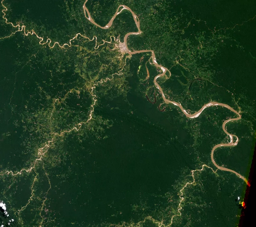
The difference in outcomes among these states represents the value of the DETER satellite data. The researchers found that using the DETER system avoided approximately 467,000-471,000 square kilometers of deforestation between 2001 and 2015 – an area larger than California and more than double the recorded deforestation during that period. That translates into about 12 billion tons of carbon dioxide emissions avoided, as well.
The team used the results of the impact assessment to monetize the net benefits of the DETER system in two ways. First, they used avoided deforestation in combination with people’s willingness to pay for ecosystem services (such as clean water, carbon sequestration, and ecotourism) to arrive at a range of $1 billion-$5.4 billion in benefits per year. Second, they looked to the social cost of carbon, a figure that helps estimate the cost to society of each additional ton of carbon dioxide emitted into the atmosphere and ranges from $51 to $185 per ton, to estimate the net benefits of DETER as $54 billion-$197 billion per year.
Caviglia-Harris notes that their findings highlight the relationship between the value of information and decision making processes. “After our study period, deforestation began to increase at rates that are now at 10-year record highs – and that’s because the Bolsonaro administration failed to enforce the laws that were in place,” she says. “Thinking that simply putting together satellite data is going to make an impact is naive. We need to have policies that are enforced. And anything we can do to show the value of those policies and the value of the supporting data is going to be relevant to addressing deforestation – and, more broadly, climate change.”
The Value of Information to Detect Harmful Algal Blooms
Research led by Stephen Newbold of the University of Wyoming centered on a different type of decisionmaker: individuals who want to enjoy a day on the water. His team’s mission was to quantify the value of satellite data for predicting the timing and location of algal blooms in California lakes, so that visitors could choose unaffected sites for boating, fishing, swimming, and other water-based recreation.
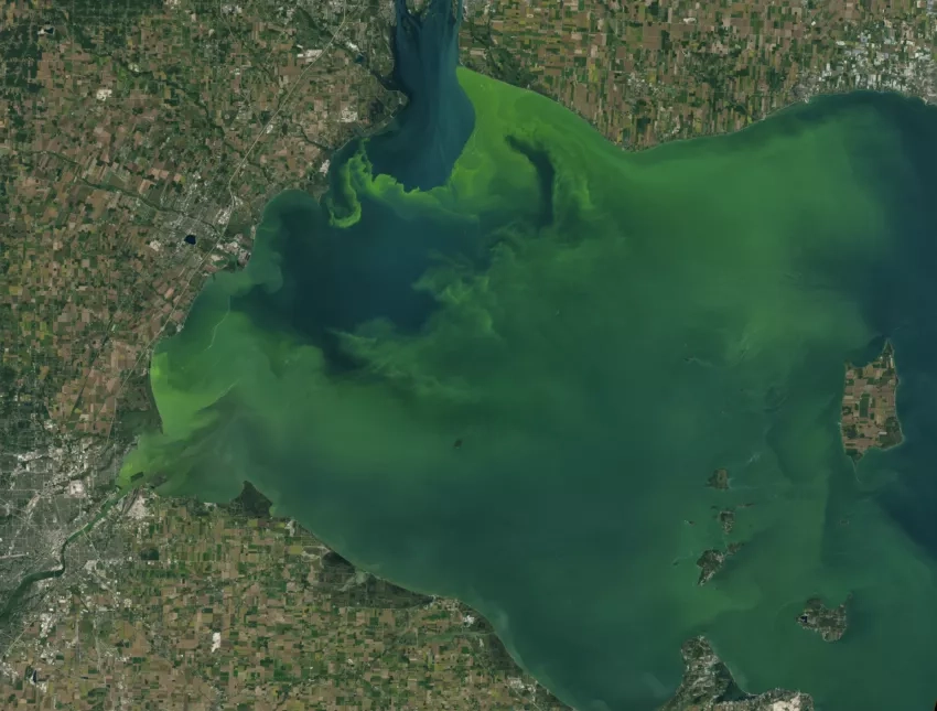
Despite their innocuous name, algal blooms are dangerous excessive growths of algae in lakes that can choke the water’s surface and often contain cyanobacteria that can be toxic to humans and non-human animals. These events are intermittent and vary in their frequency, severity, extent, and duration. Algal blooms are becoming more frequent as waters warm and urban and agricultural runoff dumps nitrogen and phosphorus – two nutrients that spur algal growth – into water bodies.
The GABS research team created a model of recreation demand that describes how lake visitors adjust their plans when harmful algal blooms are announced, based on cell phone mobility data. Then, they applied the model framework to two possible scenarios over the course of April-September 2019: The first scenario involved an early warning system for harmful algal blooms, powered by near-real-time satellite data for 100 lakes in California. The second scenario involved recreators who knew only the historic frequency of algal blooms for this same set of lakes (Figure 1). The first scenario, the researchers believed, is plausible in the near future, while the second better represented the current state of the world.
Figure 1. Impact assessment framework for the GABS harmful algal bloom project, led by Stephen Newbold

Information, actions, and outcomes for a reference scenario with satellite data and a counterfactual scenario without satellite data, involving the influence of harmful algal blooms on outdoor recreation activities in California. The reference scenario represents current conditions, and the counterfactual scenario represents a possible near-term future, when highly accurate real-time forecasts of harmful algal blooms would be widely available. Credits: VALUABLES
Their comparison of the two scenarios produced a quantitative estimate of the value of additional information about harmful algal blooms. To calculate this estimate, the researchers asked, what is the maximum amount that recreators would be willing to pay to know whether a harmful algal bloom is present at each lake among their options before deciding which site to visit? The researchers found that the total value of a perfect early-warning system was $2.46 million, applied across the 17 million visits to lakes that occurred during the time period.
“Algal blooms can severely disrupt water-based outdoor recreation activities, but they are highly intermittent and likely difficult for casual recreators to anticipate, so near-real-time satellite information on these events could be very useful,” says Newbold. “Satellite data also can be used by natural resource agencies to help identify when and where water-contact warnings should be posted. This application would be distinct from the source of value we studied in our project, but it could be an important area for further research by the VALUABLES community.”
The Value of Information to Reduce Cholera Risk
Investigating the value of information provided by another type of early-warning system – one that alerts Bangladeshi households of potential cholera outbreaks – was one of two goals of the third GABS-funded research project. “The second touchpoint we had in our team,” remarks Sonia Aziz of Moravian College, “was the concept of radical empathy.”
Cholera poses a significant health risk in Bangladesh, where disease outbreaks lead to at least 100,000 cases and 4,500 deaths every year – numbers that are almost certainly underreported. While information is available on the seasonality and peaks of cholera risk, this information often isn’t accessible to those who are most vulnerable to the transmission of the disease. The research team set out to address this problem, by making information more accessible. Putting empathy into practice, they worked in-depth with local scientists and residents in what Aziz describes as a “truly collaborative experience,” in which all participants had a voice. “We were working with one of the poorest countries in the world and needed to make sure that we understood where our Bangladeshi partners are coming from.”
The researchers developed a cell phone app that uses remote-sensing data to provide households with a monthly prediction of cholera risk that’s unique to their location, which may be categorized as low, moderate, or high. The app, called CholeraMap, provided information on how households can reduce risk when the cholera risk is high. The researchers provided the app to households – and most commonly women, who are the primary water procurers – in 40 villages in Matlab, a rural sub-district in Bangladesh. The team compared outcomes among three categories of households: CholeraMap users; households that were given a simpler app called CholeraApp that was identical in terms of design and functionality but provided users with only static, publicly available information on cholera risk; and a control group that received no app.
Over an eight-month study period, the team found that the use of the satellite-based CholeraMap was higher than the use of the simpler CholeraApp, and the satellite-based app led users to decrease their pond-water bathing and other washing. The researchers found no change in other behaviors, such as hand washing and treating drinking water, and no change in self-reported cholera incidence. However, CholeraMap users increased their knowledge and felt better equipped to deal with environmental and health risks: app users reported that they were 8–9 percent more confident in their response than control households and 21 percent less likely to report diarrhea (a symptom of cholera) as a major concern for themselves and their children.
The GABS team plans to incorporate lessons from the experiment into an improved app design and “see tremendous scalability,” according to app developer Ali Akanda. And the researchers are grateful for the funding that made the research possible. “I hail from a small liberal arts university,” says Aziz. “I’ve involved students in this work who have never even been on a plane before – so, for them to be able to see how the window from space lets you peer into and improve the lives of people who are more similar to us than different was a really great opportunity for a small research community like ours.”
Next Steps
The three GABS projects are among the first of a growing number of studies from the broader VALUABLES community that bring together natural scientists, economists, and decisionmakers to quantify the socioeconomic benefits of satellite data. As this community continues to expand, people across disciplines and roles will learn from each other to strengthen their tools and methods to measure the societal value of scientific information.
Lawrence Friedl, Director of Public Engagement at NASA Earth Science and former Director of the Applied Sciences Program, was instrumental in creating the VALUABLES Consortium. He explains, “We can expand on the approach of the value of information and build in other methods to show more and more communities how Earth science information could help them. We’re also hoping that our work over the last six years is going to lead to new research questions, especially in Earth sciences.”
Many researchers in the VALUABLES network have years of experience working as part of interdisciplinary teams, while others are newly initiated. For some, the experience with interdisciplinary research shapes how they think about impact. “The way that this opportunity has changed my thinking is fairly significant,” says Aziz. “I’ve never been exposed to interdisciplinary work that had the potential for such impact before. If this revolution can advance enough to show the improved and saved lives – and if it can change mindsets in a world that so critically needs change – it’s a privilege to be a part of that.”