A shining jewel in the chain of islands known as the Greater Antilles, Puerto Rico is affectionately called The Isle of Enchantment. Its natural allure includes tropical rainforests, rugged mountains and long stretches of beautiful beaches.
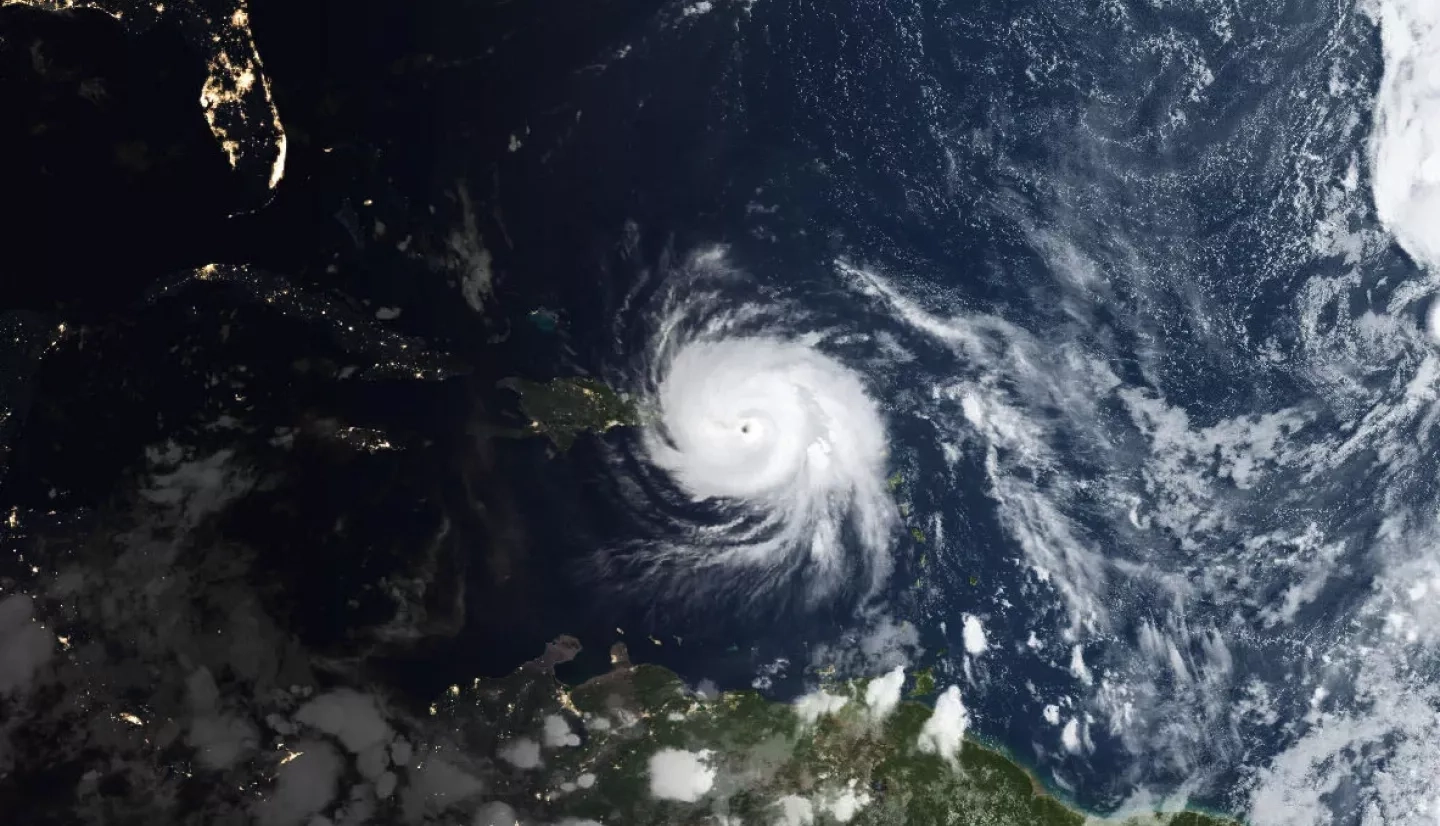
Yet, living in a tropical paradise can sometimes come at a price – Puerto Rico’s location in the Caribbean Sea often puts it directly in the path of major hurricanes. On September 20, 2017, an extraordinary storm devastated Puerto Rico – a monster named Maria.
When Maria came ashore with sustained winds of 155 miles per hour (249 kilometers per hour), Puerto Rico was still reeling from the destruction of Hurricane Irma just two weeks earlier. By the time Maria finished ravaging the island, it quickly became clear that the destruction would pose unprecedented challenges for first responders: 95% of Puerto Rico was without both electricity and cell phone service. Flooding, downed trees and toppled power lines compounded the problem by making many roads impassable and scores of communities inaccessible.
Quickly locating damage, flooding and power outages were crucial for first responders to better focus rescue efforts, deploy repair crews and distribute life-saving supplies. Scientists from multiple NASA centers worked long days to make sure that responders including the U.S. National Guard and Federal Emergency Management Agency (FEMA) received high-quality satellite maps of the island after the storm.
“It was rewarding to work with our NASA center colleagues on solutions that could assist with response efforts.”
–Andrew Molthan, NASA’s Short-term Prediction Research and Transition Center (SPoRT)
NASA’s Short-term Prediction Research and Transition Center (SPoRT) provided satellite rainfall products to the National Weather Service forecast office in San Juan after Maria destroyed local weather radar. Satellites estimated rainfall totals of more than 10 inches along Maria's track, and as much as 20 inches in other locations on the island.
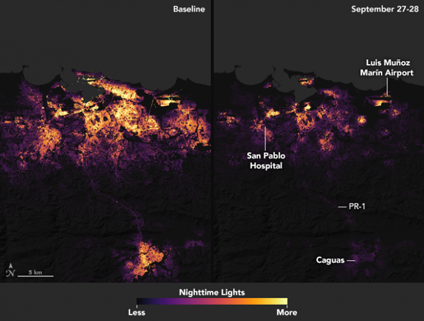
Scientists from NASA’s Goddard Space Flight Center in Greenbelt, Maryland and Marshall Space Flight Center in Huntsville, Alabama provided maps of power outages in the days immediately following Maria using NASA satellite imagery of Puerto Rico’s nighttime lights from space.
To do this, the team captured the electrical lights from a typical night before Hurricane Maria and compared it to a night following Maria, based on cloud-free and low-moonlight conditions. By combining those two images, response teams could see the widespread outages around San Juan, as well as pinpoint key hospital and transportation infrastructure.
To make the light data more useful to first responders, the Goddard team downscaled the observations into a higher resolution high-definition product that pinpointed the streets and neighborhoods.
“It is critical that we get this processing done quickly, so that we can provide the cleanest and most useful imagery to the National Guard, FEMA and other first responders,” said Miguel Román, who led the effort at Goddard. “Uncorrected images can be misleading because of things like cloud cover and changing moonlight conditions.”
Román’s team also worked closely with colleagues at Marshall from the NASA Earth Applied Sciences Disasters Program, the National Oceanic and Atmospheric Administration (NOAA) and others to share data products with first responders.
“The expertise of the Marshall team built upon past successes of the SPoRT Center, which has focused on helping end users make effective decisions from innovative NASA, NOAA and partner data products,” said Andrew Molthan, a research meteorologist with SPoRT. “It was rewarding to work with our NASA center colleagues on solutions that could assist with response efforts.”
This story is part of our Space for U.S. collection. To learn how NASA data are being used in your state, please visit nasa.gov/spaceforus.


