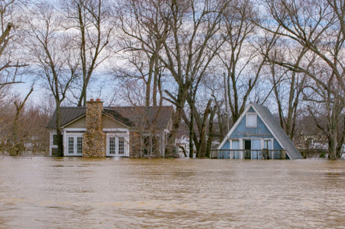
A defining characteristic of Kentucky is the Ohio River, which comprises more than 500 miles (800 kilometers) of the state's northern border. The river is an invaluable resource for Kentucky’s economy, ecology and recreation. But the Ohio River and its tributaries also make Kentucky prone to frequent flooding – especially in the winter and early spring when heavy rainfall and snowmelt can overwhelm the Ohio Valley.
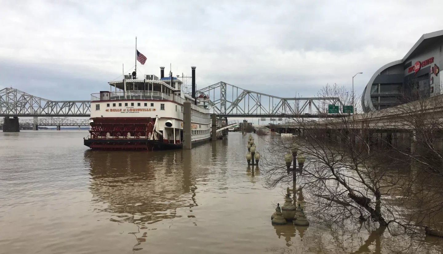
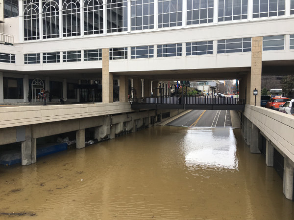
That was the case in February 2018, when the worst flooding in more than two decades swamped several states along the Ohio River. Kentucky was among the hardest hit. In Louisville alone, there were more than 50 water rescues and more than $3.5 million dollars of damage to the city’s infrastructure. To help communities in the Ohio Valley better understand the risks and impacts of flooding, a NASA’s Applied Sciences’s DEVELOP program looked at using Earth-observing data to help.
“The 2018 flood had significant impacts on Kentucky’s Ohio River communities,” said Carey Johnson, assistant director at the Kentucky Division of Water. “Floodwall closures had to be exercised, pump stations were activated and the areas that commonly flood during river floods became inundated.”
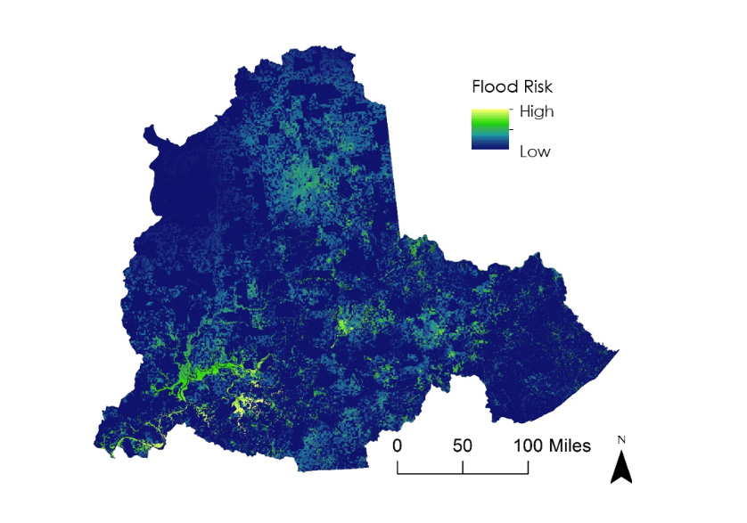
Partnering with the Kentucky Division of Water, the National Weather Service’s Ohio River Forecast Center, and the Federal Emergency Management Agency (FEMA), the NASA team looked at three years of Ohio Valley floods. They tapped into satellite imagery of precipitation, flood-water extent, local elevation and topography from 2015 to the severe flooding of 2018. The team then compared that environmental data to socioeconomic and population data, as well as road networks and infrastructure information, to create flood risk maps for communities along the river.
“We can use [the NASA data] to calculate an estimated flood depth, which is one of the most important things for us to know and understand during a flood.”
–Carey Johnson, Kentucky Division of Water
“The team found that smaller suburban areas outside of major cities along the Ohio Valley – such as Paducah and Louisville, Kentucky – were at the highest flood risk; and also contained the most inaccessible transportation routes,” said NASA's Kane Cook, the DEVELOP team lead. During the 2018 flooding in particular, the team discovered that 667 miles (1,073 kilometers) of major roadways in the Ohio Valley were impassable and 16% of all hospitals within the study area were inaccessible.
Cook says that in addition to flood risk maps, the team provided local and federal officials a detailed look at what infrastructure would likely be impacted in subsequent Ohio Valley floods. “Our partners can use the maps and analysis to determine the most effective and efficient transportation systems to take when responding to a flood, potentially reducing response times across the region and allowing more targeted flood warning messages,” Cook said.
For Johnson, at the Kentucky Division of Water, this new information will be extremely valuable in future flooding events. “During floods, we need information on flooding extent,” Johnson said. “We can use these data to calculate an estimated flood depth, which is one of the most important things for us to know and understand during a flood.” The reason flood depth is so critical, Johnson explained, is that they use it to estimate the amount of damage to specific structures.
Looking ahead, Johnson said there will likely be numerous uses for the project’s findings during other floods that will hit the Bluegrass State down the road: “We could use the data to calibrate our flood models, verify our flood hazard maps and develop new evacuation routes.”


