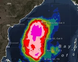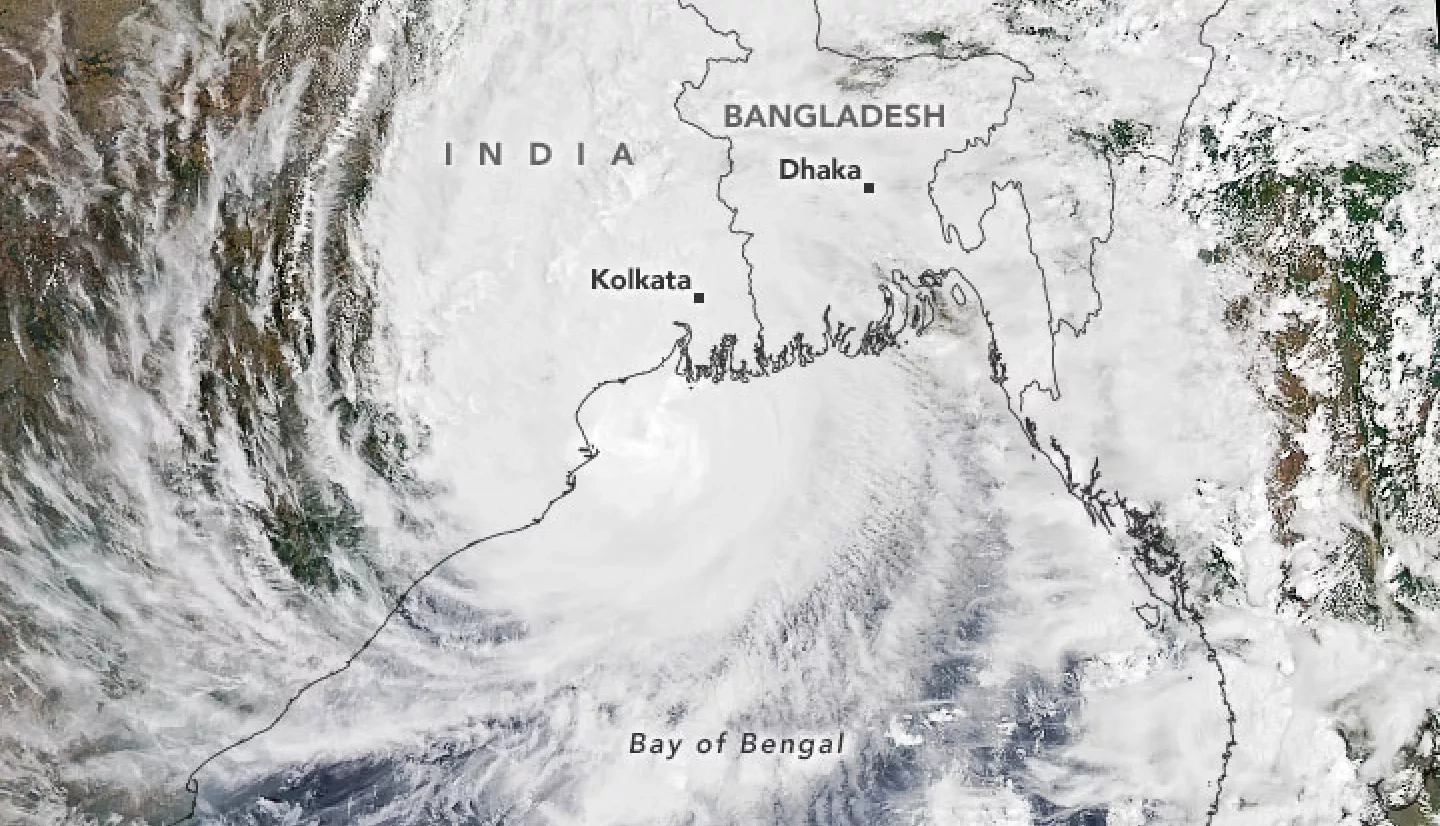
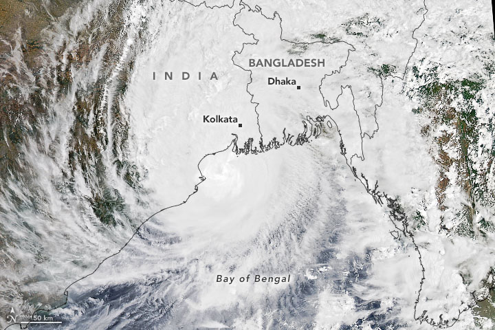
Cyclone Amphan formed on Saturday, May 16, 2020 in the Northern Indian Ocean and was initially designated Tropical Cyclone 01B. It quickly strengthened to a Category 5 cyclone as it moved north in the Bay of Bengal, making it the most powerful cyclone to form in the Bay of Bengal to date. Cyclone Amphan made landfall at 0900 UTC (2:30 PM local time) on May 20, 2020 as a Category 2-equivelent storm on the Saffir-Simpson wind scale, with winds measuring 90 knots (165 kilometers / 105 miles per hour). Landfall occurred near the India-Bangladesh border along the northern edge of the Bay of Bengal. Though it weakened before making landfall, it caused widespread damage in both India and Bangladesh due to high winds, storm surge and flooding rainfall. It is estimated that it caused $13.2 billion dollars in West Bengal alone, according to the Indian government.
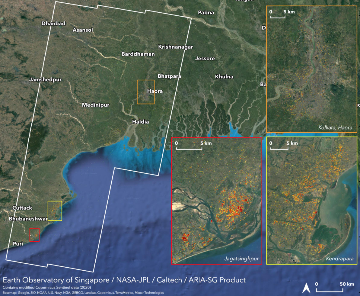
The NASA Earth Applied Sciences Disasters Program has activated to Tier 1 for Cyclone Amphan and is monitoring the situation to determine what NASA resources and capabilities may be available to support response and recovery for this event. The Disasters Program is in contact with stakeholders from the World Food Programme (WFP) and is providing Damage Proxy Maps (DPMs) and Flood Proxys Maps (FPMs) to help identify regions that were likely damaged or flooded by the storm. DPMs and FPMs generated from Sentinel-1 SAR data acquired on May 23rd were used to generate estimates that 21,260 buildings and 121,066 people were affected within the areas covered by the DPM.
Related Impact