A major explosion occurred on August 4, 2020, in the port city of Beirut in Lebanon. News reports indicate that the explosion caused numerous fatalities and injuries and damaged many buildings for miles around. News reports also state the explosion was caused by 2750 tons of ammonium nitrate, which is roughly equivalent to 1100 tons of TNT.
The NASA Earth Applied Sciences Disasters Program has activated in support of the explosion in Lebanon to determine what NASA resources and capabilities may be available to support risk management for this event.
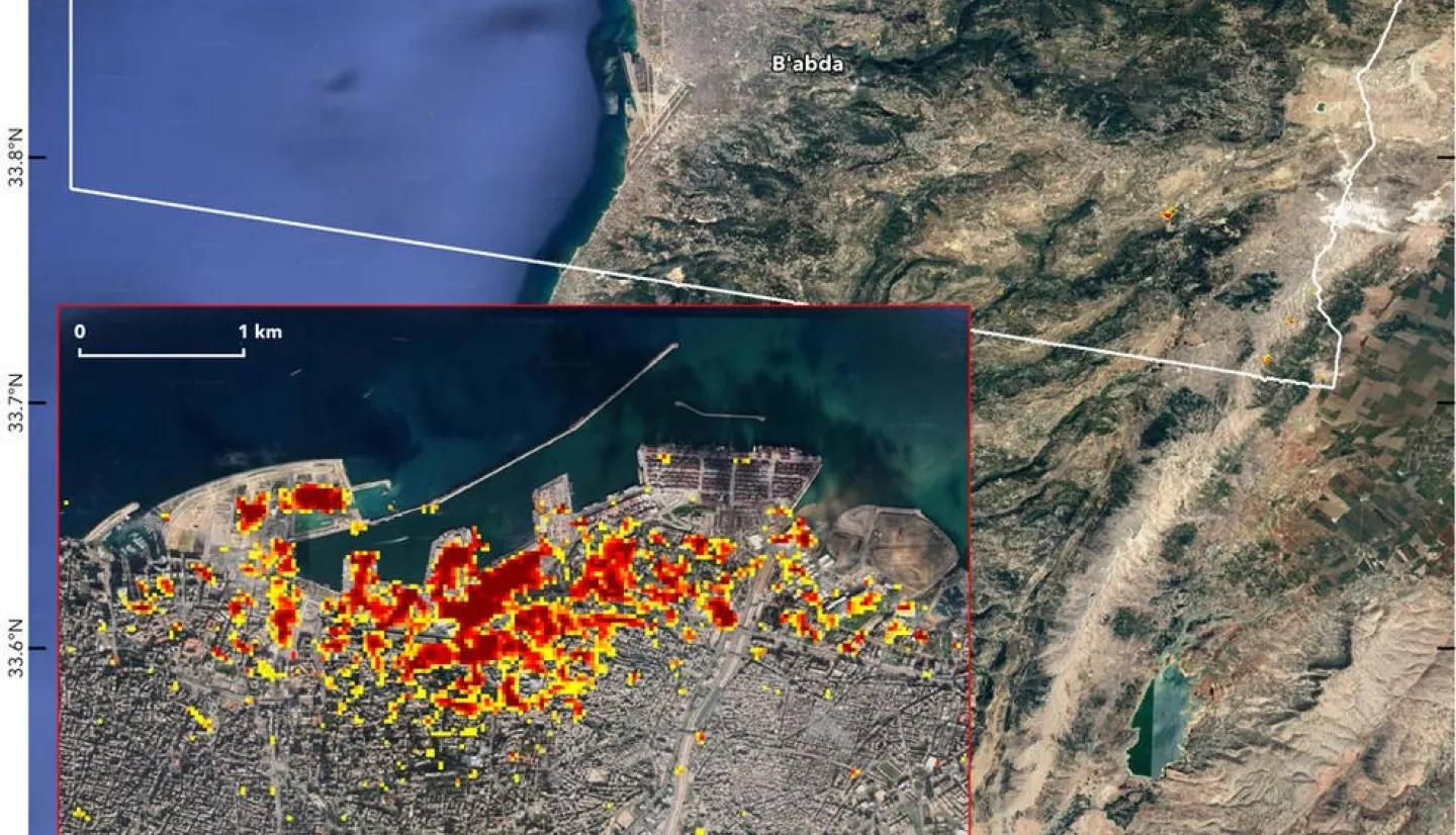
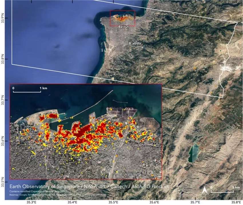
NASA's Advanced Rapid Imaging and Analysis (ARIA) team, in collaboration with the Earth Observatory of Singapore, used satellite-derived Synthetic Aperture Radar (SAR) data to map the likely extent of damage. SAR data from space lets scientists compare ground surface changes from before and after a major event. For this event, the project tried a new method to combine ascending and descending observations to see both eastern and western sides of the objects on the ground.
ARIA is a collaboration between NASA's Jet Propulsion Laboratory (JPL) and the California Institute of Technology (Caltech) in Pasadena, California which manages JPL for NASA. It is funded in part by the Disasters program area of NASA Earth Applied Sciences through the NASA ROSES A.37 research project “Global Rapid Damage Mapping System with Spaceborne SAR Data”.
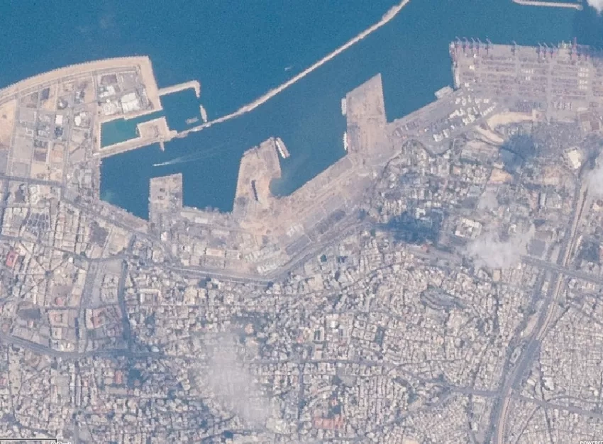
Astronauts onboard the International Space Station (ISS) also took photographs of the affected region to aid in assessing the damage. These images were then manually georeferenced by members of the Earth Science and Remote Sensing Unit at NASA Johnson Space Center in Houston.